by
by 
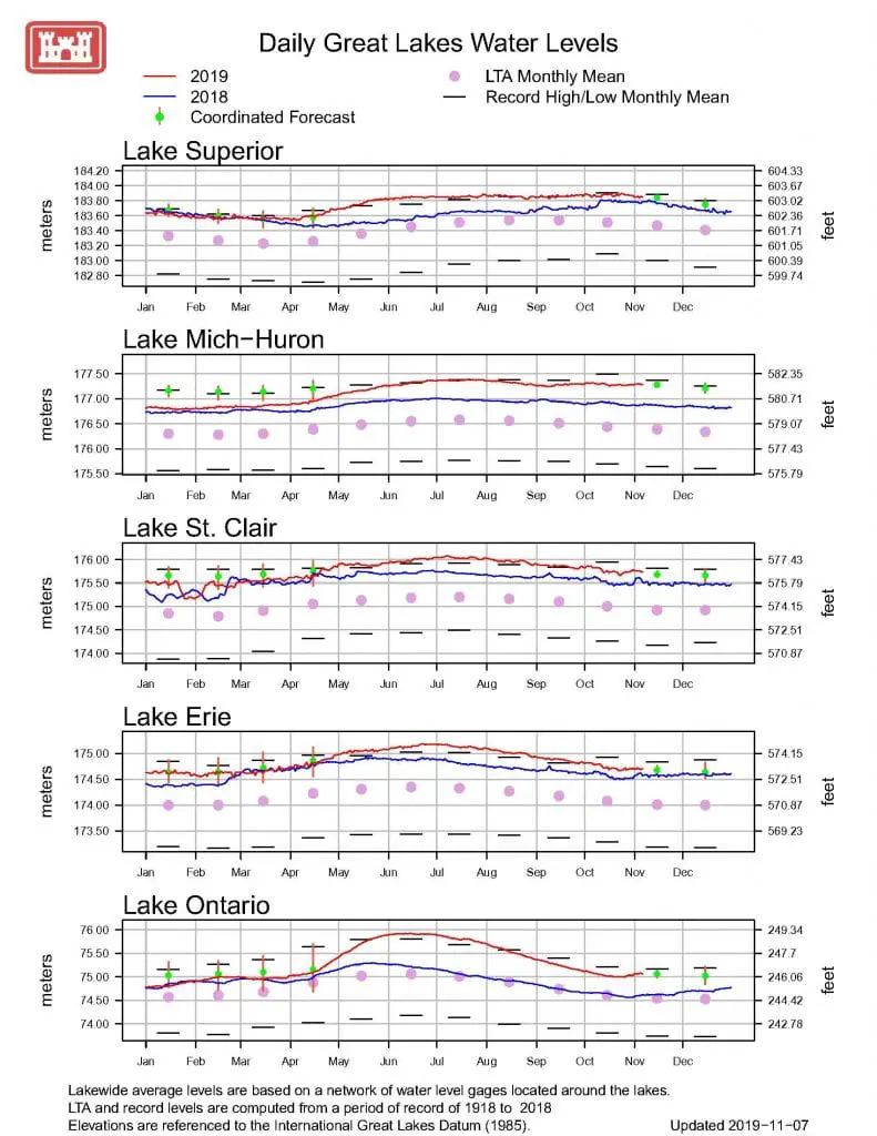
The 2020 Great Lakes water levels could break through the record books. The November 2019 update from the Army Corps of Engineers Detroit District point to an outlook that could mean the Great Lakes will continue to rise and break records in 2020. Today the water level of Lake Superior is roughly 15 inches above the November average. The big lake is only 2 inches away from a 1925 record high.
Lakes Huron and Michigan rose nine inches in May 2019 to 581.57 feet. This measurement took it very close to breaching lake water levels record the last set in May 1986. The rest of the Great Lakes; Superior, Erie, Ontario, and St. Clair were also near or at record levels the last set in 1986. This high level set the stage for ongoing near record-setting levels in 2019.
The entire Great Lakes region has received 28% above its normal month-to-date May precipitation. The October update shows that all of the lakes experienced above-average precipitation during the month. Precipitation ranged from as much as 8% above average in the Lake Superior basin to as high as 86% above average around Lake Ontario basin. The wet conditions led to above-average water supplies for Lakes Superior, Michigan-Huron, and Lake Ontario
Detroit District
Annual Seasonal Decline is Lagging in the Lakes
The increased rain meant that Lakes Superior and Michigan-Huron continued to rise just under an inch from September to October. These months typically start a decline in water levels that extend until the following spring. The Corps project that the water levels will remain well above average for the next several months. The following chart is the most current forecast of the Lakes Huron-Michigan water levels as of this month.
Great Lakes Water Level Tracking

Recognizing the economic impact of the Great Lakes, water level history has been continuously tracked since 1918. The famous Union Army General George Meade first established the water level process and measurements during his survey of Lake Huron in 1856. Residents along the southern shore of Saginaw Bay indicate that the water levels seen today mimic the levels witnessed in 1973 and 1986.
Impact of High Water Levels on the Great Lakes
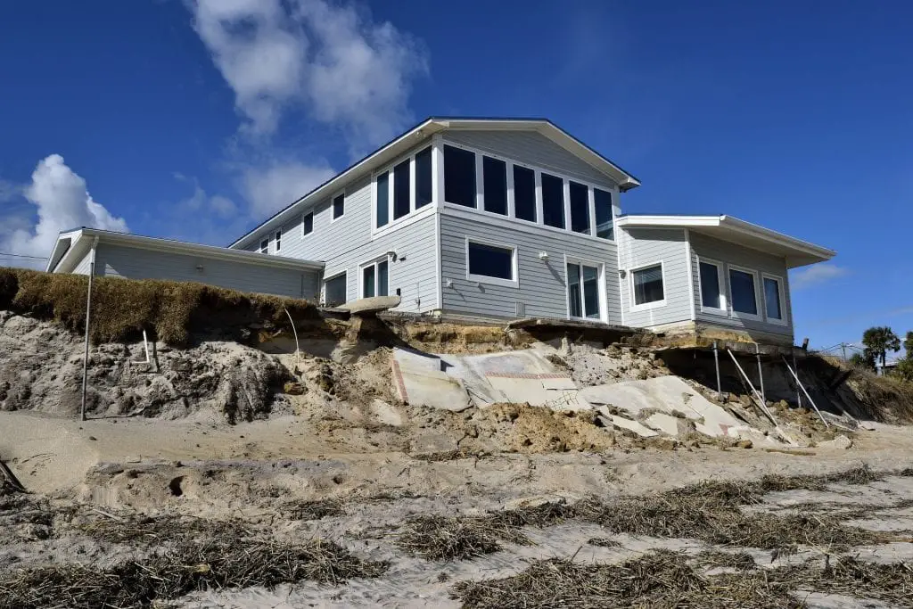
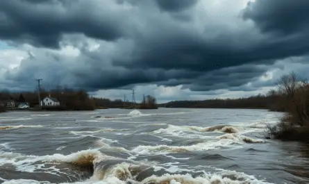
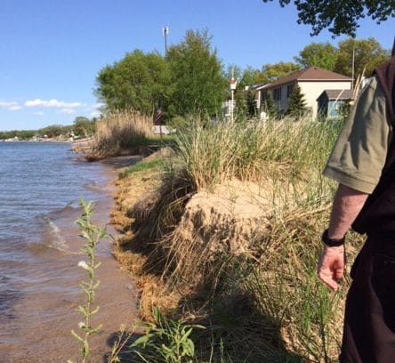
There is no question that Great Lakes water levels are rising. At least for the next several years. High water levels can result in beach erosion, loss of marshland habitat for nesting wildfowl and affect port and marina facilities and dock levels. Reports of docks being underwater in many marinas are common. Many harbors and marinas in Michigan have had to switch to floating docks due to the high variability of water levels.
Related Reading Like he 2020 Great Lakes water levels
- Great Lakes Water Use, Lies and Half-Truths
- Lake Huron Ship Travel in the 1800s
- In 2012 Great Lakes Water Levels Dropped to Record Lows
- A Castle and Michigan Indian Gold Legend in the Thumb
- Michigan has a True Genealogy Site for Researchers