These live Michigan webcams are strategically located in various spots along the St. Clair River, Lake Huron shore, and Saginaw Bay within the Michigan Thumb region. It’s a great place to check the weather, see what the beach is like, view passing ships and freighters, and observe lake conditions from the comfort of your home or office. Click on the preview image or webcam title to see the live view. If you have a webcam to add, contact us.
Last Updated: July 5, 2026,
Michigan Webcams We Love To Look At
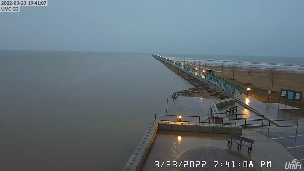
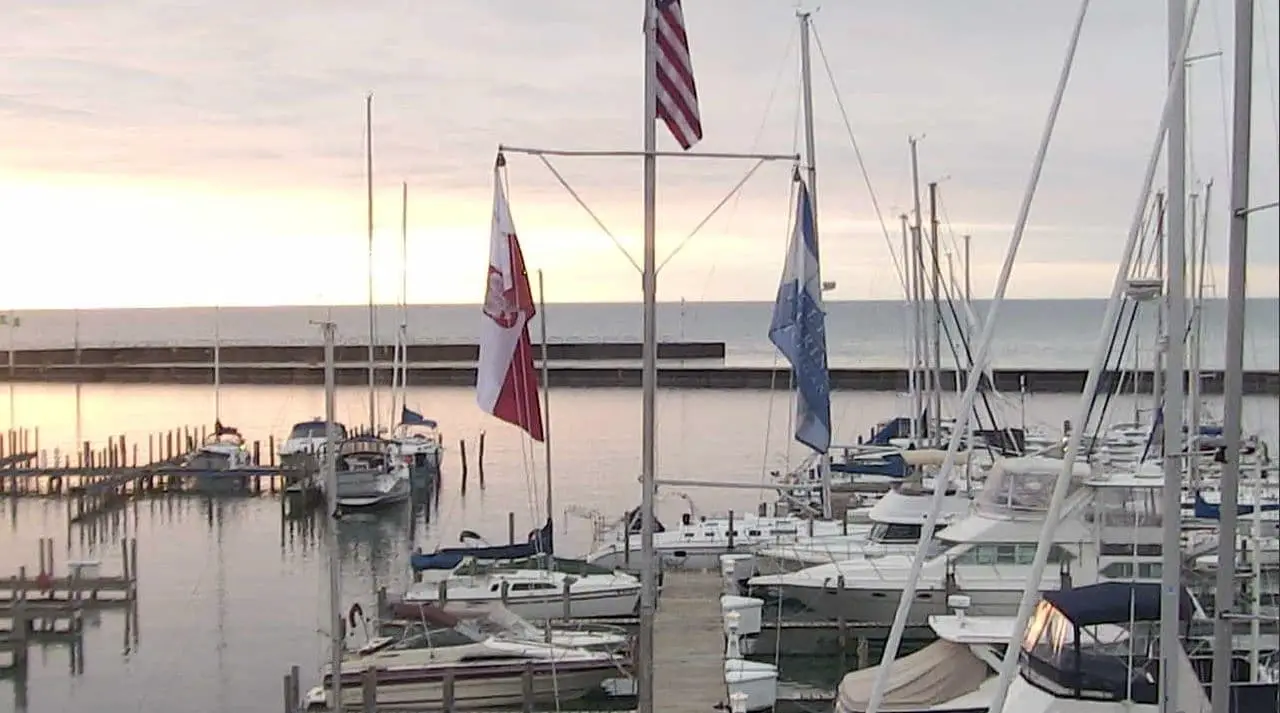
#1 Caseville Breakwall Webcam
The Caseville Breakwall webcam provides a single view of the Caseville breakwall. With the Caseville Webcam, you can check the weather and lake conditions and see fishermen catching a few fish. Facing northeast, you can make out Charity Island in the distance. The camera was updated in the Fall of 2020.
#2 Downtown Caseville Webcam (Northview)
#3 Downtown Casevillle Webcam (South View)
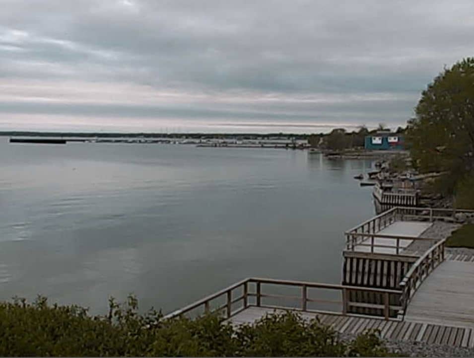
About Caseville Harbor
Caseville Harbor is located at the mouth of the Pigeon River on the east shore of Saginaw Bay. The harbor is about 17 miles southwest of Port Austin, Michigan. The harbor is ideal for shallow draft recreational watercraft. The harbor is protected with approximately 1,800 feet of pier and over 4,000 feet of maintained channel. The harbor and channel depth range between 8 and 10 feet. Caseville is a crucial Harbor of Refuge and supports charter fishing and recreational watercraft. The entire harbor has a combined 500 recreational boat slips. Caseville has established a significant interest in serving boaters and visitors to the area.
It’s one of the few break walls anywhere that encourages visitors to walk out and take a look at Saginaw Bay up close. You can fish, walk, and catch a cool breeze on this 1/4-mile sprig of concrete and stone out into Saginaw Bay. Watch the boats come in and out in the early morning and late afternoon. However, if it’s stormy, be prepared to get wet.
In 2018, Caseville updated the break wall area with a new seawall, kayak launching dock, and fishing boardwalk.
#4 Sandpoint Webcam
The Sandpoint Webcam provides a single view of Lake Huron on Sand Point. It’s a great spot to check on the local lake conditions of Saginaw Bay and Lake Huron.

It is also a Weather Underground station for local weather updates. Download the Weather Underground App on your Smartphone for forecasts and updates.
#5 Sebewaing SkyCam
This webcam is perched high above Sebewaing Harbor. Since it faces west, it’s also a great spot to view incoming storms from the prevailing west winds. You can also catch an incredible sunset too.
The Sebewaing Water Tower Skycam provides a static view of Sebewaing and Saginaw Bay. It’s perfect for a grand overview of the weather as you head west over the bay to the Upper Thumb.
#6 Harbor Beach WebCam
This webcam is located directly between Harbor Beach’s harbor and marina. Facing east, it’s a great cam to catch a sunrise.
The Harbor Beach Harbor webcam can control where the camera faces and offers preset views of the largest human-made harbor in North America. (Now, if only they would clean it off from time to time)
About Harbor Beach Harbor
The area around Sand Beach in 1872 was pretty remote, even for the pioneering standards of the time. It had no merchants and no manufacturing except a few shingle makers. In 1873, the area became one of the most ambitious harbor projects on the Great Lakes. This project was known as the “Harbor of Refuge at Sand Beach.” When it was completed, the town sprung up with a railroad station, post office, and the largest man-made harbor on the Great Lakes.
#7 Port Austin WebCam
Port Austin HarborThe Port Austin Webcam covers the state harbor and can see the upper Saginaw Bay lake conditions and weather. This webcam provides a view of the tip of Michigan’s Upper Peninsula, also known as the Upper Thumb.
About Port Austin Harbor
The Port Austin webcam provides a view of the entire harbor. This harbor is a recreational destination for shallow draft watercraft and sailboats traversing Lake Huron and Saginaw Bay. Two break walls guard the harbor, totaling approximately 3,400 feet in length. The harbor offers an ideal spot for kayakers to launch on day trips to Turnip Rock and the iconic Broken Rocks. There are also charter boat services for fishing and mid-week tours during the summer season to Port Austin Lighthouse.
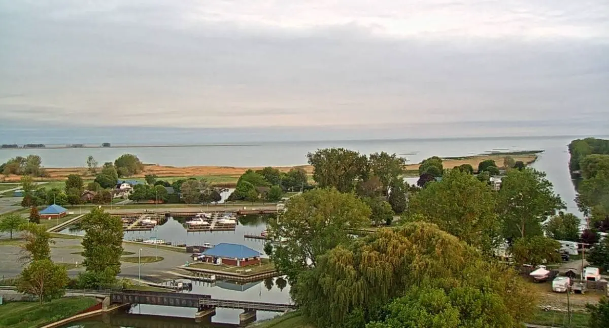
#8 Unionville – Thomas Marina Webcam
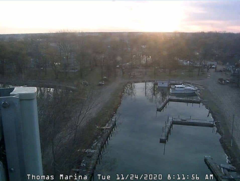
Near Unionville, Michigan, the Thomas Marina webcam provides a marina view on the Thumb’s western shore. This webcam offers great views of the ice conditions in protected marinas along Saginaw Bay.
#9 Port Sanilac Lighthouse Webcam
You can see a live webcam of the Port Sanilac Michigan harbor and the lighthouse. Using the viewer controls, pan right to see the lighthouse in operation at night.
Port Sanilac is a charming historical town located on the eastern shore of Lake Huron. So if you’re looking for fun things to do in Michigan, consider exploring with our day trip guide for the M-25 ribbon around the Thumb. It’s a great way to spend a whole day or take a weekend getaway.
#10 Tawas Bay WeatherCam
This privately owned camera overlooks the harbor and state docks in Michigan’s Tawas Bay. It’s an excellent webcam to see weather events on outer Saginaw Bay. It’s also situated to capture some incredible sunrises.
Tawas City: Tawas BayThe Tawas Bay Weathercam is part of a Tawas weather station and contributes data to the Weather Underground and other services.
#11 East Tawas Harbor Webcam
The second camera covers East Tawas. Tawas Bay is across Saginaw Bay from Michigan’s Thumb. It’s a major recreational harbor on Lake Huron and a tourist destination.
About Tawas Bay
The major attraction is it is home to one of the prettiest lighthouses in Michigan. The Tawas Point Lighthouse was in operation during the lumber boom in 1876 and ran continuously until 2016. The lighthouse and tower sit on a sandy point of land that is said to be always changing.
#12 Pigeon Michigan Weathercam
Located east of Bay Port is the village of Pigeon. The Laker Elementary School webcam is not on the shoreline; it gives views of the interior of Michigan’s Thumb. It’s a great camera to see lake effect snow squalls that blanket this area in the winter.
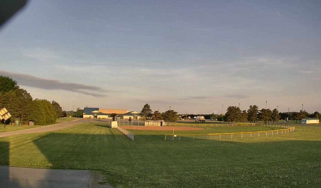
Overlooking the ballfields at Pigeon Michigan. From time to time, this camera will catch players on the Rotary Club’s disc golf course which is also located at the park.
About Pigeon Michigan
The village of Pigeon was founded due to agricultural growth in the area and railway building from the late 1800s. In 1882, the Pontiac, Oxford, and Port Austin Railroad were built from Caseville to Pontiac. The tracks ran through the small town of Berne. Nearby, Pigeon sprang up as the Saginaw, Tuscola, Huron Railroad established a crossing south of Berne in 1886. Some railway maps list the two as separate stops.
#13 The Famous Streaming Shipcam in Port Huron
This live stream camera is positioned on the St. Clair River near the Blue Water Bridge in Port Huron, Michigan. This is one of the top spots to watch ship traffic on the Great Lakes. Port Huron, Michigan, is located near the mouth of Lake Huron on the St. Clair River. The river is around 40 miles long and travels between Lake Huron and Lake St. Clair. Port Huron is approximately 60 miles northeast of Detroit.
You could observe dozens of boats on any given day, including freighters, tankers, tugs, barges, salties, passenger ships, international visitors, and other vessels.
The shipping season on the Great Lakes typically lasts from late March to early January. The harshness of the winter, on the other hand, will influence when the shipping routes open and close. Winter is also a great time to see an icebreaker in action!
#14 Live Ship Cam Marine City, Michigan
Marine City Ship Cam is located on the St. Clair River, which runs for roughly 40 miles between Lake Huron and Lake St. Clair. It’s located 53 miles northeast of Detroit.
Marine City is at the extreme base of Michigan’s Thumb on the St. Clair river. Its magnificent views of the river make it one of the best places to view freighter and ship traffic on the Great Lakes.
#15 Harrisville Harbor Webcam
This upper Michigan webcam shows static views of Harrisville Harbor. This camera is located on the western Huron Shore, midway between the Straits of Mackinac and the Blue Water Bridge, an ideal sailing destination.
The harbor provides a full-service port of refuge with enough water depths to support deep-draft boats up to 125′ LOA. The surrounding village of Harrisville has a supermarket and hardware store, restaurants, and all the necessities for the Great Lakes sailor and boater
#16 Sarnia – The Canadian View of Lower Lake Huron
The Sarnia Yacht Club is the location of this webcam. Sarnia Yacht Club is located near the mouth of the St. Clair River at the southern end of Lake Huron. The Clubhouse, with its view of the lake and the river traffic, is a popular location for social gatherings.
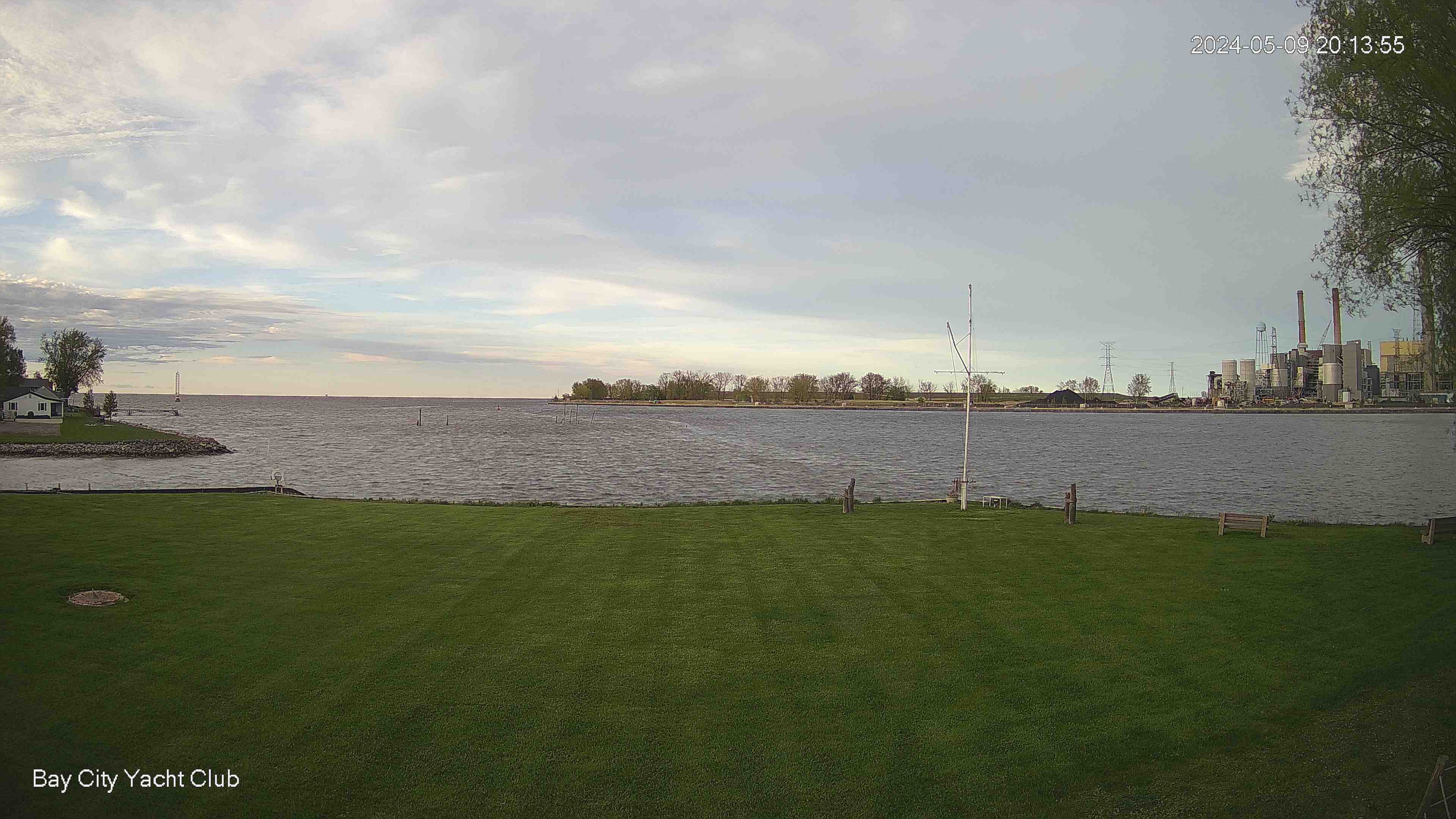
Sarnia#17 Bay City Yacht Club Webcam
The Bay City Yacht Club Webcam provides live feeds of the marina and its surroundings. Users can view real-time weather conditions, boat movements, and stunning sunsets over the water. The webcam is an invaluable tool for both club members and visitors, offering insights into the club’s activities and the state of the bay. It also serves as a safety measure, allowing for constant area monitoring. No source is needed as this is a general description.
#18 Alpena Webcam – On the Alpena Harbor Light
Alpena National Marine Sanctuary & Underwater Preserve Thunder Bay WebCam – The camera is facing south and has a pan-tilt-zoom capability of 180 degrees. The camera is now configured to four views: the LaFarge channel, Thunder Bay, the south Alpena channel break wall, and the Alpena light’s base.
Alpena: DPI#19 Alpena Township – Thunder Bay Island Lighthouse
Thunder Bay Island Lighthouse is a significant historical landmark on Lake Huron. The lighthouse, established in 1831, is the oldest operating lighthouse on the Great Lakes, having guided countless vessels through the Thunder Bay area of Lake Huron. The lighthouse stands on Thunder Bay Island, a small island off the coast of Alpena Township. Despite its remote location, this beacon of maritime history draws many visitors annually who appreciate its distinctive architecture, historical significance, and scenic surroundings. The lighthouse was automated in 1983.
Alpena Township › North-East#20 Rogers City Webcam – Presque Isle County
The webcam is located above the fish-cleaning station at Lakeside Park. Located at the Rogers City Yacht Harbor, the camera faces east toward Lake Huron.
Presque Isle County#21 Cheboygan Webcam – Benton Township
The webcam is at the Thunder Bay National Marine Sanctuary on the shore of northern Lake Huron
Benton Township › East#22 Mackinaw City Webcam – Mackinac Bridge
This webcam faces the Mackinaw Bridge and views the bridge traffic and the Straits of Mackinac.
Emmet County › North: Mackinac Bridge#23 St. Mary’s River Ferry Webcam – De Tour Village
The St. Mary’s River Ferry Webcam provides a real-time view of the ferry operations in De Tour Village, Michigan. The camera allows viewers to see the ferry’s loading and unloading process. The webcam also offers a glimpse of the scenic St. Mary’s River. It is a valuable tool for locals and travelers to check the ferry’s status. Click on the image below to see vehicles waiting for the Ferry service to De Tour across the St Mary’s River in Drummond Township.

#24 Saginaw River Webcam – Essexville
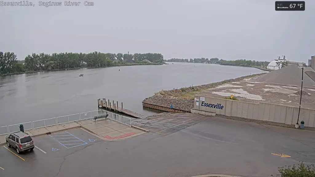
The live video is from the Saginaw RiverCam, a Saginaw Bay Watershed Council project. It captures a view of the river from the Saginaw Bay Bridge and updates it every few seconds. The Saginaw River is a big Michigan river and the longest in the state. It is about 190 miles long and runs from Saginaw Bay to Lake Huron. The river is important for transportation, recreation, and water supply.
The Saginaw RiverCam was established in 2012 to allow people to see the river in real-time. It has become a popular resource for those interested in the Saginaw River. Scientists and researchers also use it to study the river. The Saginaw RiverCam is a fantastic way to observe the Saginaw River and learn more about this significant waterway. The stream is free to watch and available 24/7.
To view the streaming video, you must view the Saginaw River Webcam on YouTube.
#25 Lambton Shores, Ontario, Canada
Lambton Shores is a municipality in Ontario, Canada, and is part of Lambton County. Noted for its vibrant natural beauty, Lambton Shores is nestled along the southeastern shores of Lake Huron. The area is rich in lush landscapes, featuring numerous parks, trails, and beaches, making it an outdoor enthusiast’s paradise. It’s the perfect destination for recreational activities like swimming, boating, fishing, and hiking. Lambton Shores is also known for its charming small-town atmosphere, complete with friendly locals and a range of amenities such as restaurants, shops, and community events. It’s a wonderful blend of natural beauty and local culture, making it a must-visit destination in Ontario.
Lambton Shores: Highway 21 at Lakeshore Rd 7#26 Grand Bend Light – Grand Bend, Ontario, Canada
The Grand Bend Light, located in Grand Bend, Ontario, Canada, is an iconic landmark with significant historical value. Overlooking the stunning huge breach of Grand Bend, the light stands tall, guiding mariners with its bright light. It symbolizes Grand Bend’s small, vibrant beach town and plays a vital role in the area’s nautical history. With its distinctive green top, the light is a beacon for ships and a popular attraction for tourists and locals. It offers breathtaking panoramic views of the lake and the surrounding landscape, making it a must-visit spot in Ontario.
Lambton Shores › North-West#27 Kincardine – Inverhuron Provincial Park
Inverhuron Provincial Park, located near Kincardine in Ontario, Canada, is a haven for outdoor enthusiasts. It offers lush forests, sand beaches, and clear waters. The park is renowned for its campgrounds and hiking trails. Visitors can also enjoy activities like swimming, fishing, and bird watching. Its rich biodiversity and stunning landscapes make it a must-visit destination in Kincardine.
Kincardine: Inverhuron Bay#28 Southampton Range Light – Southampton Ontario – Saugeen River
The Southampton Range Light, located in Southampton, Ontario, guides vessels along the Saugeen River. Built in 1903, it remains an active navigational aid. The light marks the river’s entrance, providing safe passage for boats. This historic, octagonal, wooden tower stands 10 meters tall. The Canadian Coast Guard maintains the Southampton Range Light.
Saugeen Shores › North-West: Southampton Range Light (Lighthouse) – Southampton – Saugeen River – Southampton Harbour Hotel & Spa#29 Mackinac Island Harbor
Mackinac Island Harbor is a popular destination for tourists and boaters. Its clear blue waters and picturesque shoreline attract thousands of visitors annually. The harbor offers various services, including docking, fueling, and repair facilities. Visitors also enjoy exploring the island’s historic sites, shops, and restaurants. Its stunning sunsets and peaceful ambiance make it an ideal location for relaxation and recreation.
Mackinac Island#30 St. Ignace Webcam – Mackinac Bridge
The St. Ignace Webcam offers a stunning live view, looking south towards the majestic Mackinac Bridge. This webcam allows one to monitor weather conditions and observe the bridge’s daily activities. It also serves as a window to the vibrant life in St. Ignace.
Mackinac Island › South-West: Mackinac Bridge Authority#31 Mackinaw City Webcam at Shepler’s Ferry Docks
The Mackinaw City Webcam at Shepler’s Ferry Docks provides real-time views of the bustling waterfront area. It captures regular departures of the Shepler’s Ferry, a popular transportation choice for visitors heading to Mackinac Island. The webcam also offers a glimpse of the iconic Mackinac Bridge in the distance. Besides serving as a practical tool for checking weather conditions, it allows virtual visitors to enjoy the scenic beauty of the location.
Mackinaw City#32 – North Channel – Blind River
Blind River, Ontario, is a small town located along the North Channel of Lake Huron in Algoma District, about halfway between Sault Ste. Marie and Sudbury. With a population of around 3,500, it serves as a hub for outdoor recreation and a gateway to Northern Ontario’s wilderness.
Mackinaw CityHistory Of Blind River, Ontario
Blind River has roots in the fur trade, with early Indigenous settlements using the area for fishing and travel. The town’s name comes from a river that was difficult to see from Lake Huron. In the late 19th and early 20th centuries, the community grew with the rise of logging and sawmills, which took advantage of the region’s vast forests.
#33 – North Channel – Little Current, Ontario
Little Current is the largest community within the Town of Northeastern Manitoulin and the Islands, located on the northeastern shore of Manitoulin Island in Ontario, Canada. It serves as the administrative center for the town and is the primary gateway to Manitoulin Island, connected to the mainland by the historic Little Current Swing Bridge.
Mackinaw CityHistory of Little Current, Ontario
Established in the 1860s, Little Current developed into a significant Great Lakes port. The community’s name reflects the swift currents in the narrow channel connecting the North Channel and Georgian Bay. The Little Current Swing Bridge, constructed in 1913, remains a vital link between Manitoulin Island and the mainland, accommodating vehicular traffic and opening periodically to allow marine passage.
#34 – Mackinac Bridge Webcam
A magnificent view of the bridge and the Straits of Mackinac from the Riviera Motel in Mackinaw City, Michigan, provides an enchanting real-time perspective of one of the most celebrated landmarks in the United States. This impressive 5-mile (8 kilometres) long suspension bridge ranks among the longest in the world. The live camera stream from this charming, family-owned and operated motel, situated ideally on the banks of Lake Huron, offers a delightful view of the bridge that gracefully spans the Straits of Mackinac, linking Michigan’s Upper and Lower Peninsulas. Visitors are treated to an uninterrupted vista of the breathtaking structure and the picturesque surrounding waters, making every moment truly special.
The Riviera Motel, nestled in the charming Mackinaw City, is a delightful haven for tourists eager to explore the area’s wonders, including the iconic Mackinac Island, just a breezy ferry ride away. The town is brimming with enchanting historical sites, such as the breathtaking Old Mackinac Point Lighthouse, making it an ideal base for sightseeing and taking in the beauty of this magnificent architecture.
#35 – Baby Goat Cam on Georgian Bay
This live Goat webcam stream offers a comprehensive view of the Goat Village at Farm on the Lake, located in Georgian Bluffs Township, Ontario, Canada. Viewers can observe the goats at Farm on the Lake from the comfort of their homes and gain insights into their habits and behaviors through this continuous 24/7 live stream. Upon the opening of “Goat Village” in Georgian Bluffs, visitors will have the opportunity to engage with the resident goats, as they respond eagerly to the sight of hay.
#36 – Bay Port Fish Company’s Aurora Camera From Michigan Storm Chasers
A live cam from our Friends at Bay Port Fish Company. Fishermen have worked the waters around Bay Port, Michigan, since the early 1840s. The Bay Port Fish Company, founded in 1895, operates as a commercial fishery on Lake Huron and Saginaw Bay. Over the decades, it has changed hands several times, but has been owned and operated by the Williams family for more than 40 years. Tod Williams and the heirs of Forrest Williams continue to manage the business today.
The Williams family purchased the operation from Henry Englehard in 1978 and has since maintained its legacy. The company runs seasonally from spring through fall, depending on weather conditions, and maintains a fleet of three boats.
#37 – Algonac – Basset Island, Canada
This webcam is on the Canadian side of northern Lake St. Clair, overlooking the South Channel near Basset Island and Seaway Island. The view shows part of the St. Clair River delta, where channels, islands and marked navigation routes connect Lake St. Clair with the lower St. Clair River.
The camera is useful for checking boating conditions, visibility, wind, ice and small-craft activity in the channel area near Algonac and Walpole Island. U.S. Coast Pilot notes that the St. Clair Cutoff Channel runs between Seaway Island and Bassett Island, while South Channel follows the northwest side of Seaway Island before bending toward Harsens Island.
Mackinaw City#38 – Bruce Peninsula Near Wiarton, Ontario, Canada
This webcam is listed on Windy as “South Bruce Peninsula › North,” but the linked provider identifies it as the Caframo Webcam in Georgian Bluffs, Ontario. The camera overlooks Colpoy’s Bay, a sheltered arm of Georgian Bay near Wiarton and South Bruce Peninsula.
The feed is useful for checking sky conditions, visibility, bay ice, wave activity and general weather along the Wiarton–Colpoy’s Bay shoreline. Caframo’s site describes the camera as overlooking Colpoy’s Bay from its manufacturing plant in Georgian Bluffs, with the company address listed on Grey Road 1.
Colpoy’s Bay webcam near Wiarton, looking north from Georgian Bluffs toward the South Bruce Peninsula area.
#39 – Christian Island Ferry Docs From Cedar Point, Ontario, Canada
This webcam is near Thunder Beach in Tiny Township, Ontario, overlooking the Cedar Point ferry docks for the crossing to Christian Island. Windy lists the camera under Tiny, with Beausoleil First Nation’s website shown as the provider.
The view is useful for checking ferry dock activity, Georgian Bay weather, visibility, and ice or wave conditions before travel. Beausoleil First Nation is based on Christian, Beckwith and Hope islands in southern Georgian Bay, and its site includes both ferry schedule information and real-time camera links.
The ferry connects Cedar Point on the mainland with Christian Island, serving residents, visitors and vehicles moving between Tiny Township and the island community.
#40 – Archipelago Township – Georgian Bay
This webcam is in The Archipelago Township near Pointe au Baril, Ontario, along the Highway 69 corridor north of Parry Sound. Windy lists the camera as “The Archipelago Township › North,” with the provider shown as pabweather.info. Nearby Windy camera listings also reference Highway 69 views at Pointe au Baril and Shebeshekon Road.
The view is useful for checking northbound traffic, road surface, visibility and changing weather in eastern Georgian Bay cottage country. The township’s northern area includes Pointe au Baril and the shoreline and islands of Georgian Bay from north of Carling Township toward Charles Inlet and the Naiscoot River.
#41 – Northern Bruce Peninsula – Highway 6 at Carlton Street, Looking South
This webcam is on Highway 6 at Carlton Street in Tobermory, Ontario, within the Municipality of Northern Bruce Peninsula. The camera looks south along the main road into and out of town, giving viewers a quick check of traffic, road surface, visibility and seasonal conditions near the north end of the Bruce Peninsula.
The view is useful for drivers heading between Wiarton, Ferndale, Tobermory, Bruce Peninsula National Park, Fathom Five National Marine Park, and the Chi-Cheemaun ferry area. The webcam page identifies the view as “Highway 6 at Carlton Street, Looking South,” with Ontario 511 listed as the provider. Parks Canada lists Highway 6 as the southern road access to Bruce Peninsula National Park, near Tobermory.
About Michigan’s Thumb

The Thumb is a region and a peninsula of Michigan, so named because the Lower Peninsula is shaped like a mitten. The Thumb area extends out into Lake Huron but enjoys miles of sandy beach coastline on Saginaw Bay. It’s considered the “closer up north” as it’s about a two-hour drive from Metro Detroit. The term “Upper Thumb” denotes Huron County at its tip. The Upper Thumb is a boaters paradise with sailing, fishing, and kayaking throughout the summer season. Using webcams, such as the Caseville webcam or the Port Austin webcam, is a great way to check out the weather and lack conditions.
Michigan Thumb & Lake Huron Webcam-Related Reading
If you’re interested in knowing more about some of these locations, we have some excellent overviews and highlights. Check out Six Fascinating Places to See in Harbor Beach. The largest freshwater harbor in the United States.
A series of Bart Art projects is at the tip of the Thumb near Port Austin. You really must see the Home of Emergency Ark, where an 1800s barn has been transformed into an ark on the land.
The Thumb region has its share of history. During the lumbering era, shipbuilding took place up and down Saginaw Bay. One of the biggest was Sebewaing Harbor. Our post on Sebewaing History – A Busy Harbor takes you back to when sailing ships dominated the Great Lakes.
Lastly, we tell the story of one Upper Thumb town that refused to die. Huron City was burned down twice! Once in 1871 and again in 1881. It was rebuilt both times. It has an exciting story, and many buildings can be visited today in this living museum. See The Faded Glory of Huron City

Thank you for covering the Flint water crisis in such detail. I had no idea how serious things really were, I found all the information I wanted to know right here. You would think, living in the “Water, Winter Wonderland”, that we would be the last state to have a water problem. How sad. I will be looking to see if there is anything I can do to help with my limited income.