White Rock Michigan History isn’t just about a shoreline landmark—it’s also a case of shifting names on early maps. In 1842, cartographers labeled a village called “Zappapoiton” and a stream called the “Zappapoie River” at today’s White Rock on Lake Huron. The creek is now known as Elm Creek, also called White Rock Creek. The village name faded from later atlases. This post reviews what the records show, why the spellings likely changed, and how White Rock Michigan History helps explain the mix of Indigenous, French, and surveyor terms that once marked this coast.
Where the names appear
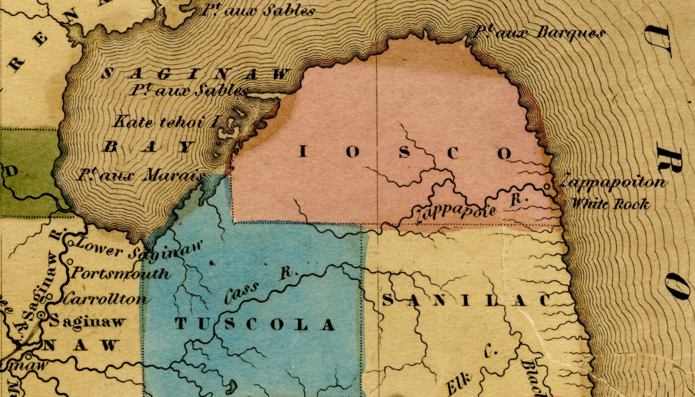
An 1842 map shows Zappapoiton on the shore and Zappapoie River entering Lake Huron at the site known today as White Rock. The stream is now mapped as Elm Creek—also called White Rock Creek—and the settlement label faded from later atlases. This case study adds a clear entry in White Rock Michigan history.
The H.S. Tanner 1842 map places “Zappapoiton” at the lakeshore with “Zappapoie R.” just south of it. Period guides list Zappapoie as a principal stream for the county, then shown on the map, matching the modern creek mouth at White Rock.
In the publication The Western Tourist; or, Emigrant’s Guide through the States of Ohio, Michigan, Indiana, Illinois, and Missouri, and the Territories of Wisconsin and Iowa: Being an Accurate and Concise Description of Each State, Territory, and County. New York: J. H. Colton, 1846. Future Huron County is called Iosco. Co. contains about 800 square miles ; bound-ed northwesterly by Saginaw bay, and northeaster-ly by Lake Huron. Zappapoie and Black riversare the principal streams,

What Zappapoie is today.
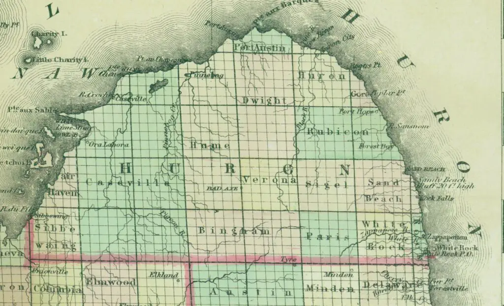
Field references and modern maps indicate that Elm Creek at White Rock is the same feature once labeled as Zappapoie River. Archival captions also mention “Shale Creek,” a local descriptive term for the same outlet.
Why the names changed
As surveyors standardized spelling and county lines settled, unique phonetic renderings—often attempts to capture Indigenous or French names—were dropped. White Rock remained the anchor term due to its role as a shoreline landmark tied to early treaty boundaries.
What Zappapoiton likely meant
The village label signals an Indigenous locality or camp near White Rock recorded by a few mid-19th-century mapmakers. No later gazetteer shows a continuing town under that spelling, which suggests the name was temporary or poorly standardized.
It may be a phonetic rendering of an Anishinaabemowin place name ending in -ong (“at/in a place”), marking a camp or village at the creek mouth by White Rock.
“Zappapoie” could reflect a mapmaker’s attempt at a term for a small river or outlet, akin to Ojibwe roots like ziibi/ziibiins (“river/creek”).
Another possibility is that “Zappapoiton” preserves a personal or clan name followed by a place marker, filtered through French-style spelling and then anglicized on the 1842 pla
How to see the site now
The outlet of Elm Creek meets Lake Huron at White Rock in Huron County, near M-25. A roadside stop offers views of the shore and the creek mouth where the 1842 map placed Zappapoie River. The shoreline setting explains why early cartographers clustered labels at this point.
These fragments—Zappapoiton and Zappapoie—don’t survive on modern signs, but they still mark the spot where a small stream, a lakeshore landmark, and a brief chapter in naming practices meet.
Final Thoughts
The evidence ties Zappapoiton and Zappapoie to the White Rock shoreline, even if the exact origin of the words remains unclear. Standardized mapping replaced those labels with White Rock and Elm Creek, but the geography—and the story—stayed put. White Rock Michigan History highlights how small features can carry big clues about settlement, treaty borders, and local usage. If new archival notes surface, we’ll update this report so readers have the clearest account of White Rock Michigan History available.


