 by
by 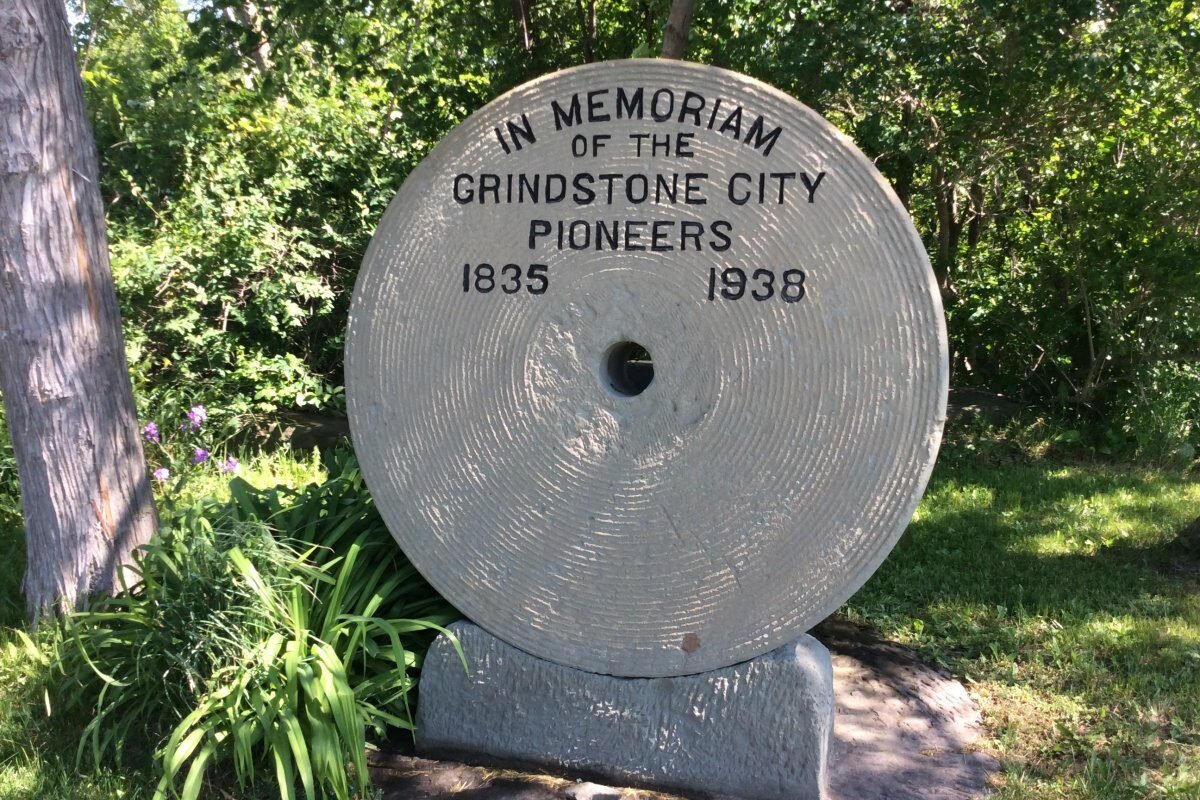
Most travelers navigate the M-25 highway looking for a place to park a camper, yet the most significant historical sites in the region are often found at the end of unmarked trails or beneath the surface of Lake Huron. While thousands of visitors flock to the shoreline for summer festivals, they often drive right past the region’s most compelling industrial ruins and geologic oddities. Planning unique day trips in Michigan Thumb requires looking toward the abandoned quarries and ancient stone carvings that define this peninsula.
It’s frustrating to spend a weekend fighting for a parking spot at a state park only to realize you’ve missed the actual history of the area. You likely want a route that offers more than just a view of the water. This guide provides a manageable itinerary that trades the noise of the crowds for the quiet significance of the region’s historical and geological landmarks.
We will examine the ancient rock carvings in Sanilac County and the remnants of the lumber industry in Port Crescent. You will also find the logistical details needed for water access to Turnip Rock and how to navigate the coastal highway. Before you head out, you can check our live webcams to monitor beach crowds and weather conditions along Lake Huron.
Key Takeaways
- Identify the prehistoric rock carvings at the Sanilac Petroglyphs, which were only revealed after the Great Fire of 1881.
- See the remnants of the world’s former abrasive stone capital at Grindstone City, where massive discarded stones still line the shore.
- Learn why the coastal waters near the Pointe Aux Barques Lighthouse are known as the Graveyard of the Great Lakes.
- Navigate unique day trips in Michigan Thumb using offline maps to handle unreliable cell service along the M-25 highway.
- Access regional history videos to understand the industrial settlements that once thrived in Huron and Sanilac counties.
Geological and Ancient Anomalies: Sanilac Petroglyphs and Turnip Rock
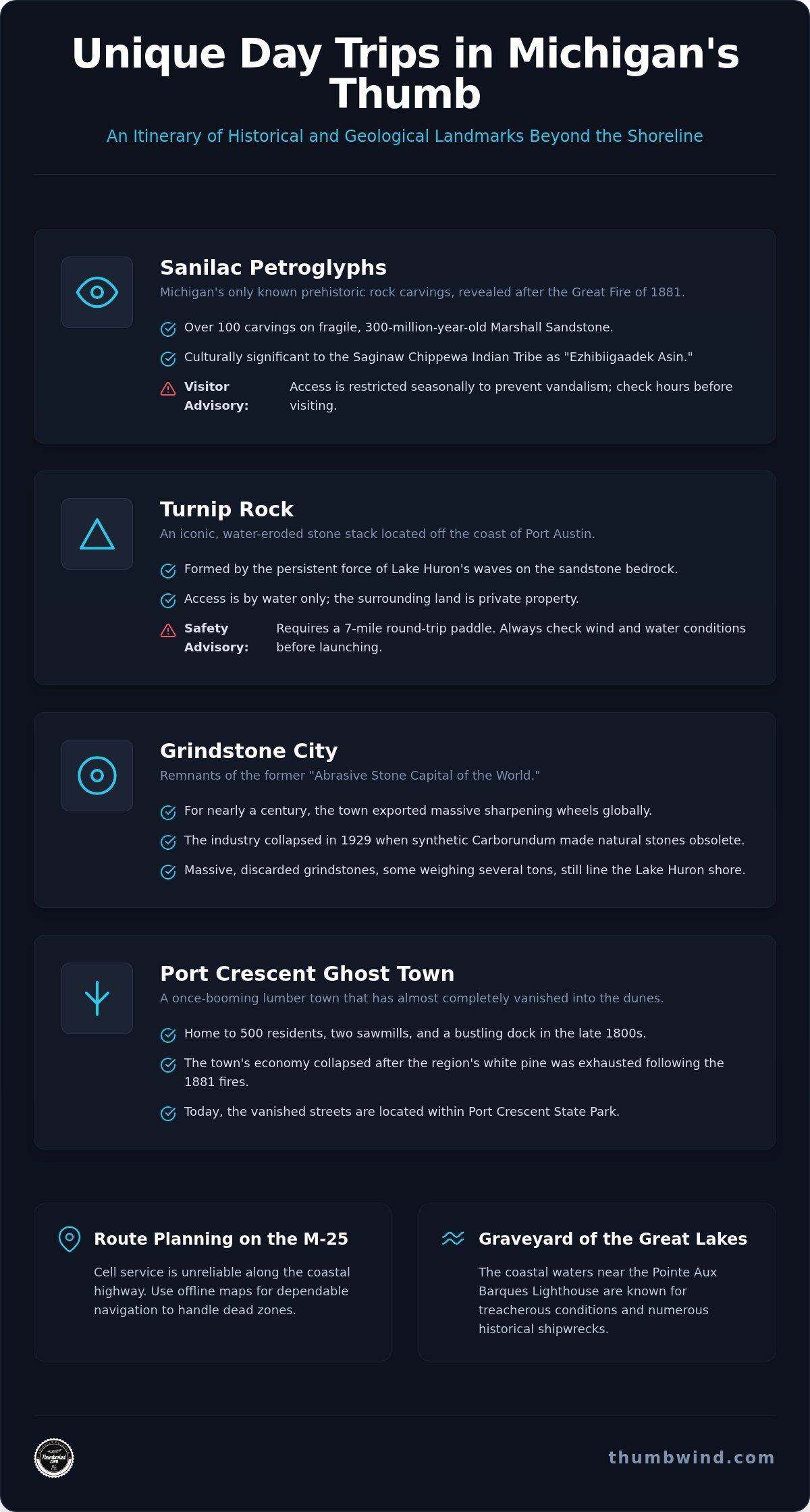
The Great Fire of 1881 did more than destroy timber; it scorched the earth enough to reveal Michigan’s only known prehistoric rock carvings. Located near Cass City in Sanilac County, the Sanilac Petroglyphs, or Ezhibiigaadek Asin, offer a rare look at the people who walked these Native American trails centuries ago. Marshall Sandstone is a Mississippian-aged rock layer that has existed beneath the peninsula for 300 million years, providing the raw material for the region’s earliest industries and natural monuments. This ancient bedrock also forms the foundation for Turnip Rock in Port Austin, a massive stone stack shaped by the persistent force of Lake Huron’s waves. These sites are essential stops for anyone planning unique day trips in Michigan Thumb that focus on deep history rather than modern distractions.
The Cultural Stakes at Sanilac Petroglyphs
State records confirm the site contains over 100 individual carvings, with the most famous being the ‘Archer’, a figure pointing a bow toward the southeast. While the site is culturally significant to the Saginaw Chippewa Indian Tribe, it faces constant threats from natural erosion and human interaction. The sandstone is incredibly fragile. You’ll find that the viewing enclosure is often gated or restricted to prevent vandalism, making it necessary to check seasonal hours before driving out. This tension between public education and preservation remains a primary concern for state historians who manage the site.
Turnip Rock: A Study in Erosion and Access
Turnip Rock is perhaps the most photographed feature in Huron County, yet it remains one of the most difficult to reach. Because the rock is entirely surrounded by private property, you cannot walk to it. Access requires a seven-mile round trip by water from Port Austin. This journey is physically demanding and depends entirely on the mood of Saginaw Bay. Inexperienced paddlers often struggle in the ‘shallows’ near the rock, where unexpected swells can tip a kayak against the abrasive stone cliffs. If you enjoy rock hunting on Michigan beaches, the base of these formations provides a fascinating look at how water shapes the land over millennia. Exploring these anomalies offers a perspective often missing from generic guides to unique day trips in Michigan Thumb. Safety is paramount; always check the wind speed before launching into the open lake.
Industrial Scars and Ghostly Settlements: Grindstone City and Port Crescent
Grindstone City once produced the world’s most sought-after sharpening stones. While many visitors view these coastal villages as quiet vacation spots, they were once noisy, soot-covered industrial hubs. Historical records indicate the Great Fire of 1881 accelerated the demise of these settlements by destroying standing timber and damaging the infrastructure these companies relied upon. These locations offer a stark contrast to the typical tourist path, making them essential stops for unique day trips in Michigan Thumb.
The Rise and Fall of the Grindstone Industry
Captain Aaron Peer founded the quarry in 1834 after he recognized the superior grit of the local Marshall Sandstone. For nearly a century, the town exported massive wheels to factories across the globe. The industry was the lifeblood of the community until a technological shift in 1929. Carborundum, a synthetic abrasive, hit the market and rendered natural stones obsolete almost overnight. Today, you can see these discarded giants, some weighing several tons, along the Lake Huron shoreline. You can also visit the Grindstone Grill and Cottages to see original quarry artifacts preserved on the grounds.
Walking the Vanished Streets of Port Crescent
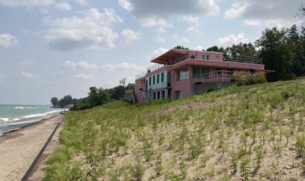
Further west, the village of Port Crescent has almost entirely disappeared into the dunes of the state park. In the late 1800s, this was a booming lumber town of 500 residents with two sawmills, a salt plant, and a bustling dock. Once the white pine was exhausted following the 1881 fires, the town’s economic reason for existing vanished. Owners dismantled the buildings and moved them by barge to nearby Port Austin or across the bay to the Great Lakes ports. These vanished streets are a highlight for those seeking unique day trips in Michigan Thumb that go beyond the beach.
The Port Crescent Steel Bridge Trail now follows the path of the former town’s main industrial artery. The only remaining structure is a lone brick chimney that once served the sawmill. It stands as a silent monument to the industrial activity that defined this stretch of Huron County. If you want to stay informed about the region’s past, you might enjoy Michigan Moments for regular updates on local heritage.
Maritime Sentinels and the Graveyard of the Great Lakes
Pointe Aux Barques Lighthouse stands at the tip of the peninsula, marking the dangerous transition into Saginaw Bay. This area is known as the Graveyard of the Great Lakes because of the treacherous shallow reefs and unpredictable currents. More than 100 shipwrecks lie beneath the surface along the coast, many representing the 19th-century grain trade that once fueled the region’s economy. The 1913 Great Lakes Storm remains the deadliest event on record, claiming dozens of vessels across the lakes. For those planning unique day trips in Michigan Thumb, these sites provide a somber contrast to the sandy beaches found elsewhere. Visiting these wrecks usually requires specialized diving gear or a glass-bottom boat tour, as they remain largely inaccessible from the shore.
The 1900 Tragedy at Pointe Aux Barques
The lighthouse has served as a sentinel since 1848, though the current 89-foot tower was completed in 1857. It’s constructed of distinctive cream-colored brick from Milwaukee, a material choice common for high-quality government projects of that era. This station was more than just a light; it housed a life-saving crew tasked with pulling sailors from the surf. You can read a detailed account of the station’s history in our Pointe Aux Barques 1900 feature. Today, the site includes a museum that documents the maritime disasters that defined the northern tip of Huron County.
Harbor Beach: The World’s Largest Man-Made Harbor
Heading south to Harbor Beach, you will find a mile-long breakwall built by the U.S. Army Corps of Engineers. This massive structure was designed to protect shipping traffic from the violent storms that frequently batter the coast. The Harbor Beach Lighthouse sits at the end of this wall and continues to operate as a private aid to navigation. It’s a significant stop for unique day trips in Michigan Thumb, though you should be aware of a major logistical drawback. The breakwall is generally closed to pedestrians due to safety concerns and the risk of being swept off by high waves. You’ll need to view it from the marina or via a boat tour to get a closer look at the architecture.
Route Planning and Survival on the M-25 Circuit
The M-25 highway follows the entire perimeter of the Thumb, stretching from Port Huron in the south to Bay City in the west. This scenic route serves as the primary artery for unique day trips in Michigan Thumb, but it requires more preparation than a standard highway drive. Cell service is notoriously spotty on the coastline between Port Sanilac and Harbor Beach. You’ll need to download offline maps before leaving the larger towns to ensure you don’t miss the turn-off for a specific historical site or trailhead.
Seasonal timing is the other major factor for a successful trip. Many restaurants and smaller attractions in Caseville and Port Austin close their doors from November through April. Before you depart, check the Michigan’s Upper Thumb Webcams to see current traffic levels and weather conditions along the Lake Huron shore. This helps you avoid the ‘Cheeseburger in Caseville’ crowds or unexpected lake-effect snow squalls.
A Recommended Day Trip Itinerary
A logical route starts in Lexington for morning coffee and a walk on the concrete breakwall. From there, head north to Port Sanilac to view the historic loop houses and the Port Sanilac Lighthouse. This village retains a quiet, 19th-century atmosphere that contrasts with the busier beach towns further north. End your afternoon in Port Austin, where you can watch the sunset at the breakwater before heading south on M-53 to return home. This loop ensures you see the most significant landmarks without unnecessary backtracking.
Logistics: Parking, Fuel, and Crowds
Fuel management is critical once you pass Harbor Beach. Gas stations are scarce on the 30-mile stretch between Harbor Beach and Port Austin; you should refuel early to avoid a long wait for a tow. If your visit falls on a summer Saturday, be aware that public parking in Port Austin usually fills by 10:00 AM due to the popular Farmers Market. Most locals use the ‘Thumb dimple’ line, an imaginary boundary from Quanicassee to Port Huron, to define the start of their journey. Planning unique day trips in Michigan Thumb within these geographic markers helps keep your driving time manageable while maximizing your time at industrial and maritime sites.
Prepare for Your Historical Circuit
A journey through Huron and Sanilac counties reveals a side of the state that most beachgoers never see. You’ve seen how ancient carvings were revealed by fire and why massive sandstone wheels still line the shore. These sites, along with the maritime sentinels guarding the Graveyard of the Great Lakes, offer a deeper understanding of the peninsula’s roots. Planning unique day trips in Michigan Thumb requires more than just a full tank of gas; it requires an appreciation for the ruins and anomalies left behind by previous generations.
Since 2009, Thumbwind has provided primary source reporting and real-time regional webcams to help residents and visitors navigate this region. Whether you’re tracking beach crowds or researching a long-vanished lumber town, the right information makes the difference between a generic drive and a meaningful exploration. Use the logistical tips provided to stay safe and connected on the M-25 circuit.
The Thumb’s history is still visible in the discarded stones and silent chimneys if you know where to look. Pack your offline maps and start your circuit early to make the most of this rugged coastline.
Frequently Asked Questions
What is the best time of year for a day trip to the Michigan Thumb?
The peak window for unique day trips in Michigan Thumb runs from late May through early September. This period matches the seasonal schedule of the Sanilac Petroglyphs, which are open from May 22 to Sept. 6 in 2026. Summer also provides the stable lake conditions necessary for paddling to Turnip Rock. If you prefer avoiding the largest crowds, late September offers cooler weather and open roads before many seasonal shops close for the winter.
Can you see the Northern Lights from the Thumb region?
You can frequently see the Northern Lights from the northern edge of the peninsula. Port Crescent State Park is a designated dark sky preserve, making it an ideal spot for viewing celestial events without light pollution. Since the park sits on the tip of the Thumb, there is nothing but open water to the north. Your success depends on the K-p index and clear weather, which occurs most often during the colder months.
Are there any ghost towns in Michigan’s Thumb that are open to the public?
Grindstone City and Port Crescent are the most prominent ghost towns available for public exploration. Grindstone City remains a living community where you can still see massive discarded sharpening stones along the coast. Port Crescent is now a state park where the foundations of a vanished lumber town are marked along the hiking trails. These sites are essential stops for unique day trips in Michigan Thumb that focus on the region’s industrial history.
Is Turnip Rock accessible by foot during the winter?
Walking to Turnip Rock over the winter ice is not permitted and is highly dangerous. The land surrounding the rock is private property, so you can’t reach it by foot from the shore without trespassing. While the lake sometimes freezes, the ice near the rock is often unstable because of deep-water currents and shifting winds. Attempting to walk on the ice frequently results in emergency rescues or trespassing citations from local authorities.
Do I need a Recreation Passport for state parks in the Thumb?
You need a Michigan Recreation Passport for vehicle entry at Port Crescent and Sleeper State Park. In 2026, residents pay $20 for an annual pass when renewing their tabs at the Secretary of State. The Sanilac Petroglyphs site is an exception, as it doesn’t require a passport or an entry fee. Non-residents should expect to pay $12 for a daily pass or $42 for an annual permit to access these state-managed beach and trail systems.
Where can I find the most reliable cell service in Huron County?
Cell signals drop significantly outside interior hubs like Bad Axe or the main streets of Port Austin and Harbor Beach. You’ll find that service becomes notoriously weak on the M-25 highway between Port Sanilac and Forestville. Verizon and AT&T provide the most consistent coverage in Huron County, but dead zones remain common near the shoreline dunes. It’s best to download your maps and check weather updates while you’re still in the city limits.
Disclaimer
Information published on Thumbwind.com is provided for general informational purposes. While we make reasonable efforts to keep articles accurate and current, details such as prices, hours, regulations, access conditions, and other information may change without notice. Readers should verify important details with the appropriate business, agency or official source before making travel, financial or other decisions. Thumbwind.com is not responsible for the content, availability or practices of third-party websites linked from our articles.