 by
by 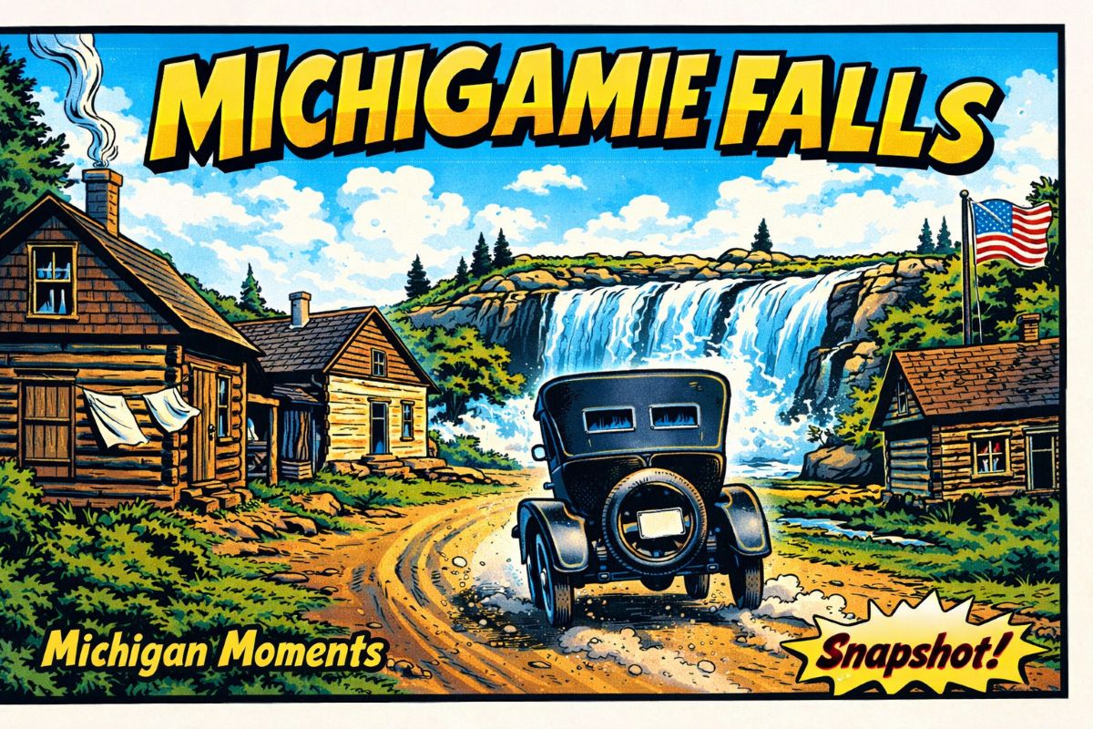
Michigan Moment Snapshot
Michigamme Falls Ghost Town: One Photo of a Vanished U.P. Camp
A dirt road, rough log buildings and an early automobile offer a rare glimpse of a possible settlement near Michigamme Falls in Iron County.
Watch this Michigan Moment Snapshot about the uncertain history of Michigamme Falls in Michigan’s western Upper Peninsula.
What This Michigamme Falls Ghost Town Video Shows
The video centers on one photograph associated with Michigamme Falls, north of Florence, Wisconsin, in Iron County, Michigan. The image shows an early automobile stopped on a rough road beside several log structures.
A few people stand near the buildings. Cut logs, uneven road surfaces and unfinished construction give the scene the appearance of a remote camp formed during the Upper Peninsula’s mining and logging period.
The photograph raises more questions than it answers. No clearly visible business signs identify the settlement, and surviving public records do not establish how long the buildings stood or why they were abandoned.
Clues Found in the Michigamme Falls Photograph
A Name From the Border Country
Michigamme Falls was a known geographic name near the Michigamme River in Iron County. Historical postcard references show the name in use by the early 20th century.
The site should not be confused with the community of Michigamme in Marquette County, more than 60 miles to the north.
North of Florence, Wisconsin
The Michigamme River approaches the Wisconsin border before joining the Brule River to form the Menominee River.
This border district supported logging, mining, road building and hydroelectric work at different points in its history.
Rough Log Buildings
The structures appear to have been built from large horizontal logs. Such construction could be completed quickly with materials cut near the site.
The buildings may have housed workers, supplies or families, but the image alone does not establish their use.
A Road Without a Commercial Center
The photograph shows a dirt roadway rather than a developed downtown. There are no visible sidewalks, utility poles, brick stores or depot buildings.
That suggests a small and possibly temporary settlement rather than a mature mining town.
The Settlement Disappears
The video suggests that families moved away and cabins were abandoned. That conclusion is plausible, but the available sources do not provide a confirmed closing date or population count.
Short-lived camps often vanished when nearby work ended or better roads redirected traffic.
The Falls Become a Hydroelectric Site
The modern Michigamme Falls name is tied mainly to the reservoir, dam and hydroelectric development on the river.
The impoundment changed the river and heavily altered the original falls.
“One photograph can preserve a place even after its buildings, roads and residents have slipped from the public record.”
Was Michigamme Falls Really a Ghost Town?
The answer remains uncertain. Michigamme Falls clearly existed as a geographic place name. Historical references, road descriptions and postcards connect the name to the Michigamme River area north of Florence.
What is less clear is whether a formally recognized village stood there. I found no strong evidence of a post office, recorded village plat, census population or established downtown carrying the Michigamme Falls name.
The photographed buildings could represent a logging camp, mining prospect, construction camp, fishing settlement or private roadside cluster. Calling it a ghost town is reasonable in a broad sense, but the term should not imply more documentation than currently exists.
Mining and Logging Near the Michigan-Wisconsin Border
Iron County grew through iron mining, lumbering and railroad construction. Camps were often built near work sites before anyone knew whether an operation would become permanent.
Log buildings could be raised quickly with nearby timber. Roads were often little more than cleared routes through the woods, and supplies arrived by wagon or early motor vehicle.
Some camps developed into established communities. Others disappeared when a mine failed, timber was exhausted or transportation routes shifted. The Michigamme Falls image fits that regional pattern, although the precise reason for this site’s decline has not been verified.
The Michigamme River and Falls
The Michigamme River begins farther north in the Upper Peninsula and flows through several lakes and reservoirs before reaching southern Iron County. It later joins the Brule River to form the Menominee River.
Today, Michigamme Lake is also known as the Michigamme Falls Reservoir. Federal and state records identify the Michigamme Falls Dam and Hydroelectric Project on this section of the river.
Hydroelectric development altered the original falls and surrounding river corridor. As a result, the modern setting does not fully resemble the place seen by early travelers or the people pictured beside the log buildings.
What We Can Confirm
- Michigamme Falls is a documented place name in southern Iron County.
- The location is on the Michigamme River north of Florence, Wisconsin.
- Historical references show the name was in use by the early 1900s.
- A road to Michigamme Falls was referenced in a state geological report.
- The surviving photograph shows log structures beside a dirt road.
- An early automobile and several people appear in the image.
- The original purposes of the buildings have not been firmly identified.
- A formal village plat or population record has not been confirmed.
- The present name is strongly associated with a reservoir and dam.
- The river is now part of an active hydroelectric system.
Edited and Corrected Video Transcript
Open the complete Michigamme Falls transcript
0:00 — A Michigan Moment Snapshot.
0:02 — By the early 20th century, this part of the Upper Peninsula carried a name: Michigamme Falls.
0:07 — It stood along the Michigamme River north of Florence, Wisconsin, in the heart of Michigan’s iron and timber country.
0:16 — The photograph shows log buildings, rough roads and piles of cut timber. The scene suggests how quickly remote work camps could form when mining, logging or construction brought people into the forest.
0:23 — Not every camp became a permanent town. Operations could fail, transportation could shift and workers could move elsewhere.
0:31 — The buildings in this photograph appear to have vanished. Their names, uses and exact location remain uncertain.
Today, the Michigamme Falls name is associated mainly with the dam, reservoir and hydroelectric project on the river.
0:40 — This single image preserves a place whose full story has largely disappeared from the public record.
Historical Sources
- Michigan4You: A Dirt-Road Downtown Near Michigamme Falls
- Michigan Department of Natural Resources: Peavy Pond and the Michigamme River System
- Michigan Geological Survey: Ground-Water Problems of the Iron River District
- Federal Energy Regulatory Commission: Menominee River Basin Hydroelectric Projects
Watch More Michigan Moments
See more short videos about Michigan mining camps, forgotten communities, historic photographs and Upper Peninsula history.
View All Michigan MomentsVideo presented as part of the Michigan Moments history series from Thumbwind Publications LLC.
Related Posts