 by
by 
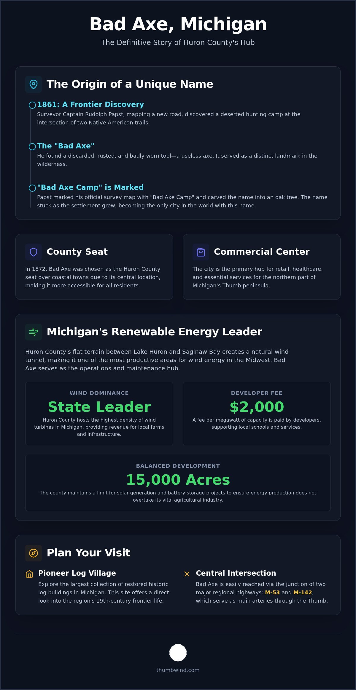
In 1861, surveyor Captain Rudolph Papst stumbled upon a discarded, rusted tool at a deserted hunting camp and decided the site needed a name. He didn’t choose something grand or poetic; he simply marked his map "Bad Axe Camp." Today, Bad Axe Michigan remains the only city in the world with this name, much to the confusion of internet searchers who often find pop culture references before they find our local history. You likely recognize the name from a quirky road sign or a map of the Thumb, but there is more to this community than a peculiar title.
It is easy to assume the name is just folklore or a marketing gimmick, but the reality is rooted in the early surveying of Huron County. This guide clarifies the definitive story of that broken tool and explains why this city evolved into the commercial and administrative heart of the region. We will look at the best local historical sites, including the Pioneer Log Village, and examine how the city maintains its role as a central hub while embracing the growth of the local renewable energy sector.
Key Takeaways
- Learn the documented story of how a damaged tool found in 1861 by Captain Rudolph Papst gave the city its unique name.
- Understand why Bad Axe Michigan serves as the vital commercial and administrative hub for all of Huron County.
- Explore how the city became a center for renewable energy and what the wind turbine developments mean for the regional economy.
- Get logistical details for visiting the Pioneer Log Village, which features the state’s largest collection of restored log buildings.
- Plan your route through the Thumb using the intersection of M-53 and M-142 to reach this central Michigan destination.
The Story Behind the Name: A Broken Tool and a Frontier Camp

Bad Axe, Michigan, functions as the commercial and administrative heart of Huron County. It’s the county seat. The town serves as a vital junction for travelers moving through the Thumb, hosting the local government offices and essential regional services. Its identity is tied to its central location, which helped it secure its status as the regional capital in the late 19th century.
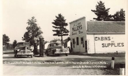
The origin of the name is not a myth, but a documented event from 1861. During a survey for a new road from Bay City to Sand Beach, Captain Rudolph Papst found a broken and rusted tool at a deserted hunting camp. He recorded the site as "Bad Axe Camp" on his official maps, a name that eventually stuck even as the settlement grew into a permanent village. To see how the modern downtown looks today, watch this helpful video:
Captain Rudolph Papst’s 1861 Find
Papst found the damaged tool at the intersection of two native American Indian trails. The axe was so badly worn that it was useless, yet it provided a distinct landmark in the dense wilderness. He carved the name into a large oak tree to mark the spot for future travelers. This specific site corresponds closely with the current intersection of Huron and Port Austin Avenues in the modern downtown district.
Incorporation and the Rise of the County Seat
The transition from a frontier camp to a political center happened quickly. In 1872, officials decided to move the county seat from Port Austin to a more central location. This sparked significant political conflict, as coastal towns fought to keep their influence. However, the History of Bad Axe shows that its inland position was ultimately seen as more accessible for all county residents.
Disaster struck in 1881 when the Great Fire swept through the region, destroying many of the original wooden buildings. This forced a period of rapid reconstruction using more durable materials like brick and stone. The fire reshaped the city’s architecture and solidified its role as a resilient hub for the surrounding farming communities.
The Energy Capital: Wind Farms and the Regional Economy
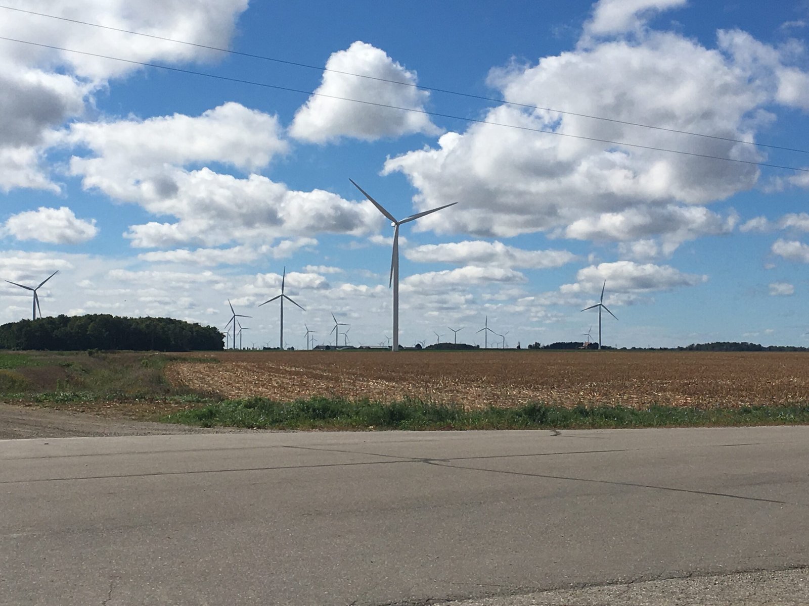
While the city’s name recalls a frontier past, the modern horizon of Bad Axe Michigan is defined by steel and technology. Huron County has emerged as the state’s leader in renewable energy. The flat terrain of the Thumb, positioned between Lake Huron and Saginaw Bay, creates a consistent wind tunnel. This unique geography makes the area one of the most productive sites for wind harvesting in the Midwest.
This industry provides a steady revenue stream for local farming families through turbine leases. According to the Michigan wind farm map, the density of these installations is highest in the townships immediately surrounding the city. As of March 2026, renewable energy developers in the county must pay a fee of $2,000 per megawatt. This revenue supports local infrastructure and schools without significantly reducing the available acreage for crops.
Huron County as a Renewable Energy Leader
The city serves as the operations and maintenance center for hundreds of turbines. Landowners often practice dual-use agriculture, planting sugar beets and dry beans right up to the base of the turbine pads. While wind dominates, the county also maintains a 15,000-acre limit for solar generation and battery storage projects. This careful regulation ensures that energy production does not overtake the region’s foundational agricultural industry.
Agricultural and Commercial Importance
As the county seat, Bad Axe Michigan draws residents from across the Thumb for retail and healthcare needs. It remains the primary shopping and service destination for the northern part of the peninsula. Local grain elevators process massive yields from the surrounding fields, which are then shipped across the Great Lakes. The city’s growth is closely linked to neighboring communities like Elkton Michigan, forming a connected network of small-town commerce.
Visitors often notice the stark contrast between the high-tech turbines and the preserved 19th-century structures at the Pioneer Log Village. It’s a visual reminder of how far the region has progressed in 150 years. To keep up with these changes, subscribe to Michigan Moments for the latest regional updates.
Exploring the Pioneer Log Village and Local Attractions
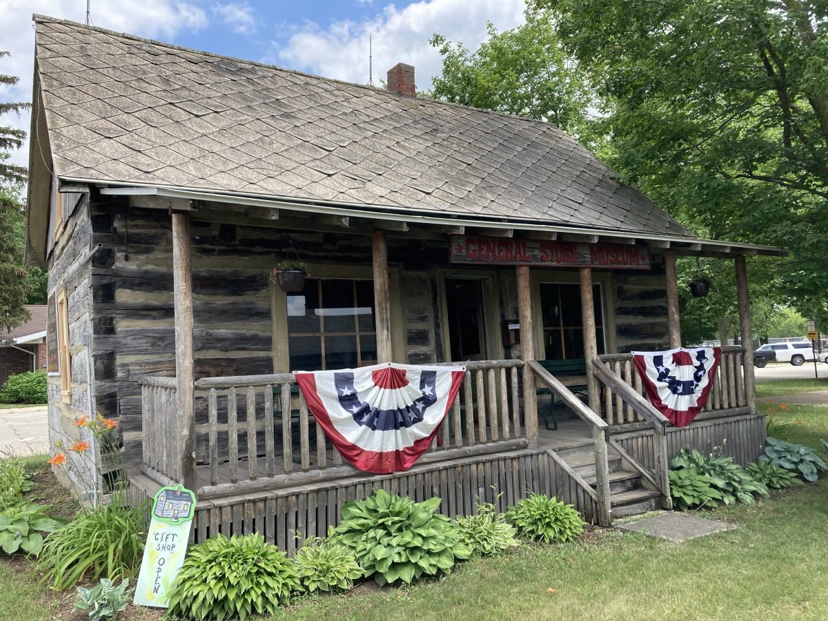
The Pioneer Log Village stands as a testament to the rugged beginnings of the Thumb region. Located within the Bad Axe City Park, this site features the largest collection of authentically restored pioneer log buildings in Michigan. Each structure was originally built between 1875 and 1900 and later moved to this central location to ensure its preservation for future generations.
Preserving 19th Century Thumb History
The village includes a general store, a one-room school, a log barn, and a blacksmith shop. One of the most recognizable structures is the Linton Memorial Chapel, which remains a popular site for small ceremonies and is available for weddings for a $40 donation. These buildings house thousands of artifacts that illustrate daily life for early settlers in Bad Axe Michigan, providing a clear distinction between documented history and local folklore.
The community celebrates this heritage during Michigan Log Cabin Day, held annually on the last Sunday in June. During the summer months, the village is open to the public on Sunday afternoons from 2:00 pm to 4:00 pm between Memorial Day and Labor Day. Admission is free, as the Bad Axe Historical Society operates the site on a volunteer basis.
Regional Events and Community Festivals
Beyond the log village, the Bad Axe City Park serves as the staging ground for the annual Hatchet Festival. This event celebrates the city’s unique name and mascot, drawing residents and visitors to the downtown area every June. The park provides ample green space for recreation and serves as a central gathering point for the northern Thumb region.
The Huron Community Fair, held at the nearby fairgrounds, is another major draw that brings thousands of people to the county seat. Travelers should plan for increased traffic at the intersection of M-53 and M-142 during the fair week in late summer. Parking is typically available in designated lots, but those visiting during peak festival hours should arrive early to navigate the crowds and find accessible spots near the main gates.
Planning Your Visit to the Huron County Seat
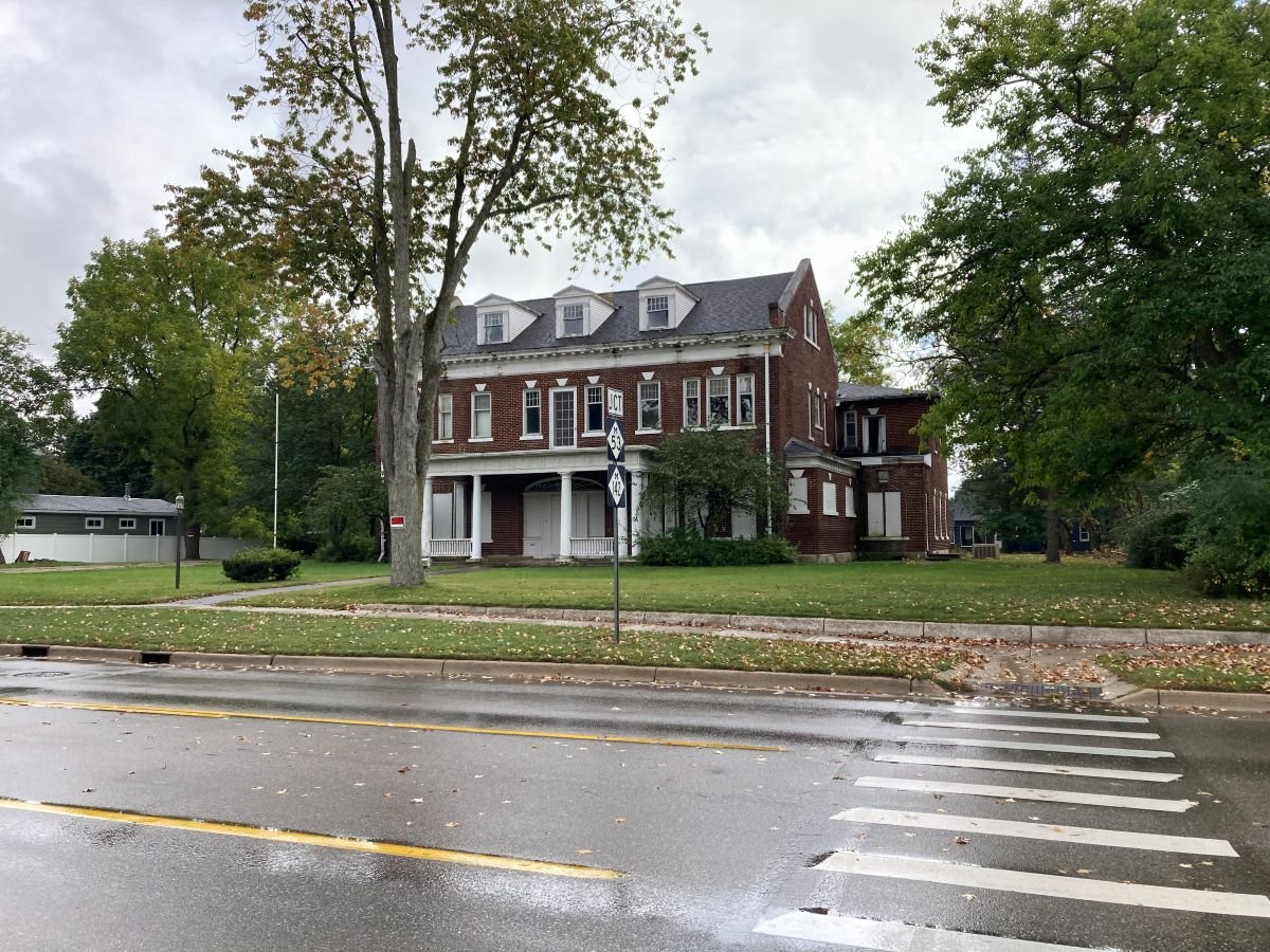
Bad Axe Michigan sits at the geographic center of the Thumb region, making it the logical starting point for any regional tour. The city is located at the intersection of M-53 and M-142. This location allows visitors to reach both the eastern and western shores of Huron County within 30 minutes. Travelers visiting Bad Axe Michigan from the south will find M-53 to be the most direct route, cutting through miles of productive farmland and the county’s signature wind farms.
Getting to Bad Axe via M-53 and M-142
The drive from Detroit takes approximately two hours, covering about 110 miles. Travelers from Bay City should expect a 75-minute trip heading east on M-142. Key stops along the M-53 corridor include Imlay City and Marlette, which offer fuel and dining options before you reach the more rural stretches of the northern Thumb. While the roads are generally clear, seasonal traffic increases during the summer months. You should watch for slow-moving farm equipment on the highways, especially during the spring planting and fall harvest seasons.
Connecting to the Tip of the Thumb
Using the city as a base allows for quick day trips to coastal destinations. Port Austin is a 20-minute drive north on M-53, offering access to kayaking and the famous Turnip Rock. The Pointe Aux Barques lighthouse is roughly 30 minutes away to the northeast. The city offers several hotels and local motels that provide more availability and lower rates than the often-crowded lakeside resorts during peak weekends.
A typical itinerary might include a morning visit to the Pioneer Log Village followed by an afternoon at Sleeper State Park in Caseville. This central positioning ensures you aren’t stuck in one spot if the weather changes on the coast. Before you hit the road, subscribe to Michigan Moments for the latest travel updates and regional history tips.
Experience the Center of Huron County
Bad Axe Michigan has transformed from a simple surveyor’s camp marked by a rusted tool into a modern leader in renewable energy. It provides a rare look at frontier life through the Pioneer Log Village while simultaneously powering the future with the state’s densest collection of wind turbines. Whether you’re using the city as a base for coastal trips to Port Austin or visiting for the annual Hatchet Festival, its central position makes it the indispensable heart of Huron County. The city serves as a reminder that even a broken tool can lead to a lasting legacy.
We’ve spent over 15 years reporting on the unique history and regional news of the Thumb. As a trusted source for travel guides and local lore, we prioritize accuracy and practical details for every traveler. We believe in preserving the small details that make these communities worth visiting. Don’t miss out on the next deep dive into our state’s past.
Take the drive up M-53 and see for yourself why this city with the unusual name remains a vital, resilient part of Michigan’s rural identity. It’s a look into the heart of the Thumb that you won’t soon forget.
Frequently Asked Questions
How did Bad Axe Michigan get its unique name?
Captain Rudolph Papst named the site in 1861 after finding a rusted, broken tool at a deserted hunting camp. He recorded "Bad Axe Camp" on his official survey map for a road connecting Bay City and Sand Beach. While residents occasionally considered more traditional names, the unique title remained through the town’s incorporation. Today, Bad Axe Michigan is the only city in the world to carry this distinctive name.
Where is Bad Axe located in relation to Detroit?
Bad Axe sits approximately 110 miles north of Detroit in the center of Michigan’s Thumb region. The drive typically takes about two hours via M-53, which runs directly into the heart of the city. Its central position makes it a convenient middle ground for those traveling from southeast Michigan toward the lakeside communities and state parks at the northern tip of the peninsula.
What are the top things to do in Bad Axe for history fans?
History enthusiasts should prioritize the Pioneer Log Village, which contains the largest collection of restored log buildings in the state. Visitors can explore an authentic 19th-century general store, a one-room schoolhouse, and the Linton Memorial Chapel. The Bad Axe Historical Society also maintains an extensive archive of regional artifacts that document the city’s transition from a frontier outpost to a modern agricultural and energy hub.
Is Bad Axe the county seat of Huron County?
Yes, Bad Axe Michigan has served as the county seat of Huron County since 1872. The administrative center was moved from Port Austin to this central location to make government services more accessible to all residents of the Thumb. Today, it remains the primary site for the county courthouse, sheriff’s office, and other essential civic institutions. Its inland position ensures it remains the functional heart of the surrounding townships.
What is the best time of year to visit the Pioneer Log Village?
The best time to visit is on Sunday afternoons between Memorial Day and Labor Day, when the buildings are open for public tours from 2:00 pm to 4:00 pm. Planning a trip for the last Sunday in June is especially rewarding because the city celebrates Michigan Log Cabin Day. During this annual event, volunteers provide deeper insights into the restoration of the 19th-century structures and the daily lives of early settlers.
Are there wind farm tours available in the Bad Axe area?
While there are no formal guided tours of the turbines, the high density of wind farms surrounding the city makes self-guided viewing easy. Most turbines are located on private farmland along M-53 and M-142. You can observe these massive structures from the roadside, but you must remain on public property. The regional wind farm map helps travelers identify the most active energy corridors and the best vantage points for photography in the county.
Disclaimer
Information published on Thumbwind.com is provided for general informational purposes. While we make reasonable efforts to keep articles accurate and current, details such as prices, hours, regulations, access conditions, and other information may change without notice. Readers should verify important details with the appropriate business, agency or official source before making travel, financial or other decisions. Thumbwind.com is not responsible for the content, availability or practices of third-party websites linked from our articles.