 by
by 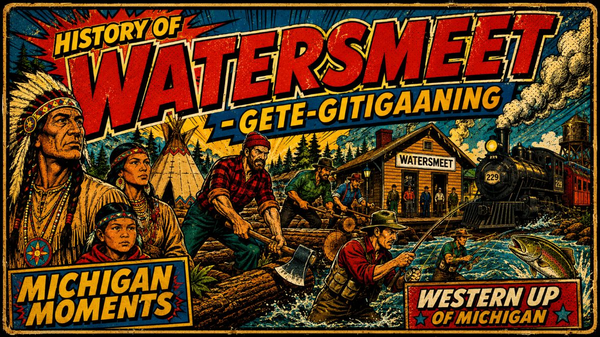
Why the History of Watersmeet Michigan Starts With Water
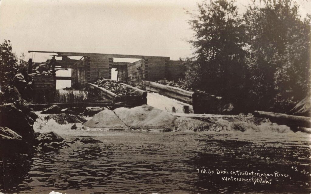
Watersmeet, Michigan, is one of those Upper Peninsula towns whose name tells the truth. The place was named because waters meet there. The Ontonagon River flows north toward Lake Superior. The Wisconsin River flows south toward the Mississippi River. The Paint River flows east toward Lake Michigan. That is not a slogan. It is geography doing something rare.
That fact gives the History of Watersmeet Michigan its first surprise. Before railroads, hotels, stores, or sawmills, this was a crossing place. Water moved people. Water carried food. Watermarked routes. Long before a steam engine pulled into town, this was already a place of movement.
Table of Contents
Watch – Watersmeet, Michigan: From Ojibwe Village to Logging Frontier
Lac Vieux Desert Came First
The story begins with the Lac Vieux Desert Band of Lake Superior Chippewa. Tribal history places the Lac Vieux Desert Band in this region through treaty history, long use, and a continuing community presence. The 1854 Treaty of La Pointe established the Lac Vieux Desert Reservation, known in Anishinaabe as Gete-gitigaaning.
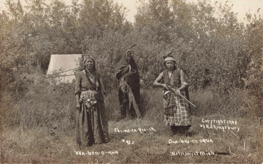
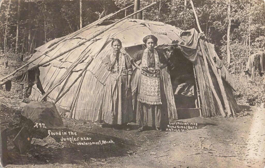
Old labels on early Watersmeet postcards use language common to their time. Today, we should read those images with care. They are not costume scenes. They are evidence of families living through a period of enormous change. The camera caught Ojibwa people in their own homeland as railroad companies, timber crews, and new businesses pushed into the same country.
Western U.P. History on Video
Rail towns, lake country, mining routes and northwoods stories shaped the western Upper Peninsula. Watch four Michigan Moments episodes built for readers who like Michigan history with faces, places and a strong sense of time.
History of Watersmeet Michigan and the Railroad Boom
Then came the railroad, and the tempo changed.
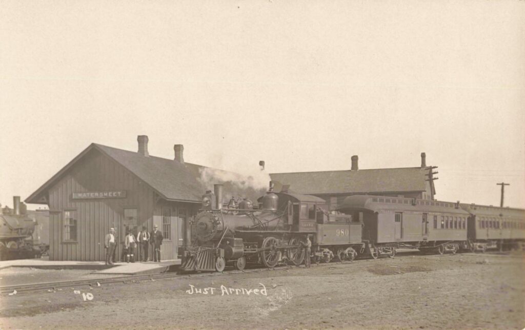
Watersmeet was settled around 1884 as a railroad station. MichiganRailroads.com describes the town as a junction on the Chicago & Northwestern line, with tracks running from Wisconsin through Land O’Lakes toward Ironwood. A second line connected Iron River to Watersmeet, while another branch ran north toward the forests around Lake Gogebic.
That made Watersmeet more than a stop. It became a working rail point. The town had water, coal, a turntable, a wye, a yard, and a seven-stall roundhouse. Those were not minor details. Steam railroads needed constant care. Engines needed water. Crews needed meals. Freight needed sorting. Passengers needed a place to wait. Watersmeet had all of it.
The counterintuitive part is this: Watersmeet was remote, but it was not isolated. The railroad made it busy. A place surrounded by forest became a connector for Upper Peninsula railroads, timber camps and iron-range traffic.
The Roundhouse Was the Town’s Working Heart
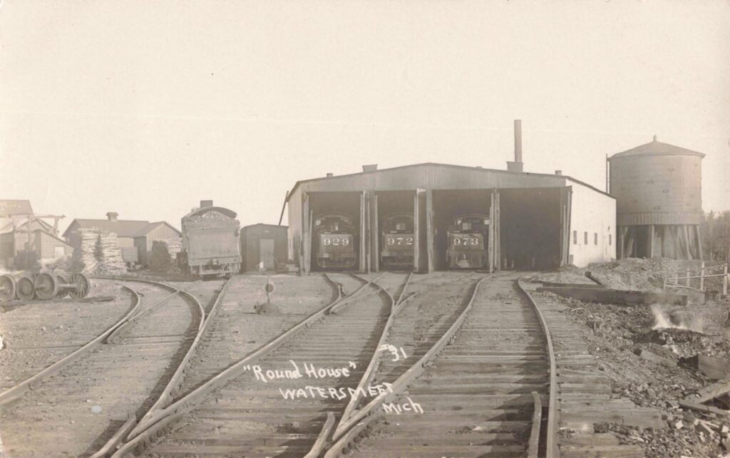
The roundhouse deserves a closer look. Built about 1890, it had massive oak beams and room to service locomotives. The building stood near Roundhouse Road and helped make Watersmeet a maintenance point, not just a station on a map.
Think of what that meant on a winter morning. A locomotive arrived, blowing steam into the cold air. A crew climbed down. Someone checked the firebox. Someone hauled coal. Someone watched the clock. In a town like Watersmeet, the railroad was not background noise. It set the day.
By 1918, the C&NW had a station agent on the day shift and a telegraph operator working around the clock. That single detail says a lot. Watersmeet had messages coming and going at all hours.
Main Street Burned, Then Came Back
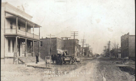
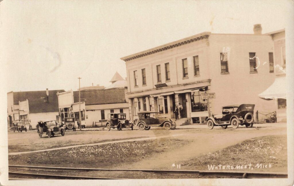
Watersmeet’s early business district had its hard turns. In 1898, a fire on Main Street destroyed much of the business section, including the Commercial House, Kelly buildings, a dry goods store, a saloon, and a barber shop. Only one business building on Main Street was saved, according to the rail history timeline.
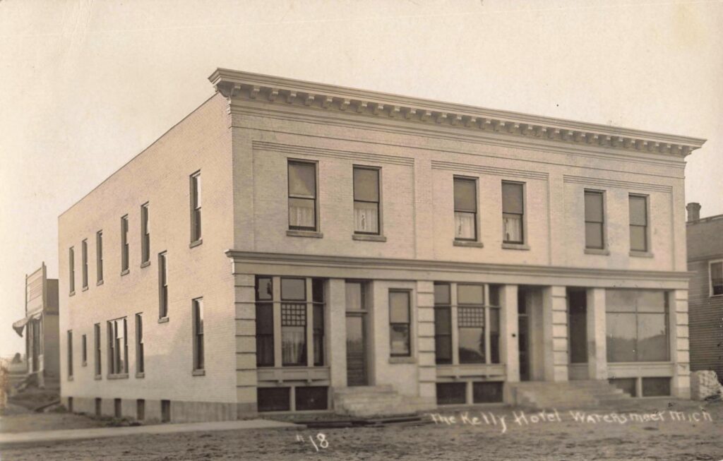
Yet the town rebuilt. That is one reason the history of Watersmeet, Michigan, feels so human. There are no grand speeches here. There are stores reopening, hotel rooms filling, rail crews eating dinner, and families getting on with the next day.
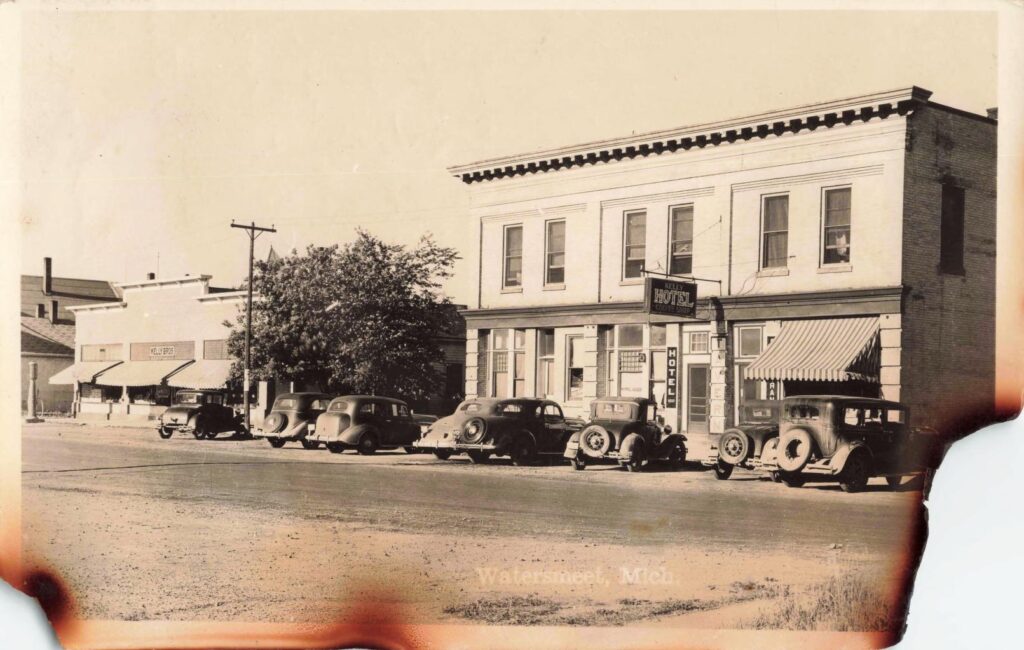
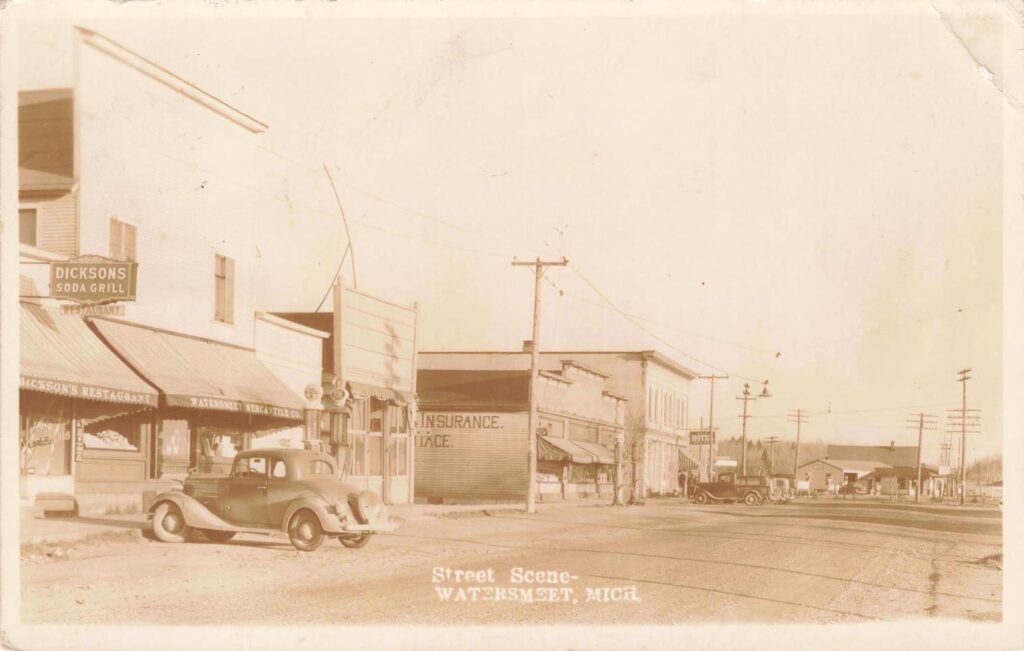
The Kelly Hotel became one of the town’s familiar anchors. In the 1930s images, the hotel stands with cars parked outside, a coffee shop sign hanging near the door, and a street that looks both modest and busy.
Stores, Lunch Rooms and the Everyday Town
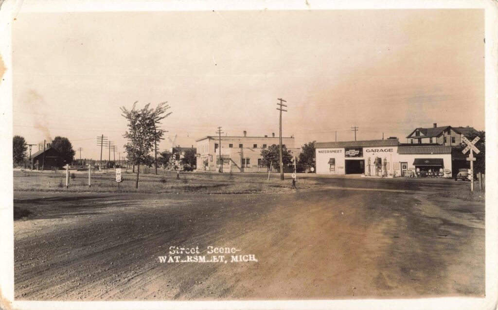
A town is more than its rail yard. It is also where people buy socks, coffee, nails, meat, medicine and a hot meal. Watersmeet’s old street scenes show a town serving workers, families, travelers and lake visitors.
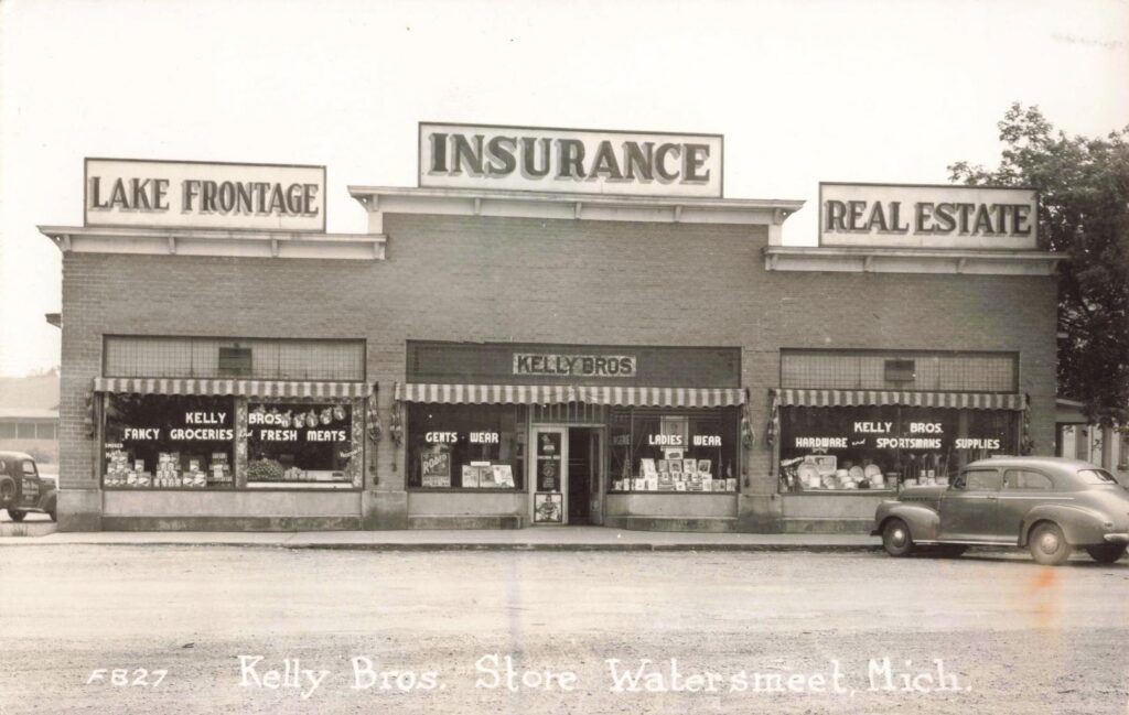
Kelly Bros. Store advertised groceries, fresh meats, clothing, hardware, insurance, real estate and lake frontage. That sign reads like a business plan for a northwoods town. It tells us Watersmeet had moved from first settlement into a service center for people who worked nearby, lived nearby or came north for fishing and rest.
Logging Built the Boom, Then Changed the Future
The forests around Watersmeet drew timber companies. The railroad helped carry logs and lumber out. In 1886, a rail extension from Watersmeet was being built toward Diamond Match Co. camps on the Ontonagon River, with the goal of opening pine timber and easing supply work.
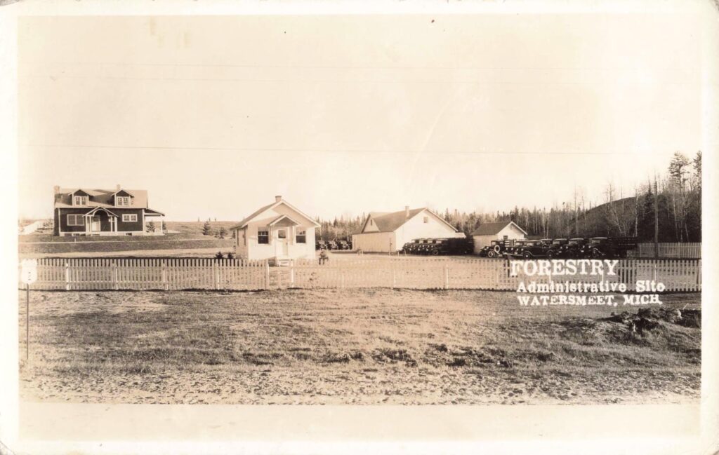
Like many Upper Peninsula towns, Watersmeet was logged heavily in the late 1800s and into the 1900s. Then came the twist. Unlike many cut-over places, more than 120,000 acres around Watersmeet were placed under National Forest Service ownership. Those acres later supported forest management, recreation, resorts, cottages and homes near area lakes.
That is the article’s strongest counterintuitive insight. The logging boom did not only remove the forest. It also helped set the stage for a different Watersmeet: a place tied to public forest, fishing, hunting and tourism.
Fish, Forests and a New Kind of Visitor
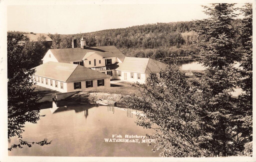
By the 1930s, the old rail-and-logging town was changing. Fish hatchery images from 1935 and 1936 show a different kind of investment. Instead of pulling resources out as fast as possible, the community was beginning to manage them.
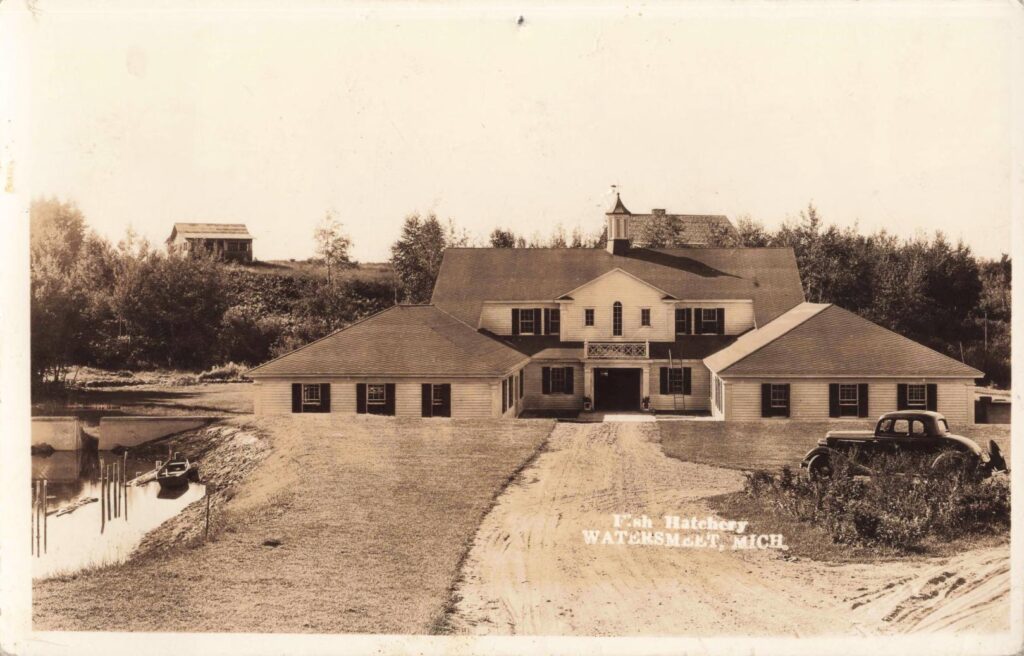
The hatchery views are useful because they show Watersmeet in transition. The buildings are tidy. The water is calm. The setting looks built for work, but not the noisy work of sawmills and rail yards. This is the Watersmeet that would become familiar to anglers, hunters, campers and cabin owners.
Rustic Riverside Inn and the Resort Era
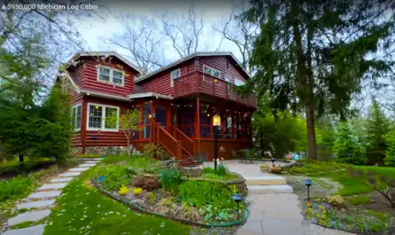
The Rustic Riverside Inn, 12 miles west of Watersmeet, belongs in the article near the end. It shows what came after the first rush of timber and rail traffic. People still came to Watersmeet, but more of them came for the lakes, rivers and woods.
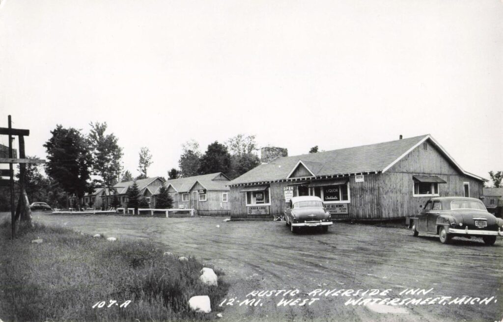
That shift did not erase the old town. It layered a new chapter onto it. The same roads and rail routes that carried workers and freight also helped carry visitors.
What the History of Watersmeet Michigan Says About the U.P.
The History of Watersmeet Michigan is not just a story about a small town. It is a story about how the western Upper Peninsula changed.
First came the Lac Vieux Desert Ojibwa, whose history remains central to the place. Then came rail lines and timber companies. Main Street grew, burned, and rebuilt. Hotels served rail crews. Stores sold groceries, clothing, hardware and lake frontage. Later, public forest and fishing helped give Watersmeet a new identity.
The town’s most unique historical feature is still its name. Waters meet there. So did people. So did industries. So did old ways and new ones.
For readers studying the History of Watersmeet Michigan, the lesson is clear. Small towns can hold large stories. Watersmeet was never just a dot near the Wisconsin line. It was a rail junction, a timber town, an Ojibwa homeland, a Main Street community and a gateway to the northwoods.
And that is why Watersmeet still earns a second look.
Images on this page may contain affiliate links in which we may receive a commission. See our affiliate disclosure for details.
Works Cited for the History of Watersmeet Michigan
Gogebic County. Little Known Facts About the Gogebic Range. Gogebic County, accessed 9 July 2026.
Lac Vieux Desert Band of Lake Superior Chippewa Indians. LVD Tribal History. Lac Vieux Desert Band of Lake Superior Chippewa Indians, accessed 9 July 2026.
MichiganRailroads.com. Station: Watersmeet, MI. MichiganRailroads.com, accessed 9 July 2026.
Watersmeet Township. Watersmeet Township Master Plan 2023-2027. Watersmeet Township, 2023.