 by
by Hiking in Michigan can become a passion. The very act of walking miles of trails in the fresh air, and the chance to see something new and unique along the way, is a true pleasure. Hiking is a memorable and safe activity that offers people a chance to relax and mentally recover from their daily lives at work and home.
Here is What We Will Cover: Hiking in Michigan
Michigan is A Playground
Choosing a Michigan hike starts with three questions: Where do you want to go, how far do you want to walk, and what terrain can you manage? This guide covers short walks, lake-view hikes, and longer routes across both peninsulas. Use the comparison below to narrow your choices, then follow the official trail links for maps and current conditions.
Experiencing the beauty of nature in this Great Lakes state is only possible in Michigan. In addition, all factors favoring hiking are found in this state. Hiking locations and accessible vistas in Michigan can be found in the wilds of the Porcupine Mountains, the enormous Sleeping Bear Dunes National Lakeshore, cross-country, river and water trails, and many more. All these places are within a day’s drive of Southeast Michigan and Detroit.
How to Choose a Michigan Hiking Trail
Choose a region first, then compare individual routes. A short walk near your lodging and a backcountry trip in the Upper Peninsula require different plans. Check whether the listed mileage describes a loop, a one-way route, or the total round trip.
Distance alone does not show how demanding a hike will be. Sand, stairs, steep grades and exposed sections can slow your pace. Before leaving, review the official map, weather forecast, and any trail or parking closures.
Compare these Michigan hiking destinations by location, distance and terrain. Some entries describe a single hike; others cover parks or long-distance trail systems where you should select a shorter section. Follow the official links for maps and current access information.
Thumbwind · Michigan trail guide
Find your next Michigan hike
Compare short walks, lake-view routes and backcountry trips. Check the route format, choose your distance and open the linked maps before heading out.
Showing all 18 entries
| Trail / destination | Region | Distance & format | Plan your hike | Maps & details |
|---|---|---|---|---|
| 01Sugarloaf MountainNear Marquette | Upper Peninsula | About 1 mile round trip | Rocky footing and stairs lead to Lake Superior views. Distance varies by approach. | Visitor guide |
| 02Rosy Mound Natural AreaGrand Haven | West Michigan | 1.4 miles out and back | 0.7 mile each way to the shoreline, with substantial dune stairs. Optional extensions add distance. | County map |
| 03Iron Belle TrailDetroit to Ironwood | Both peninsulas | Choose a section | Statewide hiking and cycling routes. Select the hiking route; ordinary Mackinac Bridge crossings require vehicle transportation. | DNR maps |
| 04Greenstone Ridge TrailIsle Royale | Upper Peninsula | 40+ miles · backpacking | Cross-island itinerary including campground spurs. Plan island transportation and overnight stays. | NPS guide |
| 05Pictured Rocks — North Country TrailMunising–Grand Marais area | Upper Peninsula | Up to 42 miles one way | Park section of a longer national trail. Choose a shorter section or plan a multiday trip. | NPS guide |
| 06Chapel–Mosquito LoopPictured Rocks, near Melstrand | Upper Peninsula | 10.5-mile loop | Full loop includes Mosquito Falls, beaches and cliff views. Roadside parking can add mileage. | NPS guide |
| 07Pyramid Point TrailSleeping Bear Dunes | Northern Lower Peninsula | 1.2 miles round trip | Overlook outing; longer loop is about 2.7 miles and includes a road section. Do not descend the bluff. | NPS guide |
| 08Escarpment TrailPorcupine Mountains | Upper Peninsula | 4.3 miles one way | Pure Michigan lists 4.3 miles; full return trip is 8.6 miles. Ridge terrain and exposed overlooks; choose trailheads carefully. | Trail guide |
| 09Leelanau State Park trailsNear Northport | Northern Lower Peninsula | 8.5-mile trail network | Choose a route within the Cathead Bay trail area, separate from the lighthouse area. | DNR maps |
| 10Kal-Haven TrailKalamazoo–South Haven | Southwest Michigan | 33.5-mile linear corridor | Former railroad corridor. Choose a shorter section and include the return walk in your plan. | DNR guide |
| 11New Buffalo Township Memorial ParkNew Buffalo | Southwest Michigan | Mileage not verified | Community-park walking routes. Confirm the intended route and distance with the township. | Township guide |
| 12Van Buren Trail State ParkHartford–South Haven | Southwest Michigan | 14 miles one way | Multiuse former railroad route through farmland and woods. Select a defined section for a shorter walk. | DNR guide |
| 13Love Creek County ParkNear Berrien Springs | Southwest Michigan | 6-mile trail network | Rolling woodland trails through beech-maple forest. Combine loops to suit your outing. | County map (PDF) |
| 14Fred Russ Forest ParkCass County | Southwest Michigan | 4-mile trail network | Woodland routes in the park and surrounding forest setting. Use the county map to plan your walk. | County map |
| 15North Country National Scenic TrailMichigan sections | Both peninsulas | Nearly 1,200 miles statewide | Select a local section. Includes the Pictured Rocks segment listed separately in this guide. | NCTA maps |
| 16Manistee River TrailManistee National Forest | Northern Lower Peninsula | About 11 miles one way | River bluffs and rolling terrain. The longer combined loop also uses the North Country Trail. | Visitor guide |
| 17North Ottawa DunesFerrysburg, near Grand Haven | West Michigan | 10-mile trail network | Wooded dunes, hills and connecting paths. Choose a loop from the county map. | County map |
| 18Hartwick Pines — Au Sable River TrailNear Grayling | Northern Lower Peninsula | Normal loop: 3.9 miles | Access alert Partial closure: bridge conditions require an altered out-and-back route. Normal loop mileage does not describe the current outing. | DNR closure notice |
No matching trails. Try a different search or choose all regions.
Top Prime Hiking Areas in Michigan
Michigan has trails that lead hikers to various natural beauties, such as waterfalls, inland lakes, soaring hardwoods brilliant with colour in multiple seasons, and the Great Lakes dunes covered with snow in winter. In addition, these trails allow visitors to access places with a perfect view of four of the five Great Lakes. Some of these scenic trails include:
Every aspect of hiking in Michigan offers beautiful scenery and destinations. Visitors to Michigan have many choices for where to stay, depending on what they want to experience. Most hiking areas have many routes that let visitors enjoy a wide range of nature from a single destination. For instance, many major Michigan State Parks have mapped and marked trails through dense forests, dunes, and boardwalks over marshes and streams and rivers.
Sugarloaf Mountain

Hiking to the top of Sugarloaf Mountain, which is 1,000 ft above sea level, offers climbers a stunning panoramic view of Lake Superior. There are two routes climbers can take to the top of the mountain: one is steeper and shorter, while the other is more gradual and takes longer.
Rosy Mound Natural Area
Rosy Mound Natural Area is a beautiful spot in the rolling terrain near Grand Haven. The area has a meandering trail through high wooded dunes and a wide, sandy Lake Michigan beach. The best hike in this area offers views of Grand Haven and Holland. This area is also one of Michigan’s great vacation destinations.
Michigan’s Iron Belle Trail – Ironwood to Detroit
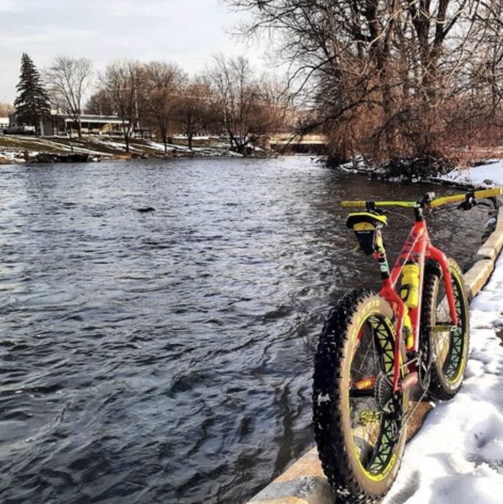
Michigan’s Iron Belle Trail has two routes that hikers can travel on foot or by bicycle. The route designated for foot traffic is rustic, while the path for bikes is shorter and paved to make the cycling process efficient. The Iron Belle Path is Michigan’s showpiece trail, passing through 48 different Michigan counties and touching hundreds of villages. Using existing routes, networks, and new connections, the path stretches more than 2,000 miles from the far western edge of the Upper Peninsula to Belle Isle in Detroit and features bicycle and hiking routes.
This trail offers hikers a beautiful experience as they pass through the white pine forest of the Upper Peninsula, over the Mackinac Bridge, and finally along the streets of downtown Detroit.
Greenstone Ridge Trail At Isle Royale National Park

Greenstone Ridge Trail is approximately 43 miles long and runs through Isle Royale National Park. The experience of traveling through a park makes it one of the best trails to consider hiking in Michigan. It allows hikers to experience the park’s state of nature. The trail offers visitors breathtaking vistas of northern Lake Superior, where they will encounter thick white pine forest, granite outcroppings, vast expanses of the Big Lake, and a few moose.
Pictured Rocks National Lakeshore – North Country Trail
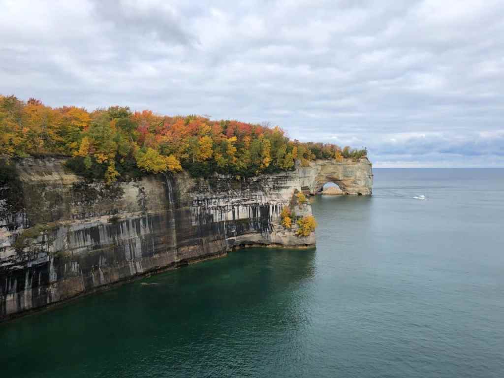
This 50-mile trail runs along Lake Superior’s southern shore in Michigan’s Upper Peninsula between Munising on the west end and Grand Maries on the east. As one of the most popular trails in the state, it does get pressure from extensive use. From Munising, hikers can catch panoramic views of Lake Superior along the bluffs. There are numerous turnouts from the main trail for access to the lake. There are reported sightings of bears, wolves, and the occasional moose.
Chapel Loop Trail
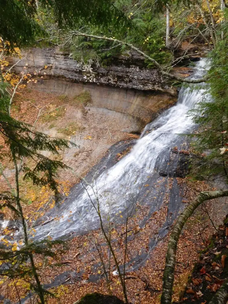
The Chapel Loop Trail at Pictured Rocks has everything a nature lover could ask for when hiking in Michigan. Incredible views, shoreline hiking, and the chance to take some stunning pictures. It’s one of the few hiking trails in Michigan with waterfalls. It’s one of the top trails in Michigan.
The 10-mile hike loop combines Michigan’s scenic views and natural wonders: the 60-foot drop of Chapel Falls, Chapel Rocks, and Grand Portal Point. Located on the shore of Lake Superior, you can even rent a boat and explore the water further.
If you choose this route, take a water bottle and insect repellent to avoid bugs and mosquito bites as you hike.
The trail town of Grand Marais is a beautiful, quaint village located on Lake Superior at the eastern end of Pictured Rocks National Lakeshore. The city is a destination point all of its own.
Pyramid Point Trail
Traversing the Pyramid Point Trail involves gentle nature walks on circuits just north of the Sleeping Bear Dunes National Lakeshore, with views of North and South Manitou Islands. Hikers will have a perfect view of Lake Michigan’s quiet beauty. It may be tempting to lope down one of the world’s largest sand dunes. However, the National Park Service specifically advises visitors not to descend the Pyramid Point bluff, citing safety and erosion!
Part of the charm of this area is the history of Native American villages that once dotted the area. This is also the area of the famous Legend of the Sleeping Bear and Manitou Islands.
Porcupine Mountains Wilderness State Park Escarpment Trail
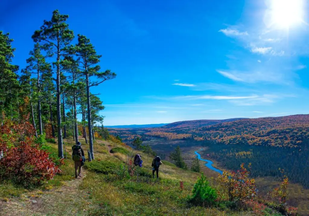
The Porcupine Mountains Wilderness State Park Escarpment Trail is located in Michigan’s western Upper Peninsula. The park is 60000 acres and is thickly forested, with waterfalls, mountains, streams, rivers, bluffs, and picturesque lakes. It also has a beautiful escarpment trail, allowing the climber to have scenic overlooks and panoramic views of various scenes like Lake of the Clouds, Lake Superior, and the upper carp River Valley.
Video: Hiking in the Porcupine Mountains on Michigan’s Upper Peninsula (Escarpment Trail + Presque Isle)
Leelanau State Park Trails
This is one of the most gorgeous walks in the area if you are on the west side of the state near Traverse City. There are 8.5 miles of trails to hike and explore here, making it an easy hike for a short getaway. While there are fewer miles to go here, there is still enough to see, such as endangered Piper Plovers soaring around and building nests on the beach near Lake Michigan.
Day Hiking in Southern Michigan
The southern part of Michigan is not left out, as it also has beautiful destinations where visitors can go hiking. Some of these places include;
Kal Haven Trail
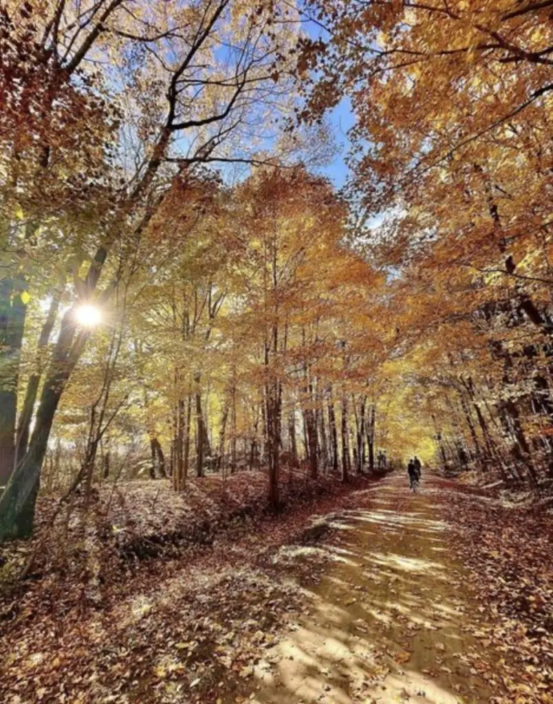
It takes approximately four hours to travel along the Kal Haven trail. It links the city of South Haven to the town of Kalamazoo. The beauty of hiking in Michigan through Kal Haven is that it allows visitors to pass through various bridges, small towns, and various points of historical sites.
New Buffalo Township Memorial Park
The park has various facilities that make it one of the best destinations for family, group, or individual vacations. In addition, the park is located on Red Arrow Highway and has a pavilion readily available for rent. Therefore, the park can host various informal and formal events.
Van Buren Trail State Park
The 14-mile Van Buren Trail State Park runs between South Haven and Hartford. This trail has a dirt-and-gravel surface. The path takes you through open farmland, blueberry fields, deep bush, and forested places. The path’s character provides a pleasant, demanding ride for mountain bikes.
Love Creek Nature Centre and County Park
The park has a river and is suitable for all skill levels. In addition, the park offers several activities, allowing visitors to choose the one that suits them.
Fred Russ Forest Park
The park is forested and glows with nature’s pure beauty. The park has a variety of species since it is also used as a research center. It has a rich history and natural beauty, making it the most visited park in Southern Michigan.
Hiking in Northern Michigan
Michigan has more than 4,600 miles of state-managed nonmotorized trails, offering opportunities for:
Horseback riding, mountain biking, hiking, and cross-country skiing. Most of the most scenic routes in Michigan are found in Michigan’s North Country. The Upper Peninsula has a rugged wild beauty that has inspired outdoor enthusiasts for generations. Here are a few on our highlight reel.
North Country National Scenic Trail
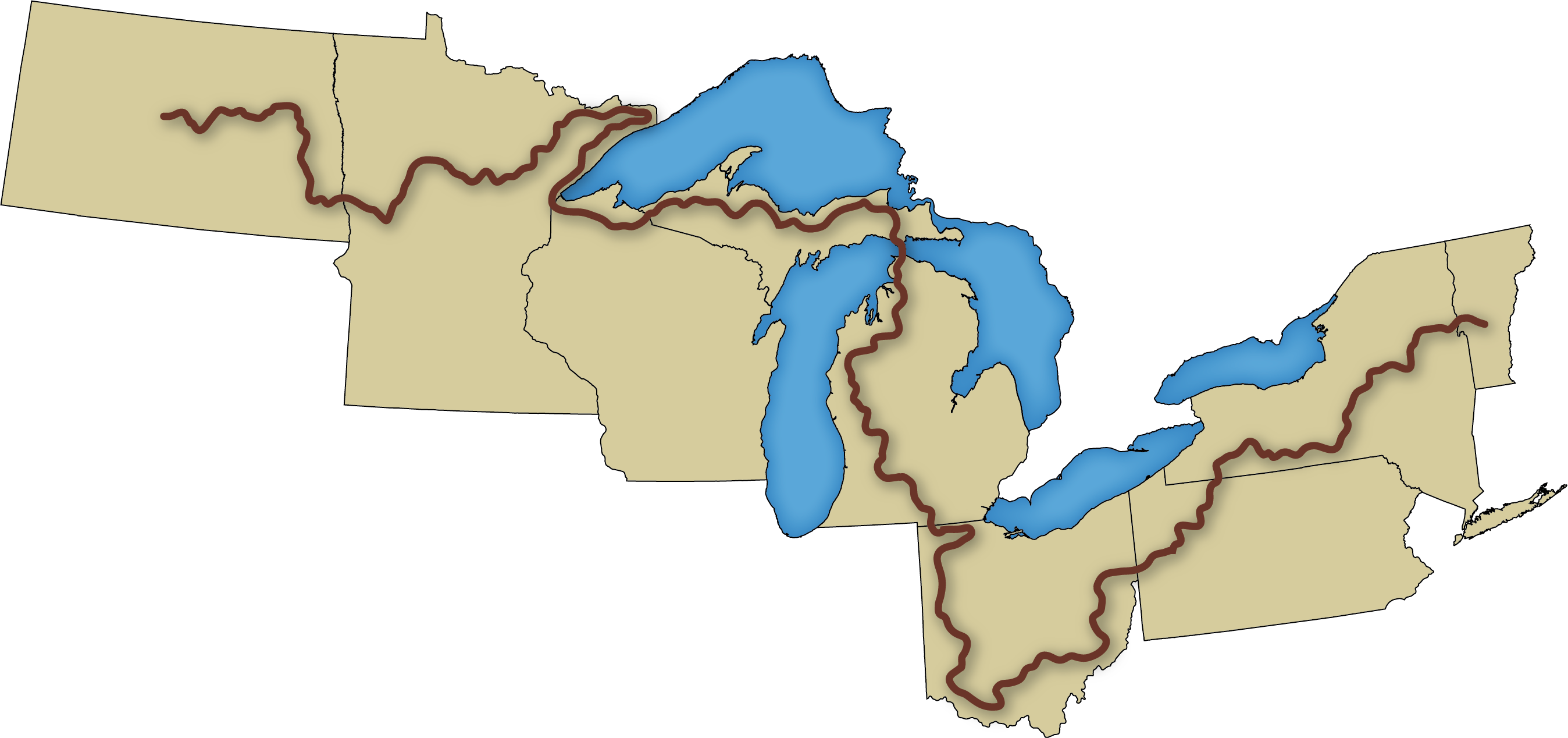
The North Country National Scenic Trail is part of America’s most comprehensive trail system, which extends over 4,600 miles. The path has varying levels of difficulty and terrain. Michigan is home to about 1500 miles of this national trail. It’s considered one of the best hiking trails in Michigan. It starts in flat farm country near the Ohio border and leads to wooded river and lake views in the Northern Lower Peninsula and beautiful Lake Baldwin. Traversing this trail is one of the most beautiful experiences, as it allows the hiker to take in a variety of scenic views. In addition, its varied terrain gives the hiker a chance to experience the beauty of the earth and its unique, exciting nature.
Manistee River Trail
Manistee River Trail follows the eastern shoreline of the Manistee River for approximately 8.8 miles through rolling hills. The trail passes through wetlands and has bridges at various points, making hiking along it a beautiful experience filled with unforgettable memories.
North Ottawa Dunes
North Ottawa Dunes is known for its excellent trail system, including stairways. The property has tremendous topography with an elevation change of 185 feet in parabolic dune formation. It has eight dunes in the rugged landscape, making the scene very beautiful for a hiking destination. In addition, it is located near Spring Lake, which adds beauty to it.
Hartwick Pines – Au Sable River Foot Trail
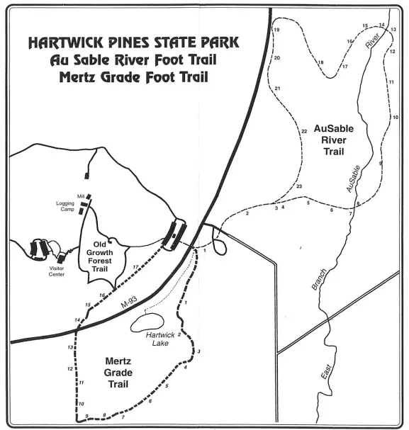
The Hartwick Pines-Au Sable River Trail, officially recognized for its route that encompasses both the iconic Au Sable River and the majestic Hartwick Pines, is among the most scenic hikes in Michigan’s lower peninsula. This trail is a 3.9-mile trek within the national forests, offering hikers a unique blend of natural beauty and serene landscapes.
Hartwick Pines State Park, part of the trail meanders, is home to one of Michigan’s last remaining stands of old-growth white pine forest. This historic forest offers a glimpse into Michigan’s rich ecological past and provides a dramatic backdrop for part of your hike. Walking through Hartwick Pines, visitors are enveloped in tranquility and awe, surrounded by towering pines that rise to the sky.
As the trail continues towards the Au Sable River, the environment shifts to the vibrant river ecosystem. The Au Sable River, known for its clear, swift waters, supports diverse wildlife and offers numerous scenic spots perfect for a rest or a photo opportunity. The trail here is well-defined and skirts the river, allowing hikers to enjoy continuous views of the water and the surrounding forest.
The Hartwick Pines-Au Sable River Trail caters to various hiking preferences, with sections suitable for casual day hikers and others that satisfy those seeking a more strenuous adventure. Throughout the seasons, this trail provides a dynamic experience. Spring and summer fill the path with lush greenery and wildflowers, fall transforms the landscape into a canvas of fiery colors, and winter offers a stark, beautiful contrast of snow-dusted trees and frozen river scenes.
For those planning a visit, the trail promises some of the most picturesque hiking in the national forests of Michigan’s Lower Peninsula and an enriching journey through diverse habitats and historical landscapes. Whether you’re a nature novice or an outdoor enthusiast, the Hartwick Pines-Au Sable River Trail offers a memorable and engaging experience in the great outdoors.
FAQs – Hiking in Michigan
What are some top hiking destinations in Michigan?
Michigan offers diverse hiking opportunities including the Iron Belle Trail, which stretches from Ironwood to Detroit, and scenic trails at Isle Royale National Park like the Greenstone Ridge Trail. Each trail provides unique natural landscapes and wildlife viewing opportunities.
Can you describe the experience of hiking at Pictured Rocks National Lakeshore?
Pictured Rocks National Lakeshore offers the North Country Trail which is renowned for its stunning views of Lake Superior. This 50-mile trail features high cliff views, dense forest sections, and access to secluded beaches, making it a premier destination for both casual hikers and adventure seekers.
What are the benefits of hiking in Hartwick Pines State Park?
Hartwick Pines State Park features the Hartwick Pines-Au Sable River Trail, noted for its historical significance and natural beauty. The park is one of the few places with old-growth white pine forests, offering a serene and educational hiking experience near the Au Sable River.
Sources & References For Hiking in Michigan
- Hostmaster. (2016, October 14). Hiking. Michigan. https://www.michigan.org/hiking
- Rousseau, M. (2018, August 13). The Most Scenic Hiking Trails in Michigan. Michigan. https://www.michigan.org/article/trip-idea/most-scenic-hiking-trails-michigan
- Strickler, J. D., & Walker, E. D. (2017). Seasonal abundance and species diversity of adult Tabanidae (Diptera) at Lake Lansing Park-North, Michigan. The Great Lakes Entomologist, 26(2), 3.
- Nineto scenic hikes in Michigan. (n.d.). Lonely Planet. Retrieved December 13, 2021, from https://www.lonelyplanet.com/articles/best-hikes-in-michigan
- Cover photo courtesy Jorge Flores on Unsplash
Related Reading: Similar to Hiking in Michigan