by
by 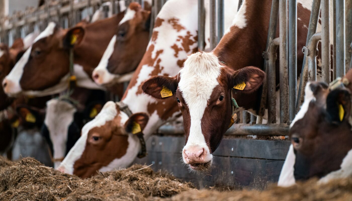
Animal Feeding Operations tied to elevated PM2.5 and health risk, spotlighting communities with low insurance and Latino populations
ANIMAL FEEDING OPERATIONS DRIVE AIR POLLUTION AND PERSISTENT INEQUITY IN U.S. COUNTIES
Ann Arbor, Mich. — A new nationwide study by the University of Michigan reveals that Animal Feeding Operations (AFOs)—concentrated hog and cattle feedlots—are associated with significantly poorer air quality and disproportionately impact socially vulnerable communities across the United States. The findings, published August 13, 2025, in Communications Earth & Environment, provide a first-of-its-kind mapping of more than 15,000 AFOs and their environmental and social burden.
CAFOs raise fine particle pollution dramatically
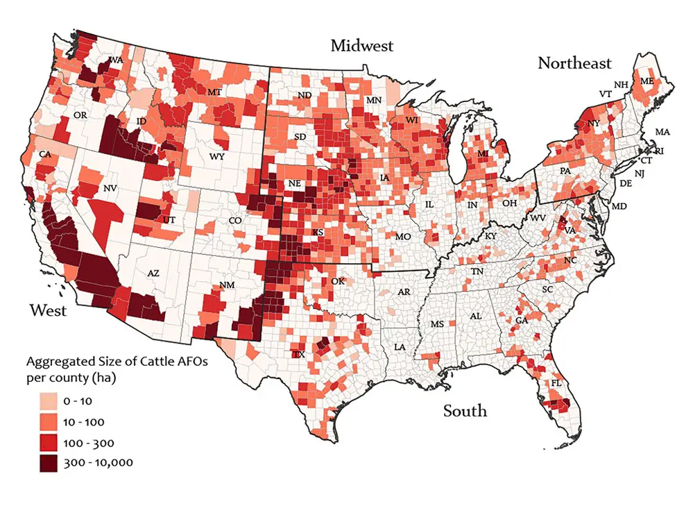
The team mapped the location and footprint of AFOs—responsible for raising roughly 70% of the nation’s cattle and 98% of its hogs—across U.S. counties. A quarter of all operations are concentrated in just 30 of over 3,000 counties. Collectively, these operations cover an area equivalent to approximately 500,000 football fields, with cattle operations comprising nearly 80% of that footprint.
Analysis of PM2.5, fine particulate matter linked to heart and respiratory disease, shows that counties with cattle AFOs had 28% higher PM2.5 levels, while those with hog operations had 11% higher levels compared with similar non?AFO counties.
Air pollution disproportionately impacts vulnerable communities
Counties hosting AFOs also tend to have larger populations lacking health insurance, lower educational attainment, and higher proportions of Latino residents. This inequitable footprint highlights environmental justice concerns: those least equipped to manage health risks are bearing the brunt of industrial-scale livestock pollution.
Professor Benjamin Goldstein of the U?M School for Environment and Sustainability, a senior author, described PM2.5 as “nasty stuff,” noting that it penetrates deep into lungs and can create scar tissue with no known safe exposure level.
Mapping offers policy focus
Senior author Joshua Newell emphasized that the spatially detailed map enables targeted policy interventions. He said: “We could focus on a limited number of counties to really address health impacts,” allowing policymakers and community groups to develop effective responses.
Lead author Sanaz Chamanara outlined her painstaking efforts to correct flawed datasets by combining government records with satellite imagery and crowdsourced data from the Counterglow citizen?science project. Many initial AFO listings lacked actual feedlot evidence. The final, verified dataset enables researchers and public health officials unprecedented insight.
Michigan At Risk – The Broader PM2.5 Pollution Threat
While the U?M study mapped feedlot pollution nationally, Michigan communities already face elevated PM2.5 levels from urban and industrial sources. In Detroit, such pollution contributes to more than 10,000 disability?adjusted life years lost annually and roughly 660 premature deaths per year, with estimated health costs of about $6.5 billion.
Michigan lawmakers are now pushing for legislation requiring regulators to account for cumulative pollution burdens when reviewing permits—a step toward stronger environmental justice protections.
Study brings needed clarity and scale
This is the first comprehensive national study mapping the environmental impact of AFOs and identifying co?located vulnerable populations. It builds on narrower, state?level analyses—which lacked the scale needed for systemic reform and policy action. The dataset now supports more robust public health, environmental justice, and agricultural oversight.
Related Coverage and Broader Context
- Detroit policymakers propose the Protecting Overburdened Communities Act, addressing cumulative pollution impacts in Michigan.
- Detroit faces ongoing PM2.5-linked health inequities costing billions and disproportionately affecting low?income communities.
Read More Interesting Feature Stories From ThumbWind
- Michigan Feature News Stories – Unveiling the diverse and vibrant people, captivating places, and remarkable events that come together to make the Great Lake State unique.
- Strange Political News – A sarcastic take on official news from around the U.S., exploring the absurdities that often arise in the political landscape while providing a humorous perspective on current events and highlighting the quirks of politicians and policies.
- Michigan Hometown News – News and events from Michigan’s Upper Thumb region worth knowing, including local stories, impactful interviews, and updates on community happenings that shape the culture and lifestyle of the area.
Your Turn – Like This, or Hate it – We Want To Hear From You
Please offer an insightful and thoughtful comment. We review each response. Follow us to have other feature stories fill up your email box, or check us out at ThumbWind News