When White Rock Was A Bit Bigger c1940

A black-and-white image shows White Rock, an offshore limestone landmark in Lake Huron near White Rock, Michigan, c. 1940. The rock gave the nearby Huron County community its name and was used as a boundary point in the 1807 Treaty of Detroit, involving the Ottawa, Chippewa, Wyandot and Potawatomi. Later local accounts note that ice and weather reduced the size of the rock over time, making older views useful records of its changing appearance. Date: c. 1940

Black-and-white image of a large pale rock formation in shallow Lake Huron water near shore, with a person standing at the left edge of the scene.

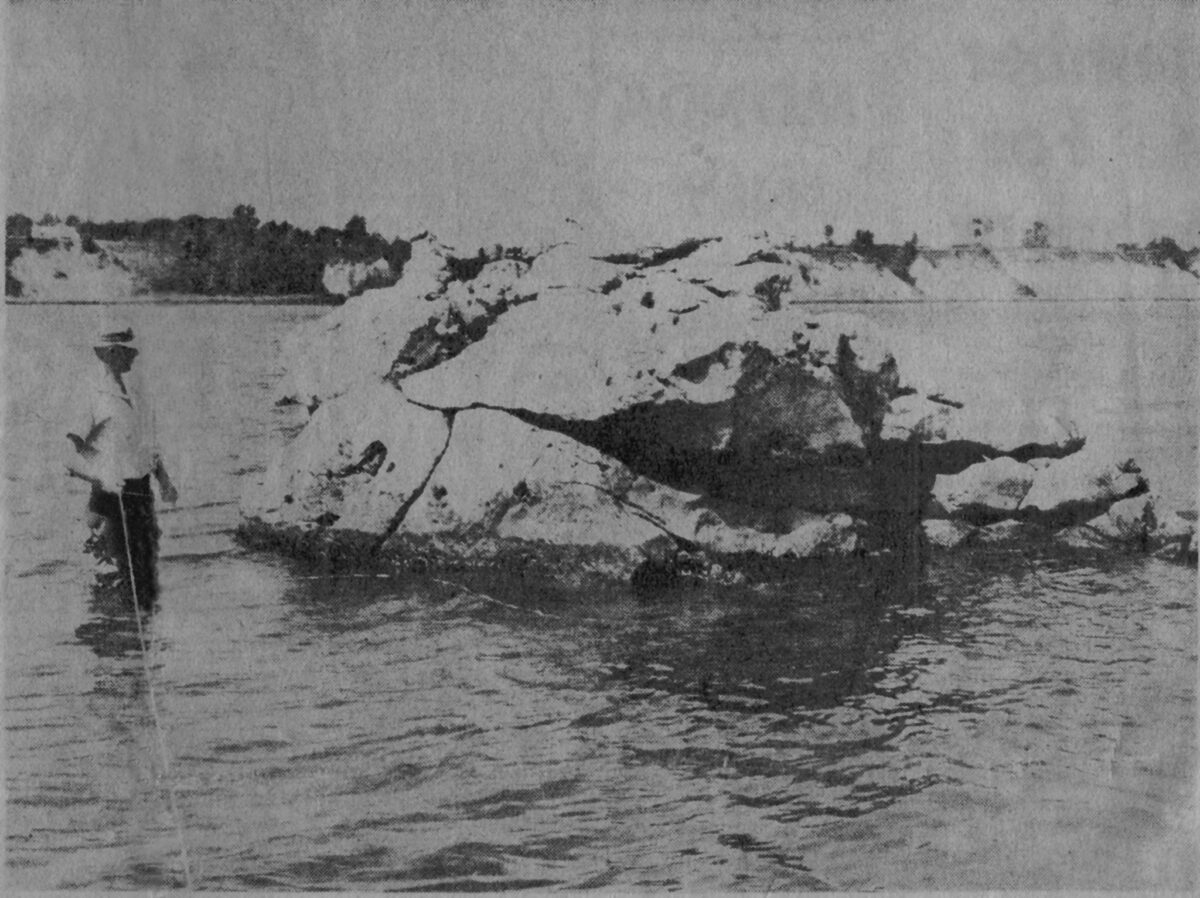
This c. 1940 image appears to show White Rock, the offshore limestone landmark near the community of White Rock in Huron County, Michigan.

The rock sits in Lake Huron, off the shoreline south of Harbor Beach and north of Forestville. It gave the nearby community its name and is best known for its role as a boundary point in the 1807 Treaty of Detroit. That treaty involved the Ottawa, Chippewa, Wyandot and Potawatomi, who ceded a large area of land in what is now southeast Michigan and northwest Ohio.

The title says the rock was “a bit bigger,” and that fits later accounts noting that ice and weather have broken it down over time. This photo likely preserves a view of the landmark before more of it disappeared into Lake Huron.

Do you remember seeing White Rock from shore, or hearing local stories about it?

#WhiteRock #HuronCounty #LakeHuron #MichiganHistory #TheThumb

Michael Hardy

Michael is the owner of Thumbwind Publications LLC. It started in 2009 covering Michigan and the Upper Thumb. Today, his Michigan Moments series has established a loyal base of 110,000 followers.

View all posts by Michael Hardy →

Leave a Reply