
 by
by 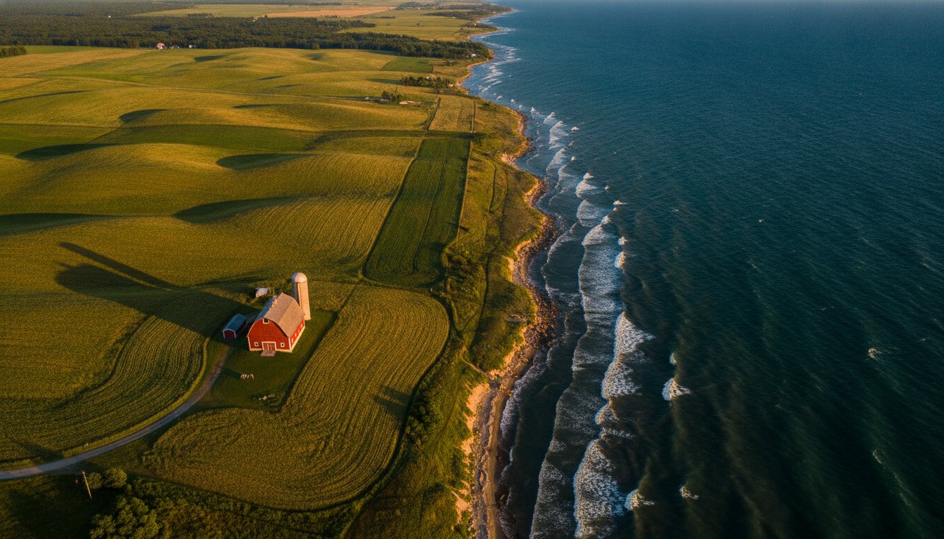
You might think you know exactly where the “Up North” feeling begins, but michigans thumb offers a different kind of magic that many travelers drive right past on their way to the bridge. It is common to feel a bit lost when trying to pin down where the region actually starts or what exists beyond the wind turbines and the waterline. While the area is easily spotted on a map, the true identity of the Thumb is found in the transition from the high ridges of Lapeer to the jagged rocks of the Huron County coast.
We agree that this region deserves more than a vague definition or a quick drive-through. This guide promises to help you discover the hidden history, coastal charm, and geographic wonders that define this specific corner of the Great Lakes State. We will provide a clear mental map of the five-county area, highlight must-visit landmarks along the newly branded “Michigan’s Thumb Coast,” and explore the rich agricultural roots that keep our local culture grounded. From the $15 Recreation Passport entry at our state parks to the quiet stories of our inland towns, you’re about to see this peninsula in a whole new light.
Key Takeaways
- Define the precise geographic boundaries of the peninsula, stretching from the rugged Lake Huron shoreline to the calm reaches of Saginaw Bay.
- Navigate the “Four-County Core” of Huron, Sanilac, Tuscola, and Lapeer to see how these diverse areas form the unique silhouette of michigans thumb.
- Experience the contrast between the 150-mile “Blue Water” coast and the rich agricultural interior that serves as one of the world’s most fertile regions.
- Plan a detailed M-25 road trip itinerary featuring hidden gems, historic lighthouses, and iconic stops like Caseville’s legendary festivals.
- Connect with the local “Front Porch” culture through a calendar of regional events that celebrate the area’s deep-rooted heritage and community spirit.
Defining the Shape: Why We Call it Michigan’s Thumb
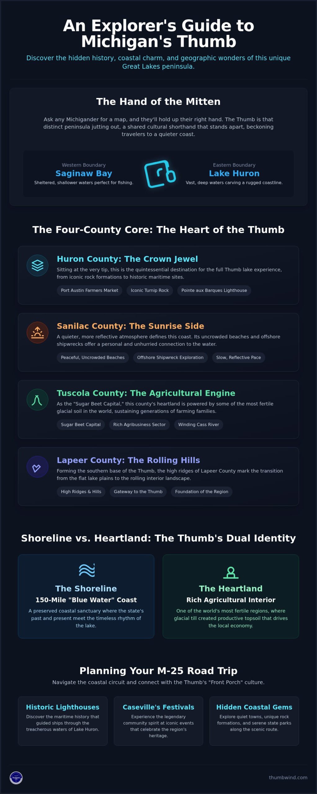
If you ask a Michigander where they grew up, they won’t reach for a paper map. They will simply hold up their right hand. The “Mitten” is more than just a shape on a globe; it is a shared cultural shorthand that defines our state’s identity. Within this silhouette, The Thumb region of Michigan acts as the distinct peninsula that rounds out the eastern edge of the Lower Peninsula. Bound by the vast, deep waters of Lake Huron to the east and the sheltered, shallower Saginaw Bay to the west, this landmass creates a sense of coastal isolation that you won’t find anywhere else in the Great Lakes State.
The Hand Metaphor in Michigan Culture
Locals share a deep emotional connection to this geography. While travelers often aim for the “tip of the thumb” in Port Austin for those iconic sunsets, the communities at the base provide the essential foundation for the region’s identity. There is a quiet pride in pointing to that specific part of the palm. The Thumb is the hitchhiker’s digit of the Great Lakes. It stands apart, beckoning those who want to escape the crowded resort towns of the west coast.
Geographic Evolution of the Peninsula
The shape we see today was carved by massive glacial sheets that receded thousands of years ago, leaving behind the indentation of Saginaw Bay and the fertile soils that drive our local economy. This proximity to the water creates a consistent lake-effect that softens the harshness of winter and extends the growing season for our sugar beet and bean farmers. While the shoreline has shifted slightly over the last century due to erosion and water level cycles, the rugged character of michigans thumb remains unchanged. Several factors define this landscape:
- Lake Huron: Provides the deep-water eastern boundary and a path for international shipping.
- Saginaw Bay: Creates a sheltered western curve perfect for shallow-water fishing.
- Glacial Till: Left behind some of the most productive topsoil in North America.
To enter this sanctuary, most visitors pass through the “Gateway” cities of Bay City or Port Huron. These urban anchors serve as the transition points from the industrial bustle of the south to the unhurried pace of the peninsula. Unlike the heavily commercialized stretches of Traverse City, the Thumb remains a “hidden” alternative. It offers a preserved coastal sanctuary where the state’s industrial past and agricultural present meet the timeless rhythm of the lake.
The Four-County Core: Exploring Huron, Sanilac, Tuscola, and Lapeer
To truly understand the character of michigans thumb, you have to look past the unified shape on the map and see the distinct personalities of the four counties that form its heart. While they share a coastline and a heritage of hard work, each area offers a different slice of Michigan life. From the rocky spires of the north to the rolling hills of the south, these counties represent the intersection of industry, agriculture, and pure Great Lakes beauty.
Huron County: The Crown Jewel
Huron County sits at the very tip of the peninsula, serving as the primary destination for those seeking the quintessential lake experience. Port Austin is the undisputed hub here, especially on Saturday mornings when the Farmers Market transforms the downtown into a vibrant community gathering. If you venture toward the water, the iconic Turnip Rock stands as a testament to the lake’s power, while the lighthouse tours at Pointe aux Barques offer a glimpse into the region’s maritime history. For a deeper look at what makes this area special, check out A Local’s Guide to the Geography of Michigan’s Thumb.
Moving south along the eastern edge, Sanilac County offers a quieter, more reflective atmosphere. Known as the sunrise side, its beaches are less crowded, providing a peaceful backdrop for those exploring the local shipwrecks that rest just offshore. It’s a place where the pace slows down, and the connection to the water feels deeply personal and unhurried.
The Inland Counties: Tuscola and Lapeer
Tuscola County is the region’s agricultural engine. It’s famously known as the “Sugar Beet Capital,” where the rich soil supports a massive agribusiness sector that has sustained local families for generations. The geology and landscape of the Thumb played a critical role here, as the flat lake plains provided the perfect foundation for these fertile fields. The Cass River winds through the county, offering a serene path for kayakers and anglers who prefer the sheltered interior to the open lake.
Lapeer County serves as the southern gateway, characterized by its rolling hills and a landscape that transitions from timber-rich roots to a modern blend of rural charm and suburban life. It feels like a bridge between the busy metropolitan areas to the south and the quiet sanctuary of the north. Before you head out on your next adventure, you might want to check our live regional webcams to see the current conditions across the peninsula.
Shoreline vs. Heartland: The Dual Identity of the Thumb
The 150-mile stretch of the “Blue Water” coast offers a dramatic contrast to the quiet, golden fields just a few miles inland. While visitors often flock to the sandy bluffs and marinas of the shoreline, the true spirit of michigans thumb lies in this dual identity. It is a place where you can watch a sunrise over a lighthouse in the morning and stand beside a massive grain elevator by noon. This tension between the maritime and the terrestrial creates a unique seasonal rhythm. Summer belongs to the boaters and beachgoers, but autumn is the season of the harvest, when the heavy machinery takes over the roads and the air smells of turned earth.
Maritime Heritage on the Lake Huron Side
The Lake Huron side is defined by its deep waters and a history that is as beautiful as it is treacherous. Towns like Bay Port still carry the legacy of commercial fishing, once the lifeblood of the coastal economy. This passion for fresh seafood is a universal coastal tradition, mirrored by establishments like The Catch that serve the Gulf Coast region. Back on the Great Lakes, this stretch of water is also a graveyard of history, famously impacted by the “Great Storm of 1913,” which claimed dozens of vessels and shaped the maritime safety standards we use today. These shipwrecks have transformed the region into a premier destination for divers who want to touch the past. The lighthouses, like the one at Harbor Beach, stand as silent sentinels that have guided generations of sailors through these unpredictable currents.
The ‘Sugar’ and ‘Bean’ Roots of the Interior
Drive inland, and the landscape flattens into some of the most fertile acreage on the planet. This area earned the title “Bean Pot of the World” because of its massive production of dry beans, a staple that built the region’s early wealth alongside the sugar beet industry. You can see this prosperity reflected in the historic architecture of towns like Vassar, where lumber and agricultural barons built grand mansions that still line the main streets. For those inspired to restore such historic properties, you can check out Third Coast Spray Foam for professional guidance on modern insulation solutions. The skyline here isn’t defined by skyscrapers, but by the towering grain elevators that serve as the modern cathedrals of the heartland. Walking through these small towns feels like stepping back into “Old Michigan,” where the preservation of the past is a point of community pride and a defining characteristic of michigans thumb.
Planning the Perfect M-25 Road Trip: A Coastal Circuit
The M-25 highway is the main artery of the coast, winding through 150 miles of scenery that defines the spirit of michigans thumb. Your journey should begin in Bay City, where you can explore the historic riverfront before the road pulls you north into the heart of the peninsula. As you drive, the industrial skyline fades, replaced by the shimmering expanse of Saginaw Bay and the quiet charm of coastal villages. It is a route that rewards the unhurried traveler who is willing to pull over for a roadside stand or a scenic overlook.
Caseville is a mandatory stop, especially if you visit during the legendary “Cheeseburger in Caseville” festival. Even on quieter days, the sandy stretches of the nearby state parks offer some of the best beach access in the region. The town’s appeal runs far deeper than its modern summer celebrations, and exploring the Caseville history rooted in 19th-century salt works and shipbuilding adds a rich layer of context to any visit. Before you set out for the day, a pro tip is to use our live regional webcams to check the lake conditions. Lake Huron can be unpredictable, and seeing the waves in real-time helps you plan the perfect day on the water without any surprises.
Must-See Coastal Landmarks
Port Austin marks the tip of the peninsula and serves as the launch point for the trek to Turnip Rock. This limestone stack is one of the most photographed spots in Michigan, accessible only by a seven-mile round-trip kayak journey. Just a few miles east, you’ll find Grindstone City. Once the grindstone capital of the world, it is now famous for its massive ice cream scoops and quiet harbor. Further south, the Harbor Beach Breakwater Lighthouse stands as a marvel of engineering, protecting one of the largest man-made harbors in the world.
Hidden Gems off the Beaten Path
If you venture slightly inland, you can find the Sanilac Petroglyphs, which are the only known prehistoric rock carvings in the state. The interior also holds the hushed remains of several ghost towns. While many people associate abandoned history with Michigan Upper Peninsula ghost towns, the Thumb has its own stories of forgotten settlements that once thrived during the lumber boom. At night, the northern tip of the peninsula offers a rare “dark sky” quality, where the lack of light pollution reveals a canopy of stars that feels close enough to touch.
After you explore the tip, begin your descent through Harbor Beach and the resort town of Lexington. The drive concludes in Port Huron, where the Blue Water Bridge stands as a soaring exit from this coastal sanctuary. To ensure your trip goes smoothly, check our latest travel guides for up-to-date information on local events and road conditions.
Beyond the Map: How to Stay Connected to Thumb Culture
The “Front Porch” of Michigan isn’t just a catchy nickname; it’s a way of life that defines the culture of michigans thumb. Here, hospitality is more than a polite gesture. It’s the neighbor who stops to help with a flat tire or the local shopkeeper who remembers your name after a single visit. This community spirit is most visible during our regional events. While we’ve discussed the energy of Caseville’s festivals, the Fourth of July parades in Bad Axe or the harvest celebrations in our inland villages offer a more intimate look at the pride we take in our shared heritage.
Preserving this connection means more than just visiting for a weekend. It’s about engaging with the stories that larger media outlets often overlook. Local media serves as the heartbeat of the peninsula, documenting the small victories and quiet changes that shape our daily lives. We invite you to be part of this preservation by sharing your own historical findings or coastal photos with the community. Every snapshot and story helps build a more complete picture of what it means to live and travel in this unique corner of the state.
Preserving the Stories of the Past
Keeping this heritage alive requires more than just memory. Historical societies in towns like Sebewaing and Elkton work tirelessly to protect physical artifacts, while our mission at Thumbwind focuses on documenting the “everyday” history of the people. We believe that a photograph of a family farm is just as vital as a record of a major maritime event. You can also use digital archives to trace your own ancestors who settled this land, uncovering the grit and determination it took to build these communities from the timber and soil.
The Future of the Thumb
As we look ahead, the region is finding a careful balance between welcoming new visitors and preserving its natural stillness. Sustainable tourism ensures that our landmarks remain pristine for years to come. We are also seeing a shift as remote work allows a new generation to trade the city bustle for the unhurried pace of michigans thumb. This influx of fresh energy helps keep our small-town main streets vibrant while respecting the agricultural roots that have always been our foundation. To stay updated on everything happening in the region, from local lore to current events, keep an eye on Thumbwind’s latest news.
Your Journey Through the Heart of the Peninsula Begins Here
The Thumb is more than just a shape on a map; it is a living landscape where the industrial heritage of the gateways meets the quiet rhythm of the lake. We’ve explored how the four-county core defines the silhouette of michigans thumb, balancing the “Blue Water” coast with a heartland of unmatched agricultural fertility. Whether you’re kayaking the limestone stacks of Port Austin or driving the historic M-25 circuit, you’re participating in a story that spans generations.
Since 2009, Thumbwind has served as a dedicated curator of these regional stories, offering independent local reporting and deep-dive historical archives that keep our heritage alive. Before you pack your bags, use our real-time coastal webcams to check the current weather and lake conditions. Explore the latest Thumb area news and history on Thumbwind to stay connected with the people and places that make this region a true Michigan sanctuary. The road is open, and the “Front Porch” is waiting for you.
Frequently Asked Questions
What counties are actually in Michigan’s Thumb?
Huron, Sanilac, and Tuscola counties form the core of the region, though most definitions also include Lapeer and St. Clair counties. This five-county area creates the recognizable peninsula that juts into the Great Lakes. While Huron County is known for its flat lake plains, you can find the region’s highest elevations in the Hadley Hills of Lapeer County. The combined population of these four core counties was 321,020 according to the 2020 Census.
Why is the region called ‘The Thumb’?
The region earned its name because its geographic silhouette perfectly mimics the thumb on a hand when you look at a map of Michigan. Since the Lower Peninsula is famously shaped like a mitten, this eastern peninsula completes the metaphor. It’s a cultural staple for Michiganders to use their right hand as a map, pointing to the “thumb” to show exactly where they live. This simple gesture has defined the region’s identity for generations of residents and visitors.
How long does it take to drive around the entire Thumb coast?
Driving the entire M-25 coastal circuit takes about three to four hours of active time behind the wheel. This 150-mile route follows the shoreline from the Saginaw River in Bay City all the way around to the St. Clair River in Port Huron. To truly appreciate the lighthouses, parks, and small-town shops, it’s best to plan for a full day. The unhurried pace of the drive is a defining feature of the “Michigan’s Thumb Coast” experience.
What is the best time of year to visit Michigan’s Thumb?
Summer is the most popular time for coastal activities, but autumn offers a unique look at the region’s agricultural harvest. July and August provide the best weather for kayaking to Turnip Rock or Caseville’s beaches. As of 2026, a Michigan Recreation Passport for state park entry costs $15 for a standard vehicle. If you visit in the fall, you’ll experience vibrant colors and the energy of the sugar beet harvest. Every season brings a different rhythm to the landscape.
Are there any ghost towns in the Michigan Thumb region?
Yes, the region is home to several abandoned settlements, including the remains of Port Crescent and the quiet ruins near Grindstone City. These sites serve as reminders of the 19th-century lumber and quarry industries that once boomed here. While they aren’t as famous as some northern counterparts, they offer a hauntingly beautiful look at the fleeting nature of industrial prosperity in michigans thumb. Many of these towns were abandoned once the local natural resources were exhausted.
Can you see the Northern Lights from Michigan’s Thumb?
You can occasionally see the Northern Lights from the northern tip of the peninsula, especially in areas with low light pollution like Port Austin. The dark sky quality at the “tip of the thumb” makes it one of the best spots in the Lower Peninsula for stargazing. Clear nights with high solar activity provide the best chance to see the lights dancing over the dark expanse of Lake Huron. It’s a favorite activity for late-night beachgoers and photographers.
What is the most famous landmark in the Thumb?
Turnip Rock is arguably the most iconic landmark, drawing thousands of kayakers to the shores of Port Austin every year. This unique rock formation was carved over centuries by the relentless waves of Lake Huron. Other significant sites include the Pointe aux Barques Lighthouse and the Sanilac Petroglyphs, which represent the only prehistoric rock carvings found in Michigan. These landmarks offer a tangible connection to the region’s ancient geography and its more recent maritime history.
Is Michigan’s Thumb part of the Upper or Lower Peninsula?
michigans thumb is part of the Lower Peninsula, forming the eastern “digit” of the mitten shape. It’s located entirely below the Mackinac Bridge and is bordered by the waters of Saginaw Bay and Lake Huron. Its convenient location makes it an accessible getaway for residents of Detroit or Bay City who want a coastal experience without the long trek to the Upper Peninsula. It remains a cherished, uncrowded alternative to the state’s busier northern resort towns.
Disclaimer
Information published on Thumbwind.com is provided for general informational purposes. While we make reasonable efforts to keep articles accurate and current, details such as prices, hours, regulations, access conditions, and other information may change without notice. Readers should verify important details with the appropriate business, agency or official source before making travel, financial or other decisions. Thumbwind.com is not responsible for the content, availability or practices of third-party websites linked from our articles.