by
by 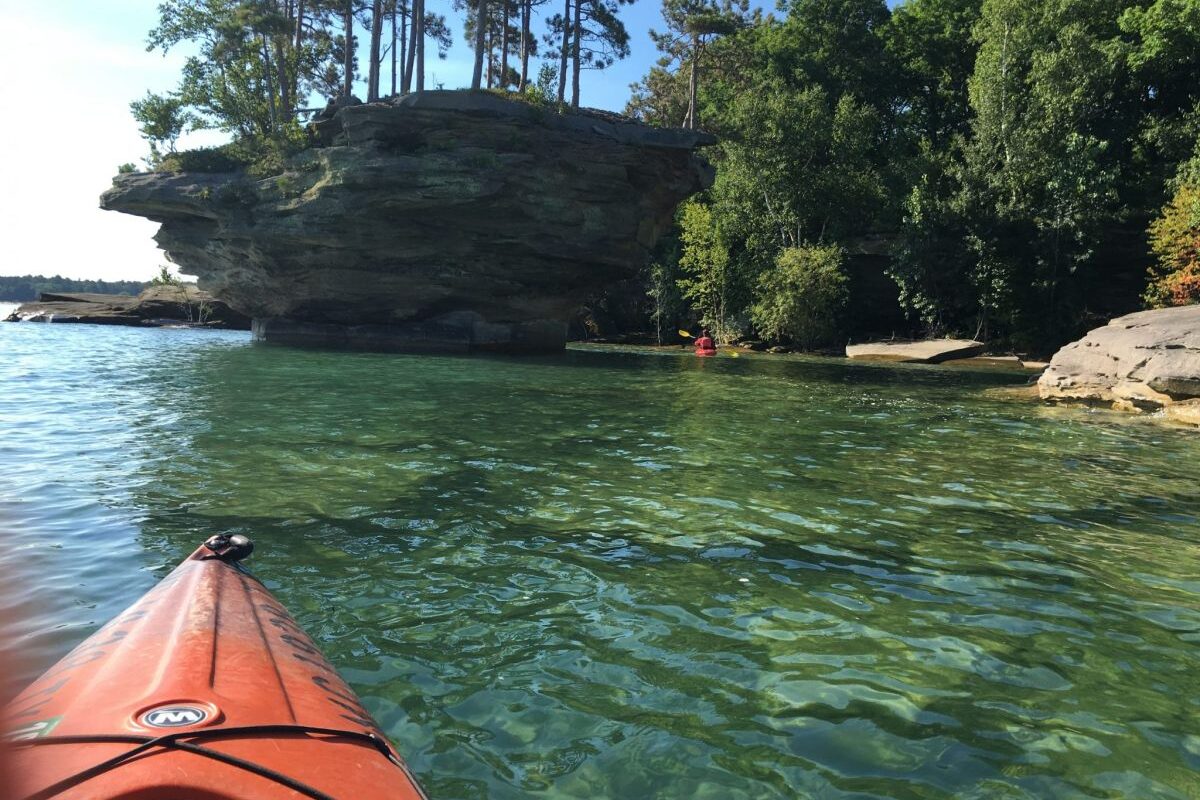
Turnip Rock Michigan is one of the state’s most photographed natural features—but it’s not easy to reach. Here’s how to get there safely, what to expect, and what many visitors get wrong.
Table of Contents
You Cannot Drive to Turnip Rock
This is the mistake that trips up most first-time visitors.
There is no public road, trailhead, or marked access point that leads directly to Turnip Rock Michigan. The shoreline in this area is lined with private property, and landowners have posted clear restrictions over the years due to heavy foot traffic.
Visitors who attempt to “find a way in” often end up:
- Parking along rural roads with no legal access
- Walking long distances only to hit private land
- Turning back after an hour or more
Bottom line: If your plan starts with driving close and walking in, it’s likely to fail.
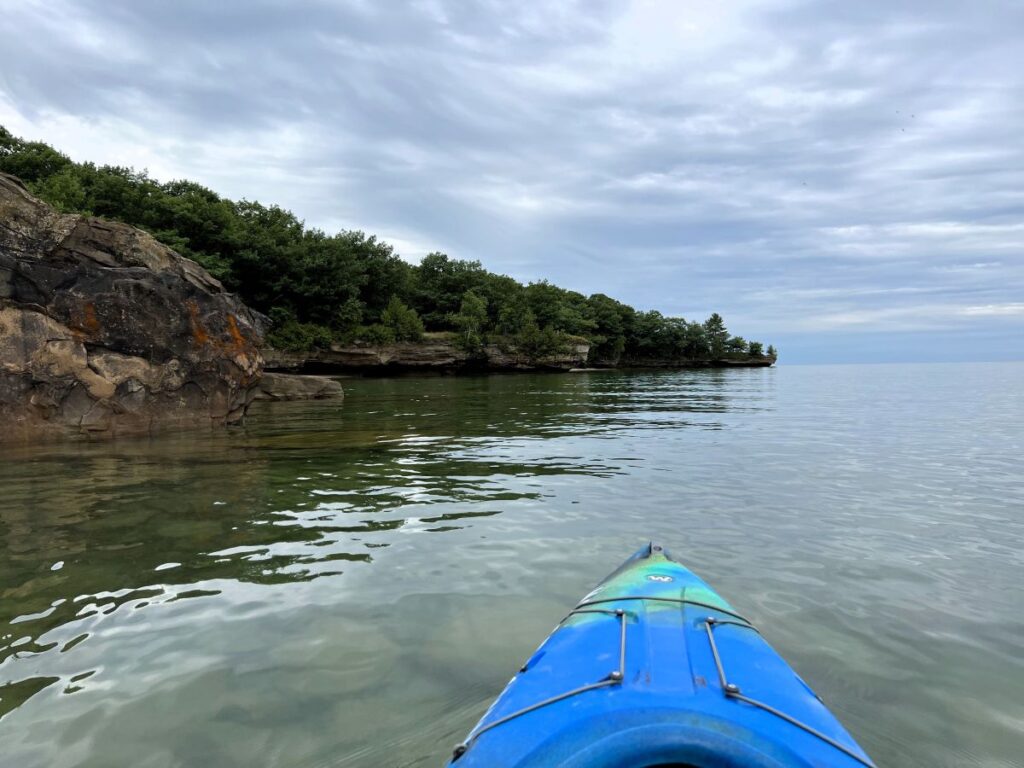
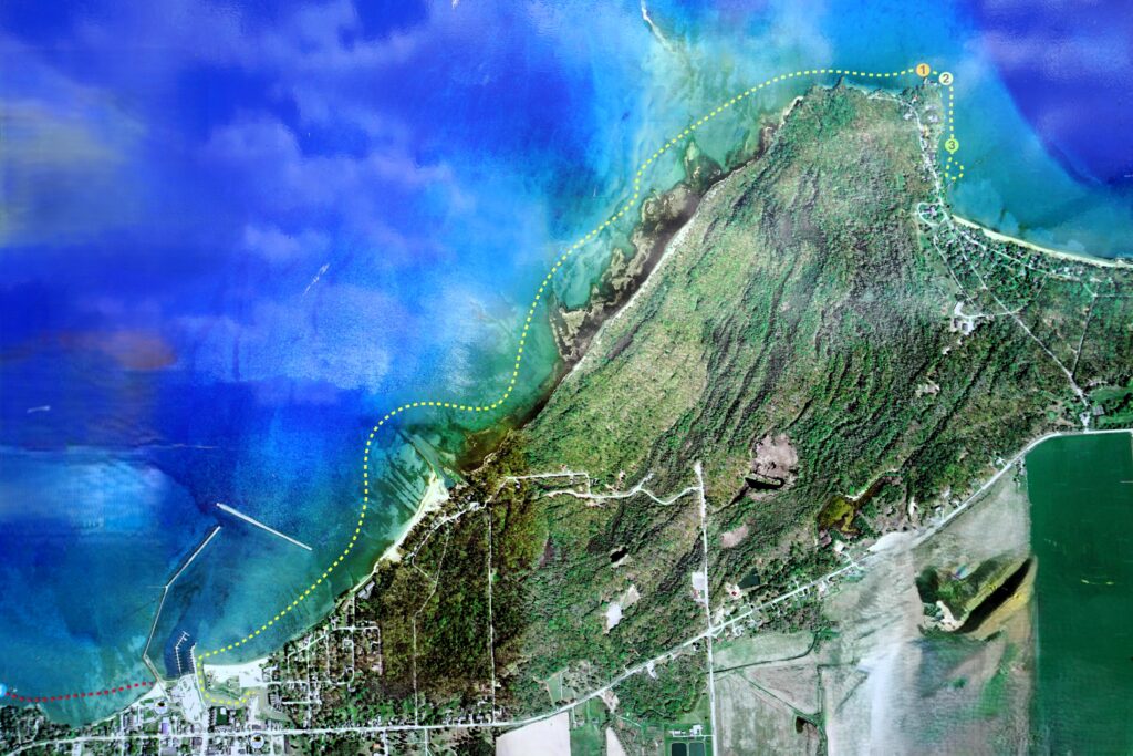
Option 1: Kayak to Turnip Rock (Most Common and Reliable)

Kayaking is the standard—and for most people, the only realistic—way to reach Turnip Rock Michigan.
Typical trip details:
- Distance: About 3 to 3.5 miles each way (6–7 miles round trip)
- Time: 2 to 4 hours total, depending on pace and conditions
- Launch area: Near Port Austin
What many guides don’t emphasize:
This is not a short paddle. If you’ve never kayaked more than a mile or two, this trip will feel longer than expected.
Insider tip:
Plan to launch early in the morning. Winds on Lake Huron often pick up by midday, and the return trip into the wind is where people struggle.
Option 2: Hiking Access (Technically Possible, Rarely Practical)
You may see references online to hiking routes to Turnip Rock Michigan. These are often outdated, vague, or incomplete. The exception is to cross-country ski to the formation in winter.
Reality on the ground:
- Public shoreline access is extremely limited. Large rock formations block the beach.
- Property boundaries are not always clearly marked
- Even experienced hikers have trouble finding a continuous legal route
Some locals will tell you it’s “possible,” but that usually comes with caveats they don’t spell out.
Bottom line: Unless you have verified, current access information, don’t rely on hiking to get there.
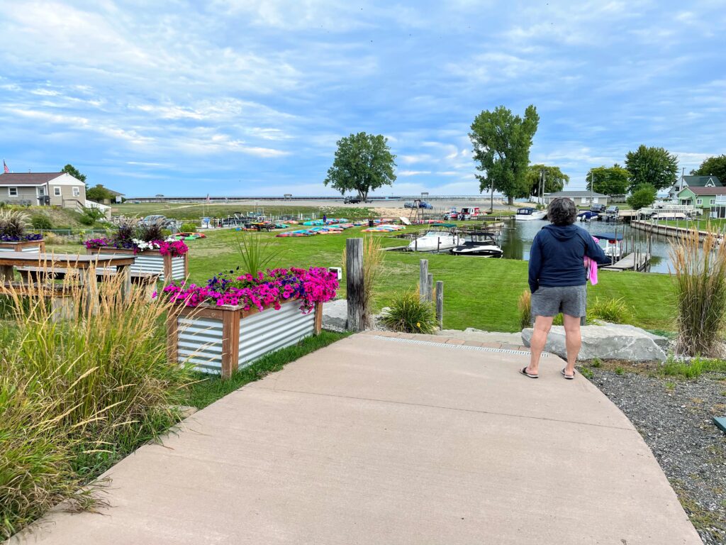
Turnip Rock Kayak Rentals and Launch Points

If you don’t bring your own kayak, local outfitters near Port Austin fill the gap—but demand can exceed supply in peak season. One of the largest outfitters is Port Austin Kayak.
Here’s what to expect:
- Rentals often sell out on summer weekends by mid-morning
- Most include a life jacket and basic instructions
- Some offer guided trips, which can be useful for first-timers
What they won’t always tell you upfront:
- Wind direction matters more than temperature
- A calm launch does not guarantee a calm return
- Afternoon conditions are often rougher than expected
Launch Points with Your Own Kayak
- Bird Creek County Park – This harborside park offers plenty of parking, and you can launch your kayak right from the beach.
- Eagle Bay Public Access – A quiet, maintained public site on Lake Huron located approximately one mile west of Grindstone City in Huron County. It offers sandy beaches and scenic views, functioning as a quaint, smaller alternative to busier coastal parks. It is operated by the Michigan Department of Natural Resources.
Insider tip:
If you’re unsure about your ability, ask specifically about wave height and wind forecast, not just “weather.” That’s what determines difficulty on this stretch of Lake Huron.
What Most Visitors Get Wrong About Turnip Rock, Michigan
1. Underestimating the Distance
On paper, 6–7 miles doesn’t sound extreme. On open water, it’s different.
Fatigue sets in on the return trip, especially if:
- Winds shift against you
- You spend too much time at the site
- You didn’t pace yourself on the way out
Practical advice: Save energy for the return. That’s where most people struggle.
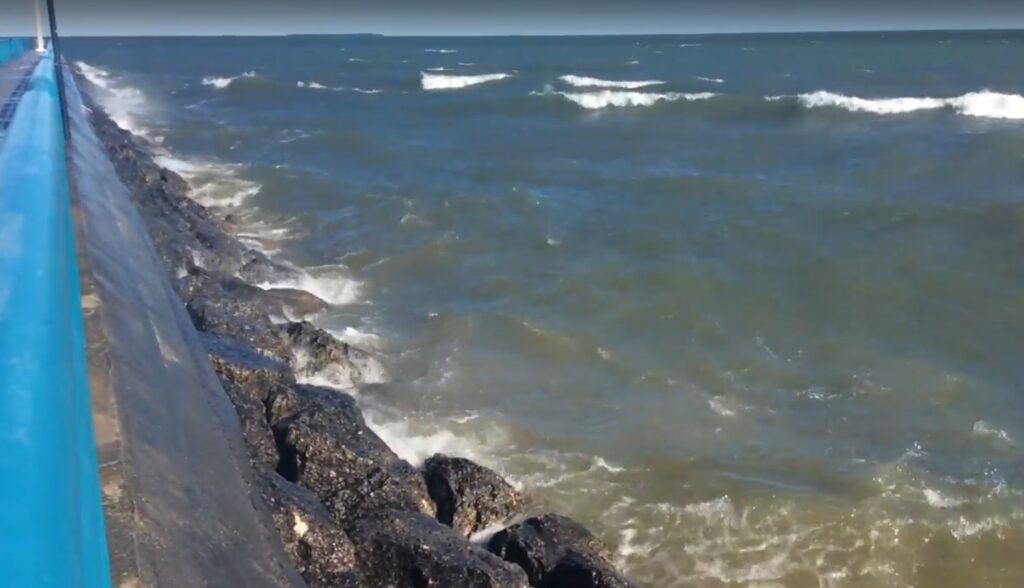
2. Ignoring Lake Conditions
Lake Huron can change quickly.
A calm morning can turn into:
- Choppy waves
- Strong crosswinds
- Difficult landing conditions
This is not rare—it’s typical on warm summer days.
Insider tip:
If the forecast shows winds increasing after noon, treat that as a warning, not a suggestion.
3. Assuming It’s an Easy Walk or Tourist Stop
Turnip Rock in Michigan is often presented online as a “must-see attraction,” which gives the wrong impression.
This is not:
- A roadside photo stop
- A short nature trail
- A casual family outing for beginners
It’s closer to a half-day excursion that requires planning.
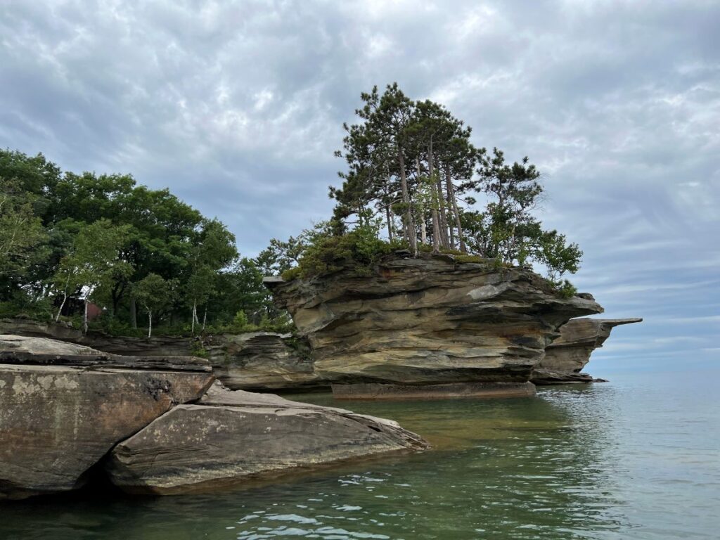
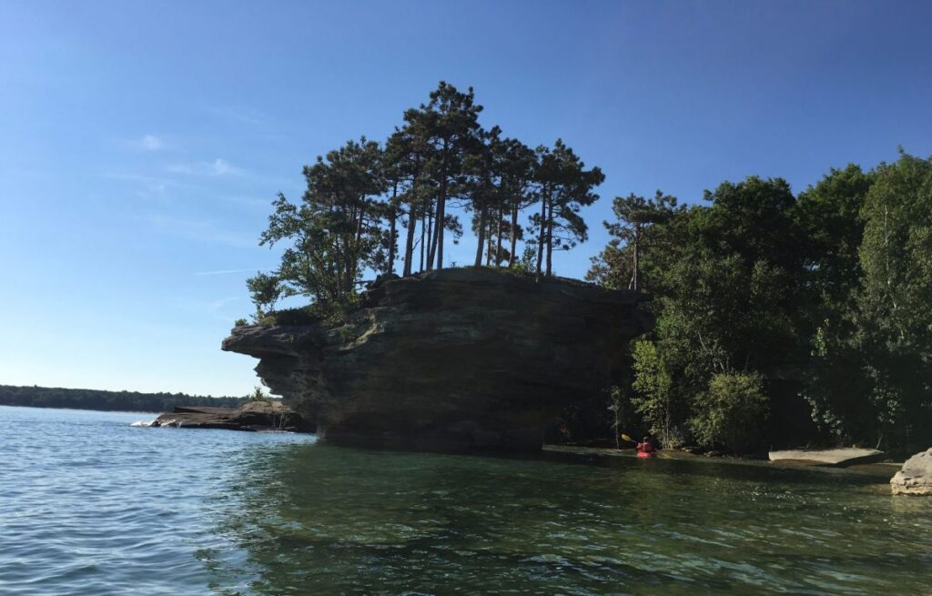
What You’ll See When You Get There
When you reach Turnip Rock Michigan, the first thing that stands out is the shape.
The rock narrows near the base and widens at the top, giving it that “turnip” appearance. It’s not large in scale, but it’s distinct enough to stand apart from the surrounding shoreline.
What you’ll notice:
- Clear, shallow water near the rock
- Flat limestone shelves that make landing easier in calm conditions
- Quiet surroundings—no crowds unless you arrive late
Insider tip:
The best photos are taken slightly offshore from a kayak, not standing directly next to the rock. That angle shows the full shape.
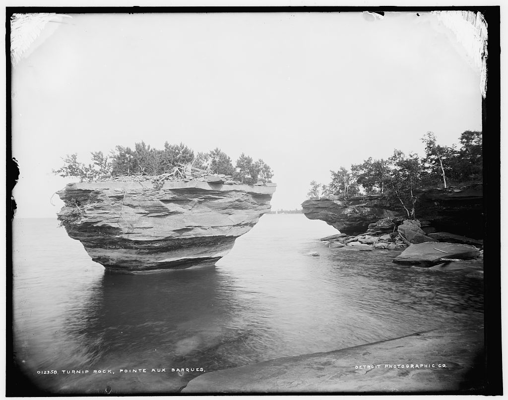
How Turnip Rock Was Formed
Turnip Rock Michigan is a textbook example of shoreline erosion along the Great Lakes.
Over time:
- Waves wore away the softer rock at the base
- Harder rock above resisted erosion
- The result is a narrow “stem” supporting a wider top
This process is ongoing. The shape you see today is not permanent—it continues to change with each season.
Context:
Similar formations exist along parts of Lake Huron, but most are either less defined or harder to reach. Turnip Rock stands out because it’s both distinctive and accessible by water.
Best Time to Visit Turnip Rock Michigan
Timing has a direct impact on both safety and experience.
Best Conditions
- Early morning launches (before wind builds)
- Weekdays in June or September (fewer crowds)
- Light wind forecasts under 10 mph
What to Avoid
- Mid-to-late afternoon returns in summer
- Windy days, even if skies are clear
- Holiday weekends when launch areas are crowded
Seasonal Reality Check
- July–August: Warm water, heavy traffic, less predictable conditions
- June & September: Cooler water, better conditions, fewer people
- Spring/Fall: Possible, but colder water increases risk
Related Posts


Plan B – What To Do When Turnip Rock Eludes You
Sometimes the wind wins.
Outfitters in Port Austin will be the first to say it: if conditions on Lake Huron aren’t right, Turnip Rock can wait. The good news is you don’t have to waste the day.
Here are solid backup options that still make the trip worthwhile:
Paddle the Harbor Beach Shipwrecks
If open water is too rough, head south to Harbor Beach.
- Protected harbor conditions make this a safer paddle
- Multiple shallow-water shipwrecks are visible from a kayak
- Shorter distance and easier for beginners
Insider tip: This is one of the few places in Michigan where you can see shipwrecks without diving.
Canoe the Pinnebog River
For a calm, low-risk alternative, the Pinnebog River offers a completely different experience.
- Slow-moving water
- Tree-lined banks and wildlife
- Minimal wind impact compared to the lake
This is a good fallback if you still want time on the water without fighting waves.
Take a Bike Ride Through the Thumb
Flat terrain and light traffic make this area surprisingly bike-friendly.
- Quiet rural roads
- Access to shoreline views
- Rentals often available locally
Practical note: Bring a printed map or download one ahead of time—cell service can be inconsistent.
Walk the Local Trails
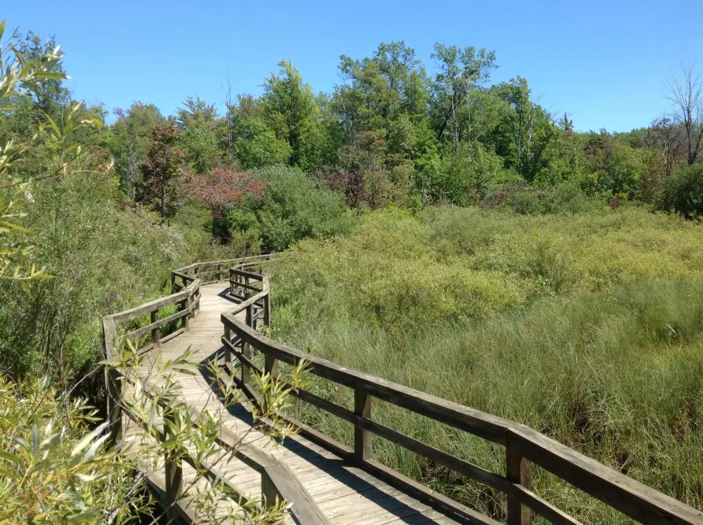
If you were expecting a hike to Turnip Rock, this is your reset. Head south on M-25 to the Huron County Nature Center and Wilderness Arboretum are midway between Caseville and Port Austin. The interpretive center offers insights into the area’s unique wildlife, plants, and animals that make the Upper Thumb their home. The wilderness arboretum spans over 120 acres of woods, dunes, and marshes, connected by an extensive trail system. This provides a glimpse of the upper thumb as it appeared 100 years ago. The land comprises alternating dune ridges (now with mature growth) and broad pine areas, oak, fern, and huckleberry
- Short, accessible walking paths
- Mix of wooded areas and open views
- Good option for families
It won’t replace the shoreline paddle, but it keeps the day active.
Spend Time in Downtown Port Austin

When the lake shuts things down, the town picks things up.
- Small boutiques and gift shops
- Casual restaurants and outdoor seating
- Seasonal foot traffic gives it some energy in summer
Visit the Farmers Market (Seasonal)

On Saturdays, the local market runs from morning into early afternoon.
- Fresh produce
- Local vendors
- Baked goods and prepared food
It’s a quick stop, but worth it if you’re already in town.
Check Out Local Art and Galleries

The Port Austin area leans into regional art.
- Barn art projects
- Small galleries featuring local artists
- Occasional pop-up exhibits
See the Butterfly House

A quieter stop, but the Port Austin butterfly house one that surprises people.
- Indoor garden setting
- Seasonal butterfly displays
- Good break from the sun or wind
Grab a Landmark Ice Cream Cone
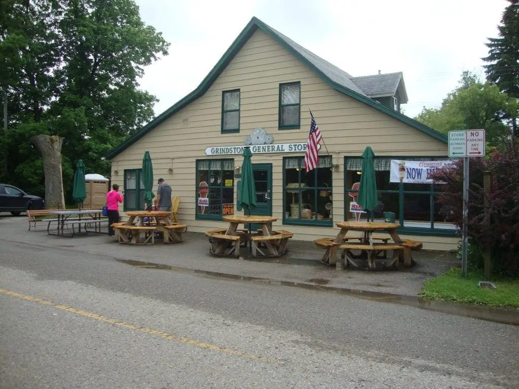
At places like the Grindstone General Store, portions are not subtle. The original store burned down in a fire. The owners are restoring the historic store. A food truck is currently on-site serving customers.
- Oversized servings
- Classic roadside stop feel
- Easy win if the day shifts gears
Catch Live Music or a Drink Outdoors
On summer weekends, you’ll usually find:
- Live music at local venues
- Outdoor seating
- A mix of locals and visitors
Turnip Rock Michigan FAQ
Can you walk to Turnip Rock Michigan?
No. There is no reliable public walking route. Most visitors reach Turnip Rock by kayak due to private property restrictions along the shoreline.
How long does it take to kayak to Turnip Rock?
Most trips take between 2 and 4 hours round trip, depending on pace, wind conditions, and time spent at the rock.
Is Turnip Rock safe to visit?
It can be safe in calm conditions, but Lake Huron weather changes quickly. Wind and waves are the biggest risks, especially on the return trip.
Final Take: Is Visting Turnip Rock Michigan Worth It?
Getting to this famous rock formation is part of the adventure. Those who make it are part of a unique group beyond the casual tourist. Turnip Rock Michigan delivers a unique shoreline view—but it’s not for everyone.
If you’re looking for:
- A quick stop
- Easy access
- Minimal effort
This is not the right destination.
If you’re willing to:
- Plan ahead
- Respect conditions
- Put in the effort to reach it
Then it’s one of the more memorable spots along Michigan’s Lake Huron coast.