by
by 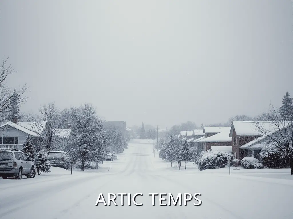
Stay informed about Michigan weather conditions on January 20, 2025, as an arctic air mass brings dangerously cold temperatures and lake-effect snow across the state.
Arctic Air Mass Engulfs Michigan with Frigid Temperatures and Snow Showers
An arctic air mass has settled over Michigan, leading to dangerously cold temperatures and lake effect snow across the state. Residents are advised to exercise caution during outdoor activities and stay updated on weather advisories.
Southeast Michigan Faces Bitter Cold and Snow Showers
DETROIT — Issued by the National Weather Service at 4:45 AM EST on January 20, 2025.

Frigid Conditions Persist:
- Highs: Struggling to remain above zero during the day.
- Lows: Dropping below zero at night through midweek.
- Wind Chills: Hazardous values between -15°F to -25°F, especially late at night and early morning.
Lake Effect Snow Potential:
- Increased lake effect snow organization possible from late today into early Tuesday.
Southwest Michigan Endures Lake Effect Snow and Extreme Cold
GRAND RAPIDS — Issued by the National Weather Service at 3:17 AM EST on January 20, 2025.
Lake Effect Snow Continues:
- Persistent snow showers near and west of US-131.
- Snow is expanding inland towards Lansing and Jackson as winds shift westerly.
Very Cold Temperatures:
- Highs: Single digits through Wednesday morning.
- Lows: Below zero at night.
- Wind Chills: Dangerously low, increasing risk of frostbite and hypothermia.
Northern Lower Michigan Braces for Accumulating Snow and Bitter Cold
GAYLORD — Issued by the National Weather Service at 2:31 AM EST on January 20, 2025.
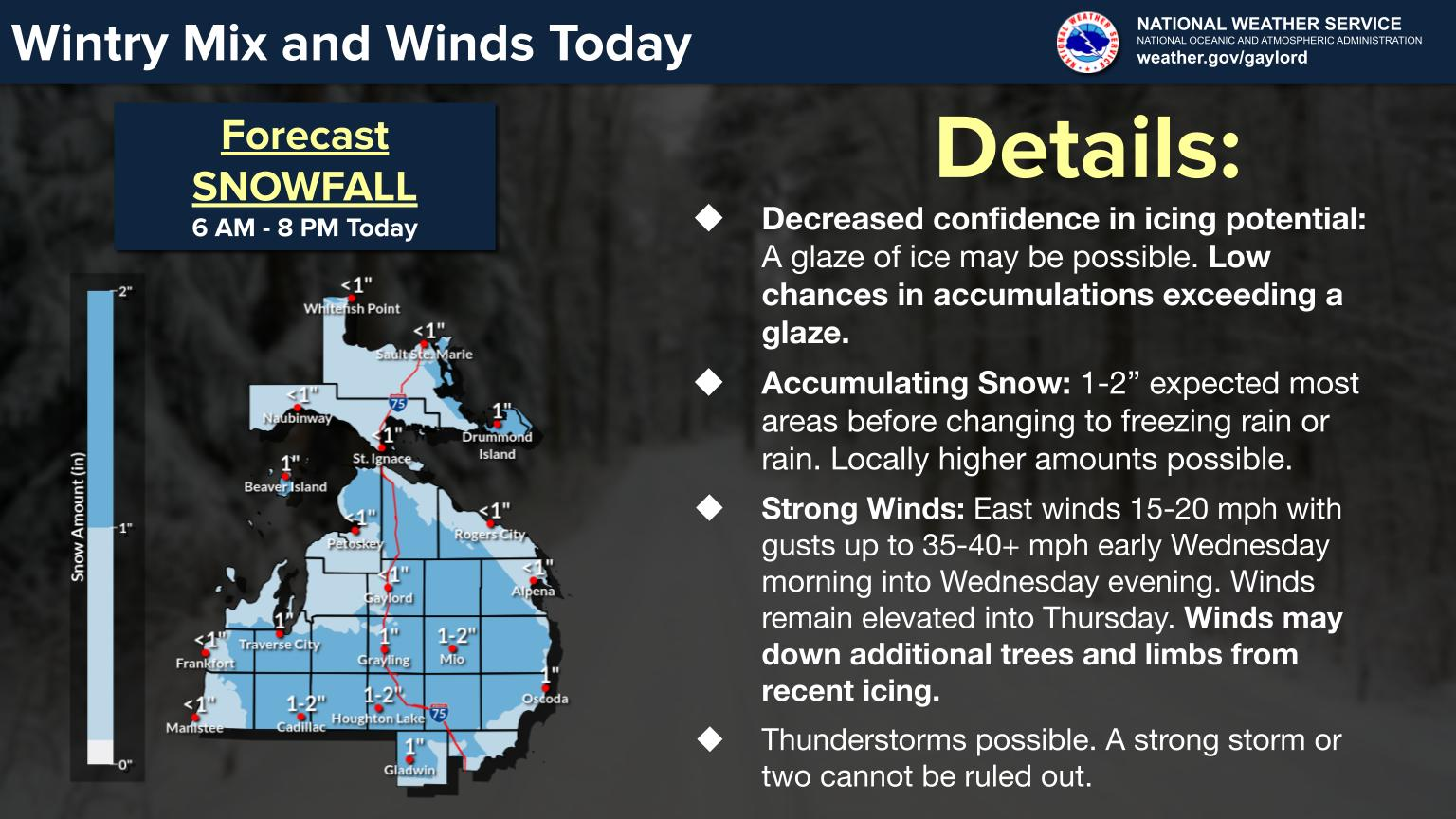
Lake Effect Snow Showers:
- Ongoing snow showers in typical snowbelt areas.
- Accumulations leading to hazardous travel conditions.
Temperature Concerns:
- Highs: Struggling to reach double digits.
- Lows: Plummeting below zero.
- Wind Chills: Extremely low, necessitating limited outdoor exposure.
Upper Peninsula Faces Dangerously Cold Temperatures and Blowing Snow
MARQUETTE — Issued by the National Weather Service at 5:16 AM EST on January 20, 2025.

Extreme Cold Warnings:
- Temperatures: Remaining mostly below zero through Wednesday morning.
- Wind Chills: Dangerously low, as cold as -40°F.
Lake Effect Snow and Blowing Snow:
- Frequent whiteouts expected in west to northwest wind snow belts.
- Very hazardous driving conditions due to fine, powdery snow reducing visibility.
Hazardous Weather Changes Fast – Stay Updated
Weather Watches, Warnings, and Advisories are frequently updated by the National Weather Service. Please look for updates to this report from the National Weather Service, or your local news channels and NOAA All Hazards radio. Please follow ThumbWind Publications for more local weather and news updates. Your helpful comments are welcome.
Recommended Reading
As an Amazon Associate, I earn commission from qualifying purchases.


Check Out Our Weather Related Features
- Climate Twins – Countries with Weather Similar to Michigan: Curious about which places on Earth share Michigan’s unique weather patterns? Our latest article dives into Michigan’s Climate Twins, revealing surprising similarities and intriguing differences.
- Live Webcams Of 7 Lake Effect Snow Cities Around The Great Lakes: Delve into the enchanting world of Lake Effect Snow in cities within the snow belt. Experience how urban landscapes transform into winter wonderlands with heavy snowfall.
- 14 Areas Around the Great Lakes With Significant Lake Effect Snow – How Does it Happen: Lake effect snow from the Great Lakes occurs when conditions of evaporation and cold upper air currents slide over the region. Water retains heat more than air. This causes some open water in the Great Lakes to evaporate into the air and warm it. Rising up into the atmosphere, this warm, wet air cools as it travels, creating snow.
Your Turn – Like This, or Hate it – We Want To Hear From You
Please offer an insightful and thoughtful comment. Idiotic, profane, or threatening comments are eliminated without remorse. Consider sharing this story. Follow us to have other feature stories fill up your Newsbreak feed from ThumbWind Publications.