by
by 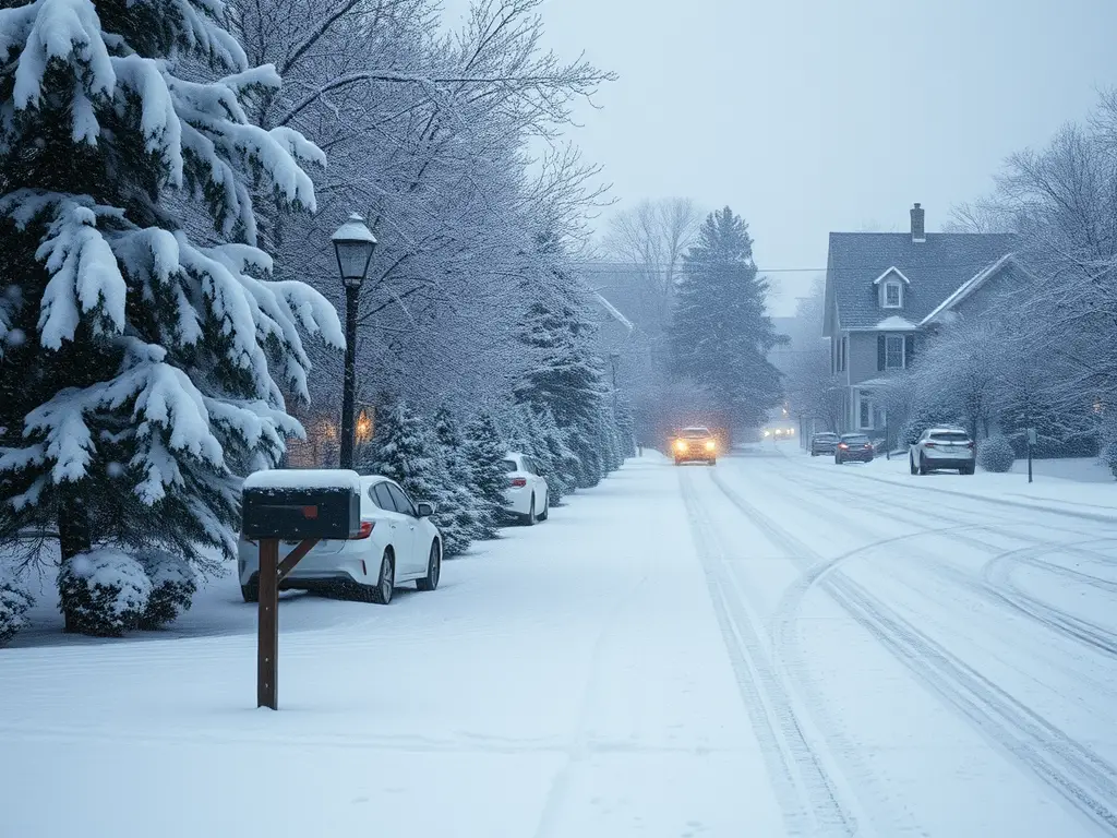
Michigan faces a series of winter storms bringing heavy snow, strong winds, and hazardous travel conditions statewide.
Statewide Winter Storms Expected to Impact Travel and Safety
DETROIT — Issued by the National Weather Service at 10:53 PM on December 5, 2024.
Southeast Michigan: Frigid Temperatures and Light Snow
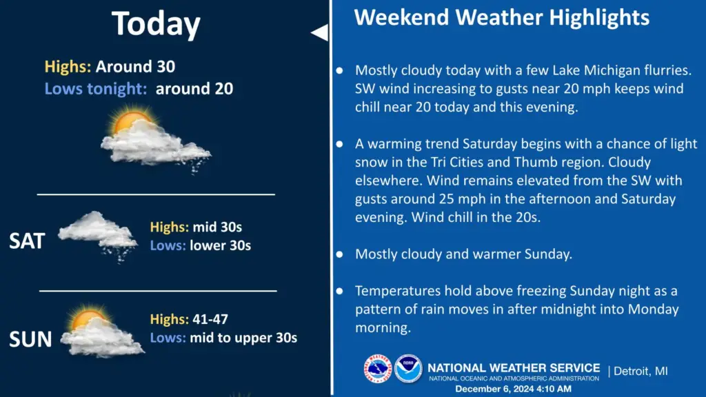
Residents in Southeast Michigan should prepare for persistent cold temperatures into Saturday, with apparent temperatures ranging from zero to around 10 degrees early Friday morning. There is a chance of light snow accumulation of less than one inch north of M-59 on Saturday morning. A warming trend is expected over the weekend, leading to rain from Sunday night into Monday.
Southwest Michigan: Lake-Effect Snow and Temperature Fluctuations
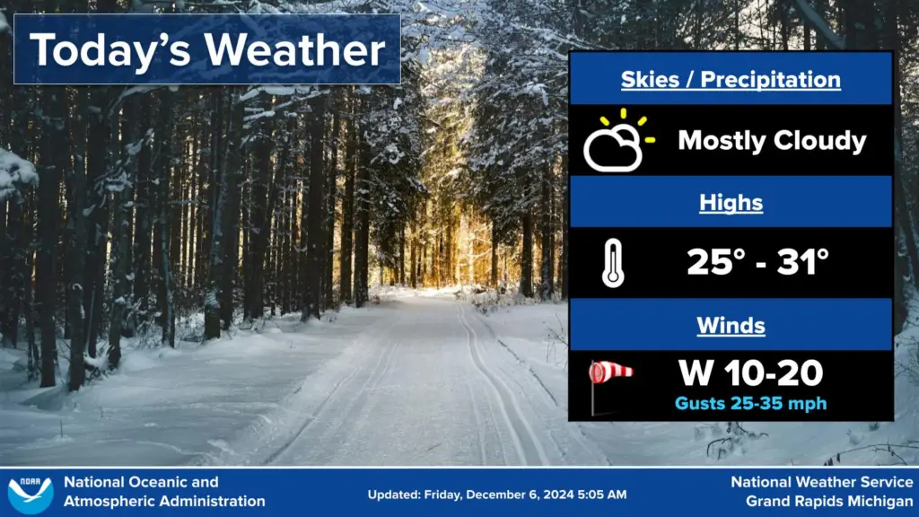
In Southwest Michigan, lake-effect snow continues to affect the region, particularly along a Muskegon to Kalamazoo line. No significant precipitation events are expected from the weekend into mid-next week. Temperatures are anticipated to warm over the weekend and then decrease into the following week.
Northern Lower Michigan: Windy Conditions with Accumulating Snow
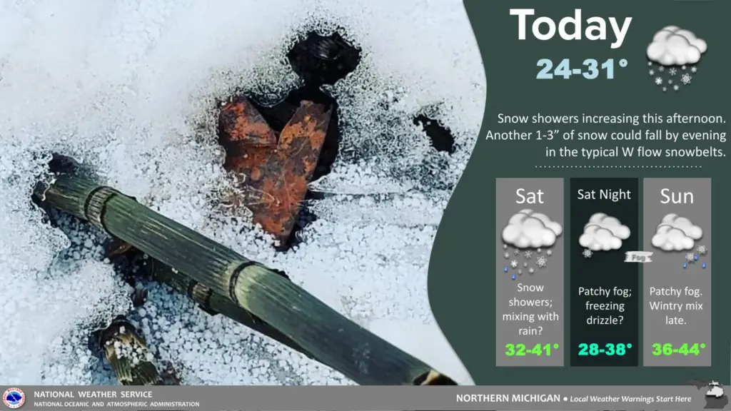
Northern Lower Michigan is experiencing windy conditions with accumulating lake-effect snow showers targeting snowbelt areas. A pattern change is ahead, with mixed precipitation possible from Friday through Sunday.
Upper Peninsula: Heavy Snow Bands and Blustery Winds
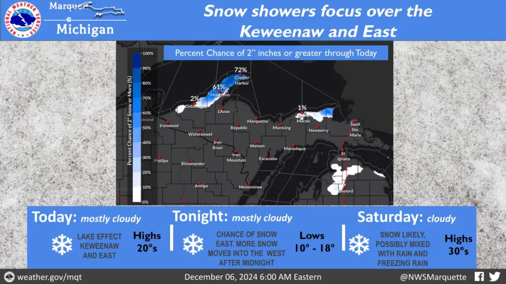
The Upper Peninsula is under the influence of heavy lake-effect snow bands, particularly in northerly belts. The combination of heavy snow and blowing snow is leading to dangerous travel conditions and near-zero visibility in affected areas. Blustery north-northwest winds, gusting up to 30-45 mph, are expected, especially near Lake Superior and in the Keweenaw Peninsula. Wind chills are dropping to near or just below zero for much of the central and western parts of the region.
Hazardous Weather Changes Fast – Stay Updated
Weather Watches, Warnings, and Advisories are frequently updated by the National Weather Service. Please look for updates to this report from the National Weather Service, or your local news channels and NOAA All Hazards radio. Please follow ThumbWind Publications for more local weather and news updates. Your helpful comments are welcome.
Check Out Our Weather-Related Features
- Climate Twins – Countries with Weather Similar to Michigan Curious about which places on Earth share Michigan’s unique weather patterns? Our latest article dives into Michigan’s Climate Twins, revealing surprising similarities and intriguing differences.
- Live Webcams Of 7 Lake Effect Snow Cities Around The Great Lakes Delve into the enchanting world of Lake Effect Snow in cities within the snow belt. Experience how urban landscapes transform into winter wonderlands with heavy snowfall.
- 14 Areas Around the Great Lakes With Significant Lake Effect Snow – How Does it HappenLake effect snow from the Great Lakes occurs when conditions of evaporation and cold upper air currents slide over the region. Water retains heat more than air. This causes some open water in the Great Lakes to evaporate into the air and warm it. Rising up into the atmosphere, this warm, wet air cools as it travels, creating snow.
Your Turn – Like This, or Hate it – We Want To Hear From You
Please offer an insightful and thoughtful comment. Idiotic, profane, or threatening comments are eliminated without remorse. Consider sharing this story. Follow us to have other feature stories fill up your Newsbreak feed from ThumbWind Publications.