by
by 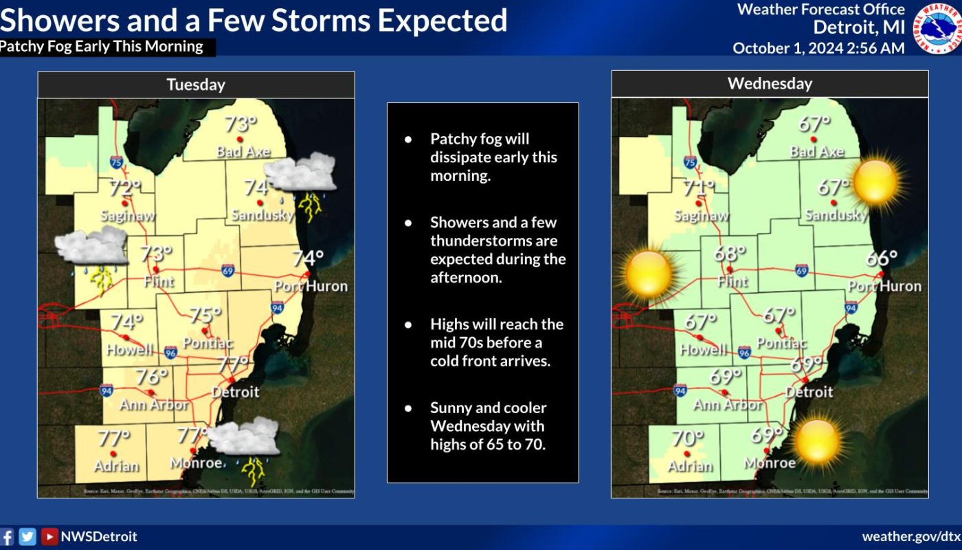
Showers and possible thunderstorms are expected this afternoon across Southeast Michigan, followed by a cool-down starting Wednesday.
Showers and Isolated Thunderstorms in Southeast Michigan as Temperatures Drop Midweek
DETROIT — Issued by the National Weather Service at 2:40 AM EDT on October 1, 2024.
Afternoon Showers and Thunderstorms to Hit Southeast Michigan
The cold front, tracking through the region today, will bring a significant wind shift from south-southwest to northwest by the evening, accompanied by cooler temperatures. The overnight lows are expected to dip into the 40s for most areas, with Detroit remaining in the low 50s due to the urban heat island effect.
Cooler and Drier Weather Follows the Showers
By Wednesday, cooler and drier conditions will settle in, with temperatures climbing close to 70°F under mostly sunny skies. However, residents in Detroit and surrounding areas should be prepared for a brief return to warmer weather by Thursday, as temperatures are forecasted to rise back into the mid-70s.
Despite a brief warm-up, temperatures will remain above average for early October, with the overnight lows staying mild. A dry cold front is expected to pass through late Thursday, but the chance for measurable rainfall remains low.
Gusty Winds and Choppy Waters for Lake Huron and Lake St. Clair
Boaters and those near the Thumb area should take caution as gusty winds are expected over Lake Huron and Lake St. Clair this afternoon. A Small Craft Advisory is in effect for these waters from 2 PM today through early Wednesday, with gusts reaching up to 30 knots. This wind shift could result in choppy conditions, so boaters are advised to stay updated on the latest weather conditions.
Hazardous Weather Changes Fast – Stay Updated
Weather Watches, Warnings, and Advisories are frequently updated by NWS. Please look for updates to this report from the National Weather Service, or your local news channels and NOAA All Hazards radio. For more local weather and news updates, please follow ThumbWind Publications. Your helpful comments are welcome.
Explore Michigan’s Thumb and the Great Lakes on ThumbWind.com.