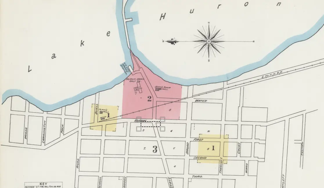
This is an old fire insurance map of Sand Beach, Michigan (now known as Harbor Beach), showing the Lake Huron shoreline, key industrial sites, and infrastructure of the time. The map highlights important features such as Jenks Flour Mill, the Huron Milling Company, and a railroad depot, all of which played a significant role in the town’s development.
Key Features:
Shoreline & Harbor: The map prominently displays the shoreline of Lake Huron, an essential factor in Sand Beach’s economy, which relied on shipping, milling, and timber industries.
Industrial Areas (Shaded in Pink): These include Jenks Flour Mill and Huron Milling, both of which were critical to the local economy, producing flour, starches, and other goods.
Depot & Railroad: The E.M.R. Railroad (likely Eastern Michigan Railroad or similar) runs through the area, connecting the milling industries to broader markets.
Yellow-Shaded Buildings: These likely indicate key municipal or commercial buildings, such as mills, businesses, or government structures.
The presence of the railroad, mills, and port access underscores the town’s role as a manufacturing and transportation hub along Lake Huron during the late 19th or early 20th century.