by
by 
If you can tell from our posts in the winter months, we love Michigan history. We really like to dig into the history of rapid and dynamic growth of the Thumb region in the 1800s. It was during a photo run of the Port Huron area that we found a new and interesting subject to focus on; Fort Gratiot.
On a single sign outside of the Thomas Edison Depot museum, there is a mention of this lonely stockade fort on the edge of the frontier.
“Fort Gratiot was built by the U.S. Army in 1814 to guard the strategic junction of Lake Huron and the St. Clair river. Troops stood ready to defend Michigan and the US against British forces in Canada.
As settlement moved westward, the fort was a stopping point for soldiers and supplies headed for the frontier. During the Civil War era, soldiers prepared for battle here, but Fort Gratiot never suffered a hostile attack. In 1879 the flag was lowered, and the fort was abandoned. “
Thomas Edison Depot museum
#1 The Americans Take Detroit in the War of 1812
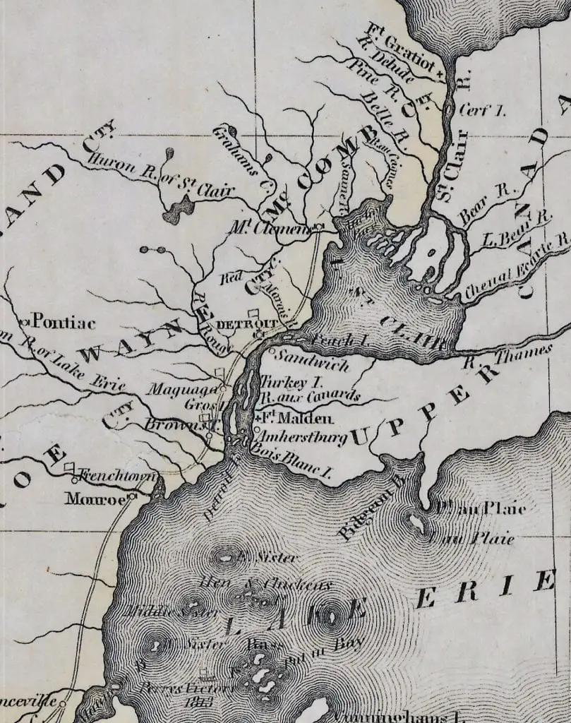
Commodore Perry’s victory on Lake Erie and the Battle of the Thames followed by the retaking possession of Detroit in October 1813, left the Americans in control of the Great Lakes. However, most of the Indians in eastern Michigan were hostile to the Americans. Along the St. Clair River, a considerable number of inhabitants on its banks made an easy opportunity for a Canadian band to made raids into American territory. A fort at the mouth of Lake Huron would serve to control the navigation of Lake Huron, protect the settlers north of Lake St. Clair from the Indians, keep back hostile incursions from Canada, and if needed, be a launch point for an invasion of Canada.
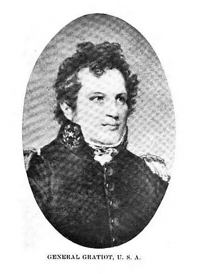
Detroit commander, General Harrison ordered a fort be erected at the base of Lake Huron and St. Clair River. Captain Charles Gratiot was named as the engineer.
#2 The Site of Fort Gratiot was No Accident
Gratiot came up the river from Detroit in May 1814 and was selected as a site close to the place where 128 years before the French had erected Fort St. Joseph, (also known as Fort Duluth), on the west shore of St. Clair River about 1,000 feet below the narrow entrance from the lake to the river and on the high bank separated from the water’s edge by a few yards of low sandy ground.
The French first established Fort St. Joseph to secure the control of the river and the fur trade of the Northwest. It also prevented the English from trafficking with the western tribes. In June 1686, M. du Luth, then in command at Fort Mackinac, received orders from M. de Nonville, the Governor of New France, to establish a fort on the “Detroit of Lake Erie”.
In 1687, about two hundred coureurs de bois, five hundred Algonquian, and thirty French soldiers gathered at Fort St Joseph under Marquis de Denonville’s orders to prepare for an attack on the Six Nations Iroquois Confederacy during the Iroquois Wars.
With a lack of supplies and no orders from the governor, the fort’s commander, Louis-Armand de Lom d’Arce de Lahontan, burned Fort St. Joseph on August 27, 1688, and moved to Michilimackinac. The passage between Lakes Erie and Huron was left undefended until 1701.
#3 Fort Gratiot’s Form Follows Function
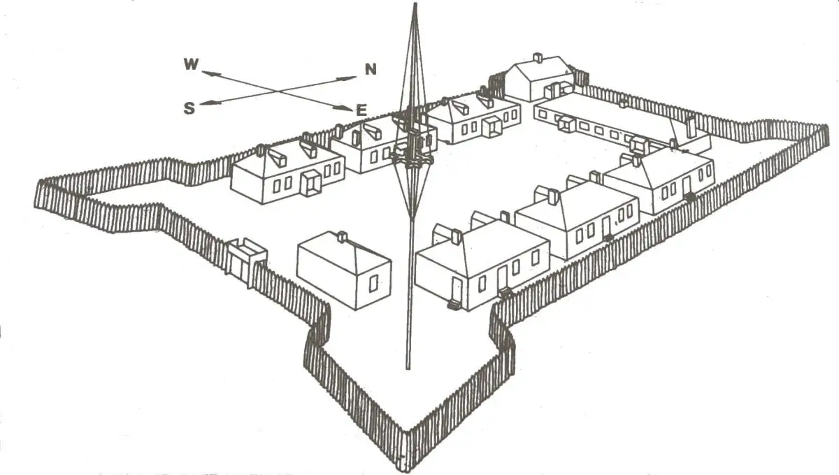
The plan and construction of the fort were simple. The only attack anticipated would be from Indians, therefore a stockade embankment to hold back their frenzied rushes was all that was needed. On the east that guns could be placed to command the river. Logs formed the base and upon them was piled earth with upright timbers forming the stockade.
#4 The Stockade on the River Was Short-lived
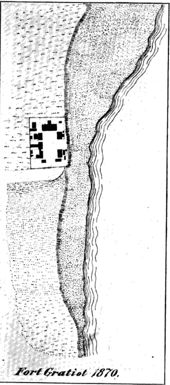
There is no record in the War Office of the plan of this fort but the sketch upon the map made by the Commissioners under the Treaty of Ghent indicates the fort structure as 165 feet in width through the bastions at the north end and about 500 feet in length, the faces at the upper and lower ends commanding the approach on the river from either direction. The fort was occupied by United States troops from 1814 until 1821 when there was no further need for a fortification. Fort Gratiot was abandoned, and the logs and stockade gradually rotted away until the walls became mere mounds of earth.
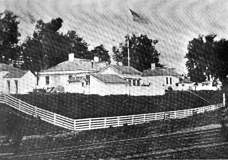
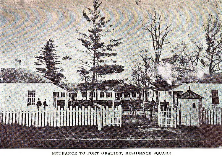
The US Army rebuilt the fort in 1828 due to unrest among the Wisconsin Indians. However, there was little danger of attack from Indians and no anticipated problems from the English in Canada, so no fortification was built. The mounds of the old walls were leveled and an enclosure made of thick pickets driven into the ground. Log barracks and other buildings that were subsequently covered with boards remained in use until the final abandonment of the fort in 1879.
#5 The Mystery of the Application of Fort Gratiot to the National Register of Historic Places
Despite a fair amount of research on Fort Gratiot, I was still looking for more background information on the site. The location of the original fort was listed on the National Register of Historic Places in 1980. The application used to be considered as a historic place contains a wealth of background information. I was surprised to discover that the application for Fort Gratiot was deemed “Restricted” by the National Register Information System. To obtain details, we will have to file an FOIA request.
Weather at Fort Gratiot Mi
Sources
- The History of Detroit and Michigan or the Metropolis Illustrated – Silas Farmer, 1889
- Michigan History: Volume 4 January 1, 1920, Michigan Department of State
- Armand, Louis (1905). Reuben Gold Thwaites, ed. New Voyages to North-America, Volume 1. A. C. McClurg. pp. xxii-xxiii.
- Title: Fort St. Joseph Site, National Register Information System ID: 73000944
- Title: Fort Gratiot, National Register Information System ID: 80004069
- Michigan Territory. By James Finlayson. From A Complete Historical, Chronological, and Geographical American Atlas, published in Philadelphia by Carey and Lea in 1822. Michigan State University Map Collection
Related Reading For Fort Gratiot
- Fort Gratiot Light Station – The area just to the north of Port Huron has a rich history. Noted as a strategic chokepoint, the mouth St. Clair River was the gateway to the northern lakes and the rich fur and lumber trade. Shipping on the Great Lakes increased in the 1820s and Congress recognized the need for a navigational aid at the mouth of the St. Clair River. This is how Fort Gratiot Mi Lighthouse was established.
- The Lightship Huron – At the extreme southern end of Michigan’s Thumb lays the town of Port Huron. This lakeside town has close ties to the boating and shipping industry. It’s the starting point of the famous Port Huron to Mackinac sailboat race and was the first large-scale boatyards in the Great Lakes. One interesting little site, located in a county park, is the Lightship Huron.
- Leland’s Picture Perfect Fishtown – The numerous wine vineyards and scenic countryside are well worth the trip. The next day we took a forty-minute morning drive north of Traverse City to the small scenic slice of the historic Fishtown on the edge of Lake Michigan on the Leland peninsula. Walking the docks is to experience a scene that is over one hundred years in the making.
- Lewis Cass’s 1820 Voyage Around Michigan – Henry Schoolcraft was asked to join an expedition organized by Governor Cass of Michigan in 1819. Its purpose was to locate the source of the Mississippi River’ and explore the Great Lakes region. As an expert mineralogist, he was tasked with describing Michigan’s significant topographical features, natural history, and mineral wealth. The expedition took approximately 40 men in five long voyageur canoes commonly used in the fur trade on the Great Lakes.