by
by 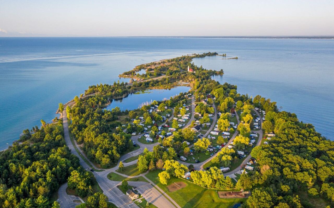
Across Saginaw Bay from Michigan’s Thumb sits one of the prettiest lighthouses in Michigan. The Tawas Point Lighthouse operated during the lumber boom in 1876 and ran continuously until 2016. The lighthouse and tower sit on a sandy point of land that is said to be always changing. It was said that ship traffic on Saginaw Bay during the late 1800s resembled a busy highway.
Table of Contents
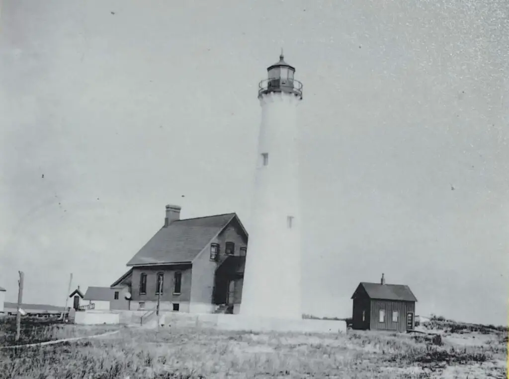
The Tawas Point Light House
Tawas Point is 2.5 miles southeast of East Tawas on Tawas Beach Road, off US-23. Bay City is slightly over an hour away, while the Detroit area is three hours away. The 183-acre park is located at the tip of a sand dune that separates Lake Huron from Tawas Bay.
The park’s campground lies on Tawas Bay, where the water is shallow and warm for swimming. The Tawas Point Lighthouse is included within the park. The station is the only one of its kind on the Great Lakes, and it was erected in the Victorian era.
History of the Tawas Point Light
This Tawas Point Lighthouse is actually the second lighthouse on the point. In 1850, the Lighthouse Service commissioned a light station to safely guide ships into Tawas Bay. The first light station was built in 1852 at the end of Tawas Point, then known as Ottawa Point. The prisms of its fifth-order Fresnel Lens magnified the light, making it visible to mariners up to ten miles away. Keepers lived on-site to maintain the light and keep it refueled with lard oil.
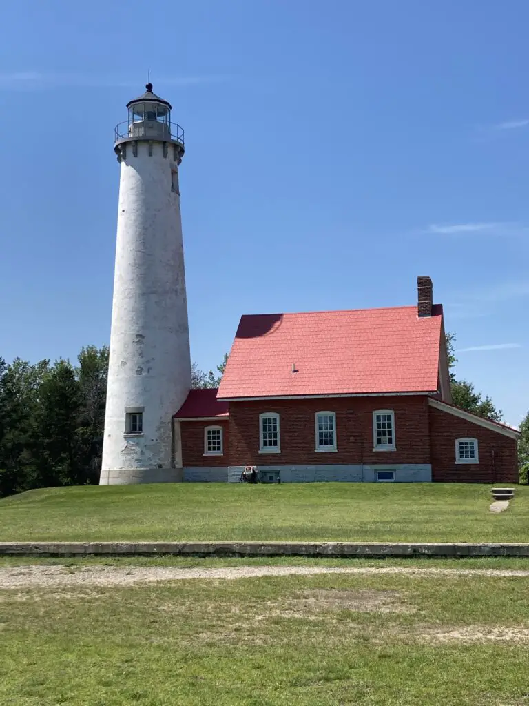
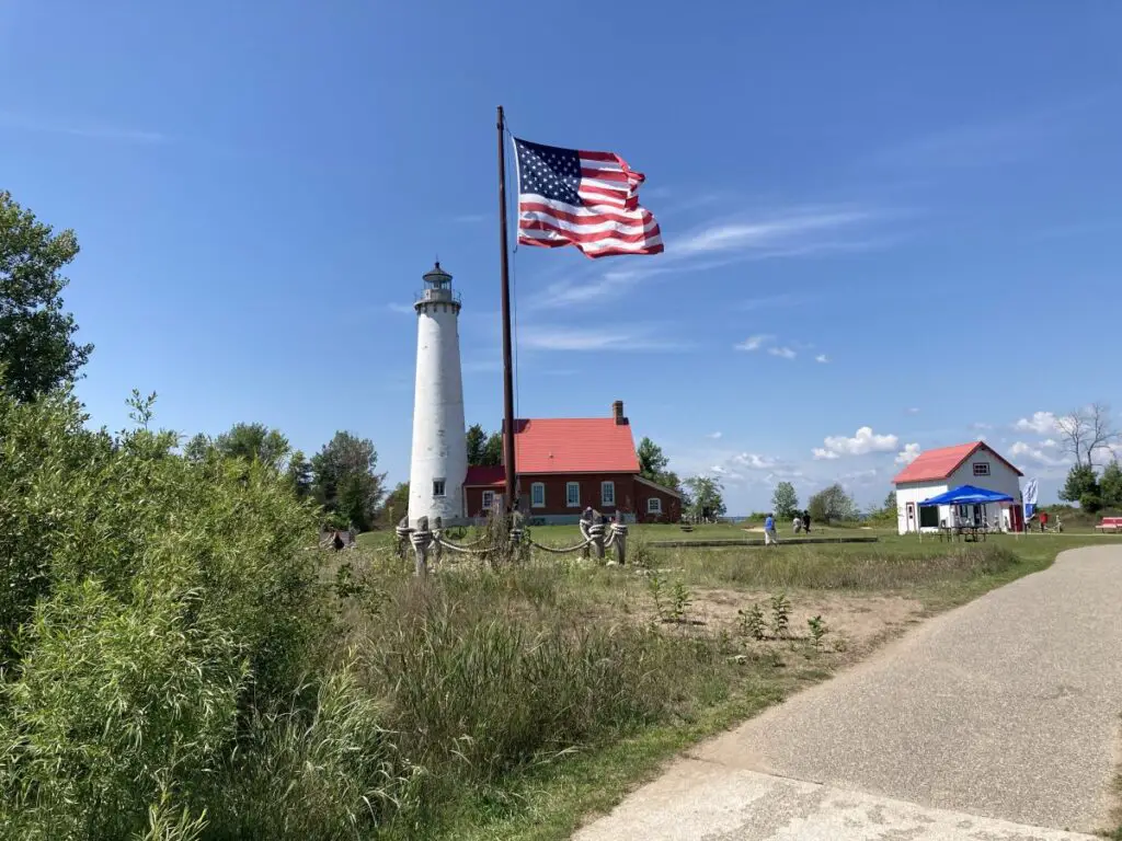
However, the shifting sands on the point continued to grow until it was of no use to navigation. The 67-foot tower for the second light was built in 1873 and finished in time for the shipping season in 1876. The tower was built at the points end and protected by rock-filled timber cribs. A life-saving station was built nearby.
During the reconstruction, a fourth-order Fresnel lens was installed and is still in place. The light was powered by kerosene until 1935 when it was converted to electricity. The 200,000 candle power light can be seen for 16 miles out into Lake Huron and Saginaw Bay. The fourth-order Fresnel lens is still in place. Today a foghorn is in place at the point which is almost a mile away from the light tower.
Double Dwelling At Tawas Point Light
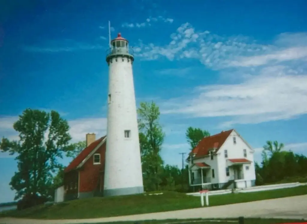
For years, there were two keepers houses at Tawas Point Light. Assistant keepers lived in temporary quarters that were little more than shacks. In 1921 the house from the Ecorse Light Station on the Detroit River was moved to the site. It was converted into a two-family residence. Lightkeepers and Coast Guard personnel lived in the double dwelling until 1993. It was removed in 2002.
The Tawas Point Light Oil House
The Tawas Point Light’s fuel was previously kept in an oil room in the keeper’s house. The Lighthouse Service switched from lard oil to extremely flammable mineral oil (kerosene) in the 1870s, but it wasn’t until 1898 that the Tawas lightkeepers got a separate storage structure for their fuel.
In 1898, a three-man crew from Detroit completed the oil house in four and a half days. They adopted a design that has been employed for over two decades in Great Lakes light stations.
Tawas Point Lighthouse Tower Climb Video
The Michigan History Center has produced a video that offers viewers a virtual tour of climbing the lighthouse tower. As each step is made up of the tower, bits of history and fascinating design and functional aspects of the lighthouse are revealed. In the end, there is a little test you can take to on seven of the little aspects of the Tawas Point Lighthouse.
Tawas Point Lighthouse – Virtual Tower Climb 2020 from Michigan History Center on Vimeo.
Fun Activities at the Tawas Point Lighthouse
Today, the lighthouse is part of Tawas Point State Park, and the Michigan Department of Natural Resources maintains responsibility for the lighthouse structure and grounds. Lighthouse tours are led during most summer weekends, from Memorial Day to Labor Day. Special events, such as the Tawas Point Haunted Lighthouse weekend, also exist in October.
Hike Along the Point On the Sandy Hook Nature Trail
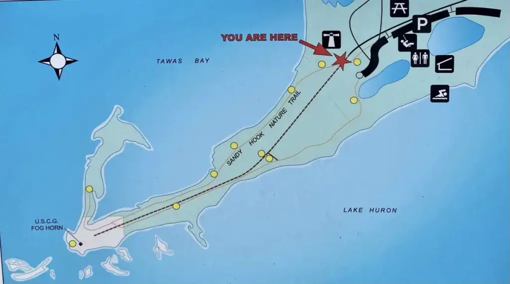
Tawas Point has long been referred to as the Midwest’s Cape Cod. The changing sand has created a natural land hook that includes sandy beaches, wetlands, tiny dunes, and a variety of species. The Sandy Hook Trail stretches about 12 miles along Tawas Point, a two-mile land that separates Tawas Bay from Lake Huron. The trail is predominantly sand, with a few boardwalk sections to preserve eroding portions.
Tawas Point is home to red foxes, white-tailed deer, turtles, and snakes, among other animals. In addition, the route, which is designated as an important bird area, allows visitors to witness over 300 species of migrating birds in the spring and fall.
Weather At Tawas Point Lighthouse
The weather at Tawas Point Lighthouse, Michigan, often varies, reflecting the state’s typical climate. Summers are warm, with temperatures around 70°F, perfect for outdoor activities. Winters, however, are harsh, with temperatures dropping below 20°F and heavy snowfall. Spring and Fall are mild and wet, offering beautiful scenic views. The lighthouse experiences winds from Lake Huron, making it an ideal spot for birdwatchers and windsurfers (“Tawas Point State Park,” n.d.).
Further Exploring Nearby Au Gres and Omer Michigan
Beyond the popular attractions of Au Gres, Michigan, one may find enjoyment in exploring its neighboring town, Omer. Known as Michigan’s smallest city, Omer offers a unique charm with its annual events like the Sucker Festival and Arenac County Fair. The Rifle River and the Au Gres River provide opportunities for fishing and water sports. Visitors can also enjoy hiking at the Au Gres City Park and camping at the Riverbend Campground. Both towns showcase Michigan’s natural beauty and small-town appeal (Michigan Economic Development Corporation, 2021).
Related Sites and Reading
- 10 Things To Do In Tawas Michigan – Fun Across the Bay – On summer evenings, we can see the blinking lights of the Tawas, Michigan, from our beach. It’s a day’s sail from Caseville but a several-hour drive from the Upper Thumb. The bay is clear due to the currents coming in from Lake Huron, and the little town nestled near the harbor is a charming mix of a tourist town and art colony.
- A First and Exciting Saginaw Bay Sail – The morning air was hot, still and you could almost taste the humidity as we headed out on our first cruise with our 33-year-old Catalina 27. Our three boys and one of their friends slid between the stays to get to the bow to enjoy a bit of a breeze. It was a fine day and I was grinning from ear to ear as I looked back to see the Caseville harbor break wall slide in and out of the mist and into our first Saginaw Bay sail.
- Turnip Rock – 7 Basic Things to Know When You Kayak – One of the most amazing sites in the Upper Thumb is Turnip Rock. Considered one of the ten most beautiful places in Michigan. Carved over time by the force of constant wave action, the soft limestone has been shaped to its namesake and separated from the mainland over thousands of years.
- Lighthouses of Michigan’s Upper Thumb – There are 124 Michigan lighthouses across the state. They are unique, functional and draw many visitors to explore their grounds or climb the towers. Of the four lighthouses in the Upper Thumb, only one is accessible directly from the land. All the others need a boat to access.
- Huron County Lighthouses Guard the Shore – These videos of the Huron County Lighthouses tour were stumbled upon a couple of years ago, and we were impressed with their high-quality production. However, I don’t think they were well promoted as they only have about 1,500 views.