 by
by 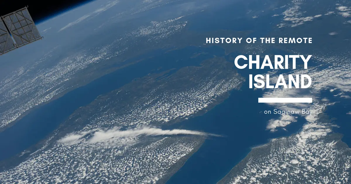

There it sits—a lush tree-lined island on the horizon of Saginaw Bay. Big & Little Charity Islands are ten miles from the southern shore of Saginaw Bay. Except for the seasonal residents who live and host tours at the lighthouse keepers’ house, the island is uninhabited. These islands are considered by the US Fish and Wildlife Services one of the more remote and least visited islands in the Michigan Island National Wildlife Sanctuary. Visitors are few due to the bolder-filled and treacherous shallow waters that surround the island. Charity Island history is one of isolation and remoteness in a busy shipping area.
The Remote Island Dominates Saginaw Bay
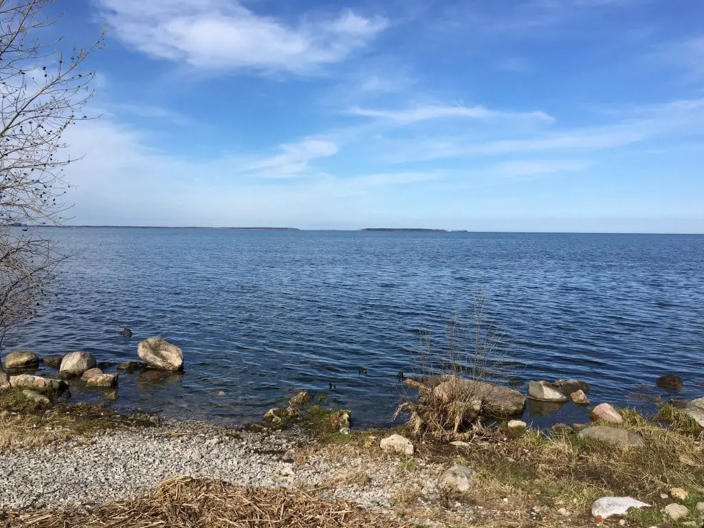
Big Charity Island is one of the larger islands on the US side of Lake Huron. At over 250 acres, it imposes a dominating outline at the mouth of Saginaw Bay.
Charity Island sits almost in the middle of Saginaw Bay between three birdwatching and migratory sanctuary. Fish Point Federal Wildlife Refuge in the Thumb, the Shiawassee National Wildlife Refuge near Bay City, and the Tawas Point State Park are two best-known birdwatching sites in Lower Michigan. Saginaw Bay is an important migratory stopover for birds such as the Tundra Swan. Charity Island is a stopping point for over 200 species of migratory birds, and the island is designated as part of the Michigan Islands National Wildlife Refuge.
It has an 11-acre pond that is spring-fed and surrounded by reeds. It’s a favorite spot for nesting Bald Eagles and other birds, and as a result, the US Fish and Wildlife Service has denoted both islands as off-limits to camping and hunting due to their role in the region as a rookery.
Native American History of the Island Chain
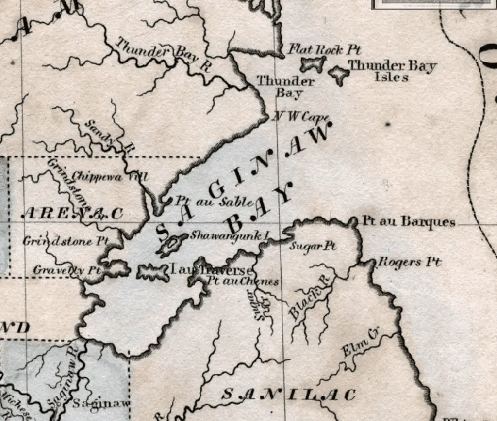
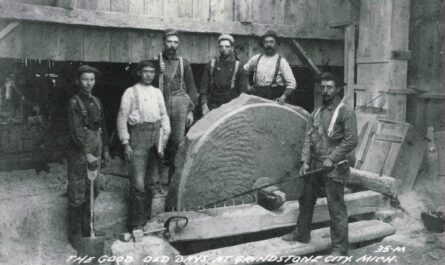
Local lore tells that the largest island has been used for 1000’s of years as a stopping point for native American Indians traversing Saginaw Bay and as a source for the stone called “chert,” which is used for making stone tools. The first notation of the island in maps from the late 1600s by the French denoted the Big Charity Island with the name of Shawangunk. Shawangunk has been translated to mean “in the smoky air” in the eastern US tribe in the Lenape language. The French named the small island to the south “Ile de Traverse” or Traverse Island.
The Voyages of LaSalle
The island was supposedly visited by the French explorer de La Salle in August of 1679 while on his way to Mackinac on the Griffin. However, some historians dispute this claim as it was noted that the Griffin crossed the 30 miles of Saginaw Bay at night.
“The same day the vessel scudded before a fresh breeze along the eastern shore of the lake, headed north by east until the evening when the wind has changed to the southwest, and being very strong, they bore toward the northwest. On the ‘morrow M. de La Salle found himself in sight of land having crossed during the night a great bay named Sakeinam which extends southward more than thirty leagues.”
Discoveries and Voyages of Cavelier de La Salle from 1679 to 1681
The Exploration of Lewis Cass and Henry Schoolcraft
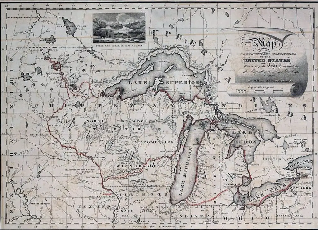
In 1820, United States Secretary of War John C. Calhoun authorized Michigan territorial governor Lewis Cass to lead an expedition of scientists, Canadian voyageurs, and Native Americans into the wilderness of the upper Great Lakes to survey the territory and look for the source of the Mississippi River.

Cass included Henry Schoolcraft in his group of 40 explorers. Schoolcraft was a noted mineralogist and geologist and was key to the expedition’s mission. The route that they took to cross Saginaw Bay mirrors a popular theory that the route between Oak Point-Charity Island-AuSable was part of a well-known Indian transit route that included a stop at the island as a safety precaution from the fast-moving storms that are well known in the bay
Schoolcraft noted in his journal the following entry:
“In crossing the bay we landed a few moments upon Shawangunk island which is found to be based upon compact limestone and contains embedded masses of Chalcedony, and calcareous spar. I also picked up, during the short period we remained, a lump of the argillaceous oxyd of iron, and some detached fragments of a coarse striped jasper. These discoveries created a strong desire to make a geological survey of the island, but we were prevented from attempting it, by the necessity of expeditious progress across the bay while the weather favored.”
The expedition continues to the mouth of the Au Sable river then to Michilimackinac and presses on to Sault de Ste. Marie and Fond du Lac and into Wisconsin.
Charity Island and Michigan’s Lumbering Era
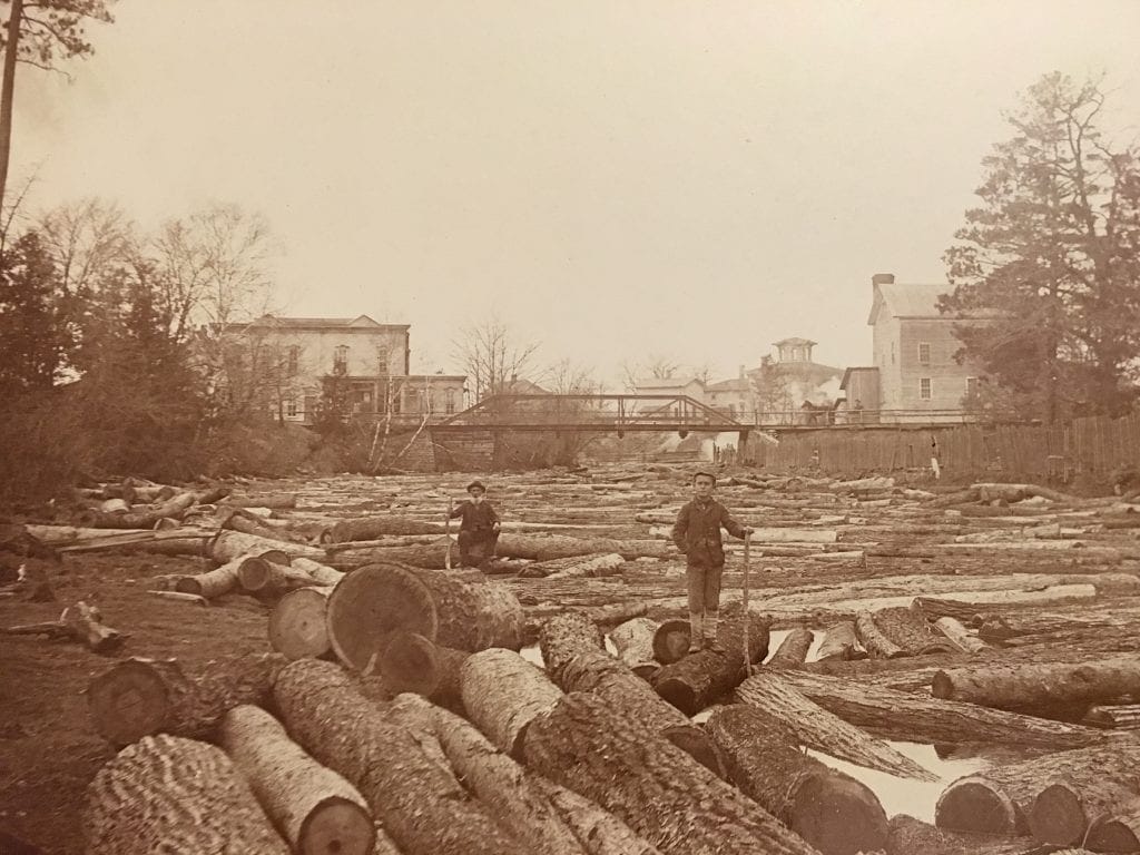
The timber along the Saginaw Bay region was exploited early in Michigan’s lumbering era (1830-1910). Lumber mills were built on just about every river outlet that led to Lake Huron or Saginaw Bay. Mills were built in Bay City, Saginaw, Sebewaing, Caseville, Port Crescent, New River, and Port Hope. The rivers provided convenient transportation for logs to the sawmills which were located near the lakeshore ports. Ships entering into the shallow bay had to contend with the limestone reefs and shoals at the tip of the thumb and around Charity Island.
Navigation issues were evident throughout the Great Lakes. In 1838 Lieutenant James T. Homans was tasked with assessing the waters west of Detroit as part of a new regional lighthouse district. Hormans was tasked to make reports regarding the condition of each and make recommendations for any future lighthouses. One of his recommendations to place a lighthouse at the mouth of Saginaw Bay. (5)
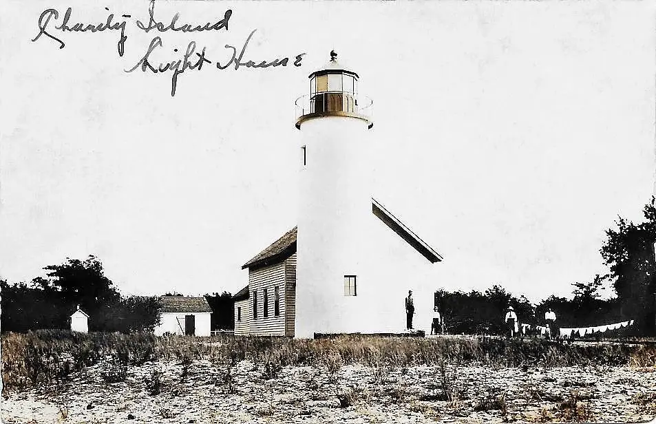
Development of the Charity Island Lighthouse
Charity Island history is not complete without learning about its forlorn lighthouse. Congress appropriated funds for the construction of a lighthouse on “Traverse or Charity Island in Saginaw Bay for $5000. (and also for Port Austin Lighthouse for the same amount) (2) Construction on the island began in 1856 and continued into the following year. A 39-foot brick tower was constructed from brick brought in from Milwaukee on the steamer Search. As the tower was being built, the editor of the Bay City Express traveled by the island on the ship. In an article by the newspaper on June 6th he chided the government on such a needless expenditure since the island itself was known as a source of good building stone. (3)
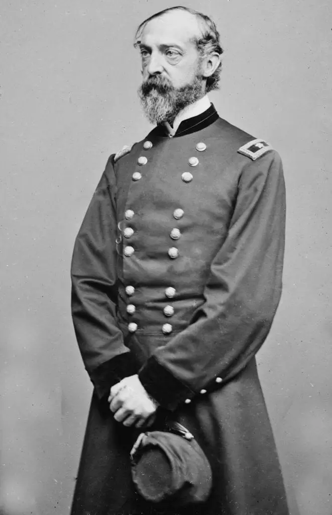
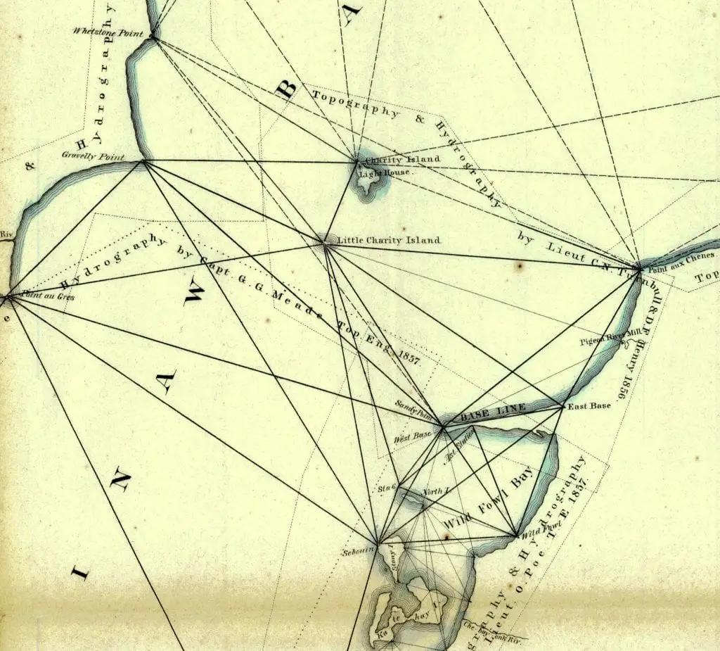
At the same time, the lighthouse was being built a Captain George Meade was ordered to begin surveying the Upper Great Lakes including Saginaw Bay. The bay was critical to the young states’ lumbering industry and no accurate maps existed that showed exact distances and depths of the area. Thus grounding and wrecks were all too common.
Meade set the baseline of his Lake Huron surveying starting from the long peninsula of Sand Point. From here he set up triangulation towers at key points along the north and south shore including a newly constructed lighthouse on Charity Island in the middle of the bay.
Colin Graham took command of the light as its first keeper in May and began regular operation soon after the tower and light were completed. The light provided a 13-nautical-mile range of visibility. This range was planned as the government was in the process of constructing a set of lights up and down the coast, and 13 nautical miles was considered adequate both to keep boats off the island and to navigate from one light to the next.
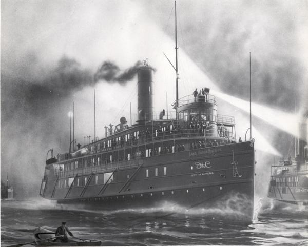
The Wreck of the Oconto 1885
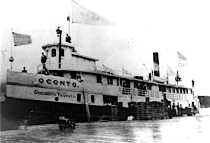
On the afternoon of December 4th, 1885, the passenger ship Oconto was making its last trip for the season out of Oscoda toward Alpena. However, the ship was greeted in the bay by a blinding snow squall and gale-force winds. Captain McGregor decided to turn back and take shelter in nearby Tawas bay.
In the gale, the ship’s course was too far east, and as it was passing, Charity Island is grounded in the shallows that guard the island. The captain and crew saw the lighthouse and thought they were near Tawas. They freed the ship, and upon coming around, they hit aground again and came to a dead stop.
The Oconto was stuck but not taking on water so the passengers and crew remained on board and weathered the gale until the next day. The night was brutal. They were carrying livestock which broke free and wandered the ship. In the morning light, they could see that the ship was about a mile away from Charity. The captain signaled with a whistle and soon the lighthouse keeper McDonald and assistant William Pierce could be seen onshore. They launched a lifeboat and began rescue operations.
The 23 passengers and several of the crew were taken by rowboat to shore where two women and a child went to the lighthouse and the men took shelter in fishing huts on the island. The 47 wreck survivors and crew disbanded and made their way back to the mainland over the next week.
While all of the passengers survived the ordeal, one crew member the ship’s cook, Charles Brown, died of fright and was reportedly buried on Charity Island.
The Oconto was salvaged in the spring and resumed service only to sink near the St. Lawrence River at Fisher’s Landing.
Charity Island’s Role in the Fishing Industry
With the lighthouse fully automated, the government sold Charity Island to the Gillingham Fish Company in 1926, retaining just the lighthouse reservation. Gillingham Fish Company was established in 1886 and was at its peak of fish production in the 1920s and 1930s when they purchased the island They shipped tons of perch, walleye, herring, whitefish, and carp to New York and Chicago in refrigerated railroad cars from Bay Port. In November 1915 Bay Port Fish company sold $30,000 in stock to purchase Little Charity Island from the indebted Beutel Fisheries Company.
Automation of the Charity Island Lighthouse

In 1916 the Charity Island Lighthouse on Saginaw Bay became the first Great Lakes lighthouse to be fully automated. A newer light located closer to the shipping channels at Gravelly Shoals light became operational between 1939 and 1942 the Charity Island Lighthouse was discontinued. The tower and the keeper’s house were left to the elements.
Another element of Charity Island history is the number of times it was bought and sold. In 1963 Gillingham Fish company sold the Big Charity island to Saginaw businessmen for development as an island resort. Plans called for a landing strip, bridle paths, and biking trails. The General Services Administration received a top bid of $15,500 for the lighthouse reservation on the northeast tip of the island.
Charity Island Development
Standish real estate broker Bob Wiltse and investors bought Charity Island in 1993 for development. They were envisioning 24 exclusive homes across the island. The project’s first phase was to take 60,000 pounds of dynamite to blast out the small harbor. It took 16 weeks to carve out the small marina and connect it to the lake by a channel.
In 1997 plans for development were deferred, and Robert Wiltse sold most of the island to the U.S. Fish and Wildlife Service as a new acquisition for the Michigan Islands NWS. The non-profit Nature Conservancy bought a few more acres from Wiltse and bought the lighthouse from the government.
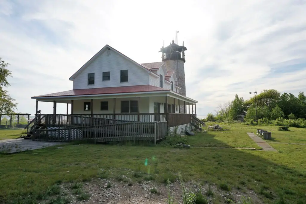
Robert kept five acres around the lighthouse keepers’ house, which architects said was unsalvageable and had collapsed. Robert and Karen Wiltse rebuilt an updated light keepers home on the same foundation and keeping much of the site lines and details of the original house. However, it has been updated to be self-sufficient with wind and solar power generation and its own water purification system.
Sightseeing Dinner Cruises and Island Lodging
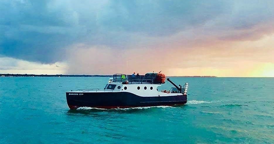
Wiltse built a new house on the site in 2003, which hosts weekend visitors for lighthouse sightseeing and dinner cruises. Guests can use a tour company to embark on the island from Caseville Municipal Harbor with Explorer Charter Cruises or Tawas City at Au Gres in Arenac county with Charity Island Transport. The tour includes a review of Charity Island’s history. If you’re brave, you can climb the tower of the historic lighthouse. Returning to port, one gets to view the famous sunsets on Saginaw Bay on the boat ride home.
There is also a new Charity Island lodge built for those who want to say on the island. It sleeps four, and there is a three-night minimum stay. Transportation from the mainland is included
Give Us A Review
If you like our stories and research, please take a moment and give us a good review. We appreciate your comments and observations. Click Here to give a review on Google.
Sources
- Relation of the Discoveries and Voyages of Cavelier de La Salle from 1679 to 1681: The Official Narrative www.americanjourneys.org/aj-122/ Page 35.
- (2) THIRTY-FOURTH CONGRESS. SESS. I. C. 160. 1856 p 100.
- (3) Saginaw Bay Survey by George Meade Documented by Old City Newspaper, Bay City Express, in its issue of June 6, 1857
- (4) A Sesquicentennial History of the Corps of Topographical Engineers 1838-1863
- (5) Great Lakes Navigation and Navigational Aids Historical Context Study By Theodore J. Karamanski 2017, National Park Service
- (6) New York Times Dec 12, 1885
- (7) GLMS 19 – Bay Port Fish Company, Bowling Green State University
Related Reading for Charity Island History


Very interesting. I used to live in Sebewaing and now I live in Grand Haven.
Thanks for stopping by.
Nice job Mike, thank you.
Robert & Karen Wiltse
Thanks for stopping by. Will you resume tours when the Covid pandemic subsides?
I grew up in Caseville and graduated from high school there, but nobody seemed to know much about the islands. I even worked for Bob Gillingham and he never shared anything. I’m glad it has developed. Thanx.
Hi Chuck…we are always discovering more about the Upper Thumb. Thanks for your interest.
Very interesting article. Learned a lot. I am from Sebewaing and we were friends of Bob Wiltse’s dad, known as Chuck.
Thanks for stopping by.
I seem to remember dredge sand (from the Saginaw Bay channel) being dumped on, or near the Charities in the 60s. Was this the case?