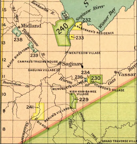
This 19th-century map details the presence of Anishinaabe (Ojibwe/Chippewa) communities throughout the Saginaw Valley. It marks key Native villages, personal residences, and government-assigned land allotments tied to federal treaties and policies. Numbered tracts such as 229, 230, and 240 likely represent parcels granted through the 1855 Treaty with the Chippewa or similar arrangements intended to divide tribal lands into individual ownership.
Notable landmarks include Campau’s Trading House, Kish-Kaw-Ba-Wee Village, and Knaobashk’s Residence—each signifying key cultural or economic centers for Indigenous families. The map also shows the proximity of emerging settler towns like Midland and Vassar. It reflects a time of major change, when Native land claims were being redrawn under pressure from expansion, often reducing sovereign territories to scattered, regulated holdings.
Discover more from Thumbwind
Subscribe to get the latest posts sent to your email.