by
by 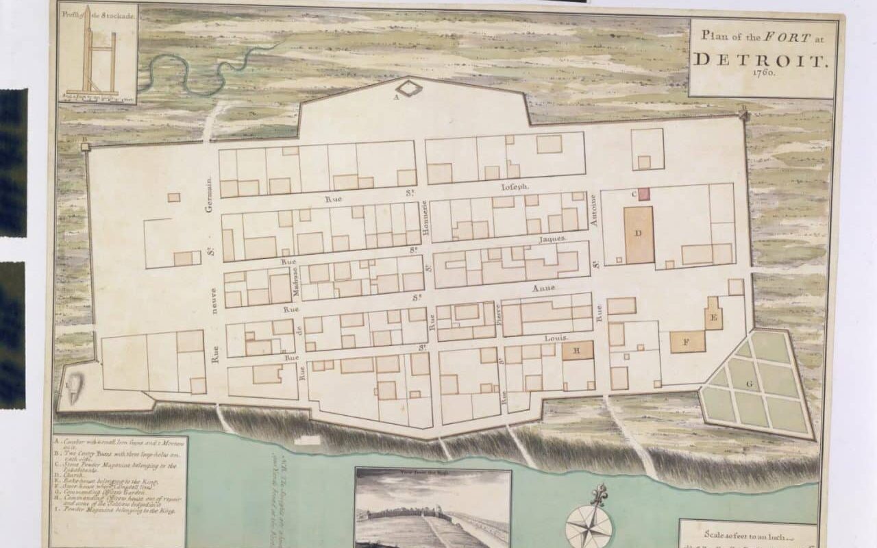
Michigan history enthusiasts are excited about the recent addition of Detroit’s rare 1761 manuscript plan to the Clements Library at the University of Michigan. This map of Fort Detroit gives a glimpse of what Detroit looked like just as the British took control of the upper Great Lakes from France.
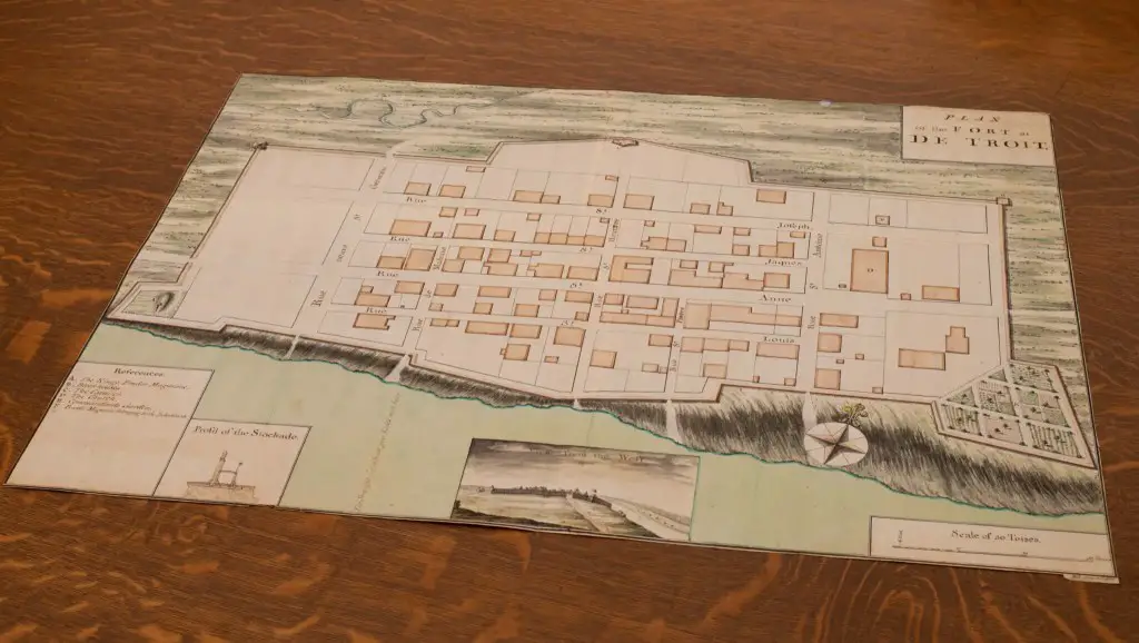
The “Plan of the Fort at De Troit” was last seen by the general public in 1967 when it was offered for sale at Sotheby’s. It will now be housed in the William L. Clements Library at the University of Michigan.
“This map was executed by noted surveyor and map draftsman William Brasier for General Jeffery Amherst in 1761,” noted Brian Dunnigan, a map curator emeritus specializing in early Detroit, Mackinac, Niagara, and 18th-century Great Lakes history. “Comparing maps helps to understand the growth and changes taking place in Detroit. This map was drawn just months after Detroit was ceded from New France to Great Britain and depicts the fort that Pontiac and his warriors later attacked during the summer of 1763.”
Former Clements curator Dunnigan used the photo featured in the Sotheby’s sale catalog to write about this hand-drawn map for his book Frontier Metropolis: Picturing Early Detroit, without knowing to whom the original was sold at the time.
Details of the 1761 Map – Plan of the Fort at De Troit
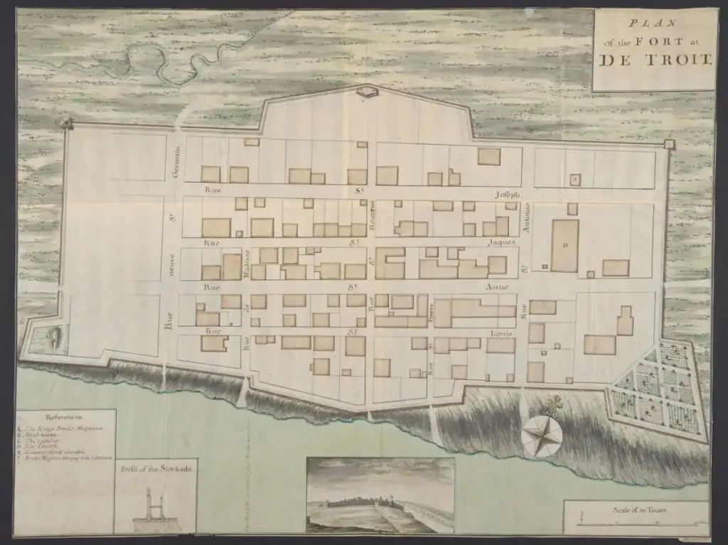
In 1761, British General Jeffery Amherst commissioned this unique layout of Fort Detroit, which was hand-drawn by famed surveyor and map draftsman William Brasier. It represents Fort Detroit in pen, ink, and watercolor only months after being surrendered to Great Britain from New France.
The map is a completed, colored plan of the fort enclosure and houses along named streets within; it was completed shortly after New France relinquished the fort to Great Britain. The map includes a table referencing the King’s powder magazine, blockhouses, cavalier fortifications, the church, the commandant’s garden, and the citizens’ powder magazine.
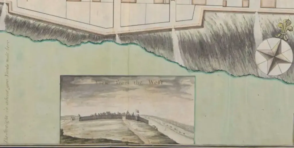
It was derived from an older “Plan of the Fort at Detroit,” 1760, attributed to Diedrich Brehm (initially held by the Burton Historical Collection, Detroit Public Library). The absence of structures at the fort’s western extremity, perhaps due to a disagreement over ownership of these westernmost lands, differs from the original layout. The inset “View from the West” is particularly noteworthy, depicting a stockade fence, roofs, a waving flag, and a road leading into the fort.
Acquiring The Plan of the Fort at De Troit Took Funding
When Paul Erickson, the Randolph G. Adams Director of the Clements Library, learned that the plan was again for sale, he felt it belonged there. The main issue was that the expense of the map would be a significant drain on the acquisitions budget. “This map is unique, one-of-a-kind. Manuscript materials of any kind from before the Revolutionary War are rare. Items like this map that can help bring researchers back to a specific time and place so, and they’re priced accordingly.”
The Clements Library has started a crowdfunding effort to acquire $42,500 to acquire this Detroit plan. The initial glimpse of the map sparked such excitement that numerous donors have rushed forward to give $20,000 in matching money. “Matching funds for this campaign means that every new donation will be immediately doubled to help in reaching our goal. Through crowdfunding, we hope anyone in the world passionate about the history of Detroit and the Great Lakes can have a hand in supporting this exciting acquisition,” Angela Oonk, the Clements Library’s Director of Development, agrees.
The map has found a fitting home at the Clements, where it will join their rich collections of manuscripts, maps, and other primary materials from the colonial era and the lead-up to the American Revolution, such as General Amherst’s and General Thomas Gage’s files.
The Map of Fort Detroit is a Capstone to the Book Frontier Metropolis by Brian Dunnigan
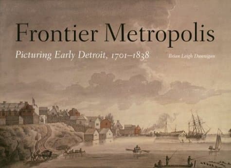
Detroit is older than many other cities in the eastern United States despite its inland position due to its roots as a French colony. Frontier Metropolis shows and explains all known pre-photographic photographs of Detroit to present a virtually comprehensive visual timeline created by persons who knew the city.
Brian Leigh Dunnigan assembled these maps, plans, and perspectives to depict the history of Detroit and its communal life throughout the city’s first 137 years. The text accompanying the photographs sets them in their historical perspective and provides descriptive remarks of individuals from the past. At the same time, the chapter introductions analyze concerns encountered by Detroit citizens over the years covered. No other book illustrates Detroit’s transformation from a struggling farming hamlet and trade station to an industrial behemoth as clearly as this one.
Frontier Metropolis, presented in a stunning, large-format design and illustrated in full color, is a unique and engaging look into the city’s rich and diverse background.
Related Detroit Reading
Steamship Excursion From Detroit 1910
Detroit Zoo To Get 100% Michigan Renewable Energy
Yes! There Are Hiking Trails Near Detroit, And These 6 Treks Will Whip Your Butt Into Shape
What Is The Oldest Original Michigan Coney Island In The State?
Discover more from Thumbwind
Subscribe to get the latest posts sent to your email.