Our title may be a bit overstated, but what the heck? Michigan beaches are awesome. After extensive research and sand in our shorts, we have collected ratings and descriptions of the top 50 beaches in Michigan. These fantastic bits of shoreline are ideal spots to stick your toes in four of the five Great Lakes. These are the top-rated state, county, and local beaches noted for their beauty, cleanliness, and handicap accessibility. Some were a real surprise with these Michigan beaches near me.
Some of the most magnificent beaches in the world may be found along Michigan’s 3,200 miles of Great Lakes shoreline, 11,000 interior lakes, and tens of thousands of miles of rivers. The state boasts almost 1,500 public access areas (excluding private land and state parks) where you may swim, paddle, fish, and enjoy the outdoors.
If you are a beach-going enthusiast, bookmark this page. We will be adding additional beaches to this list in the near future.
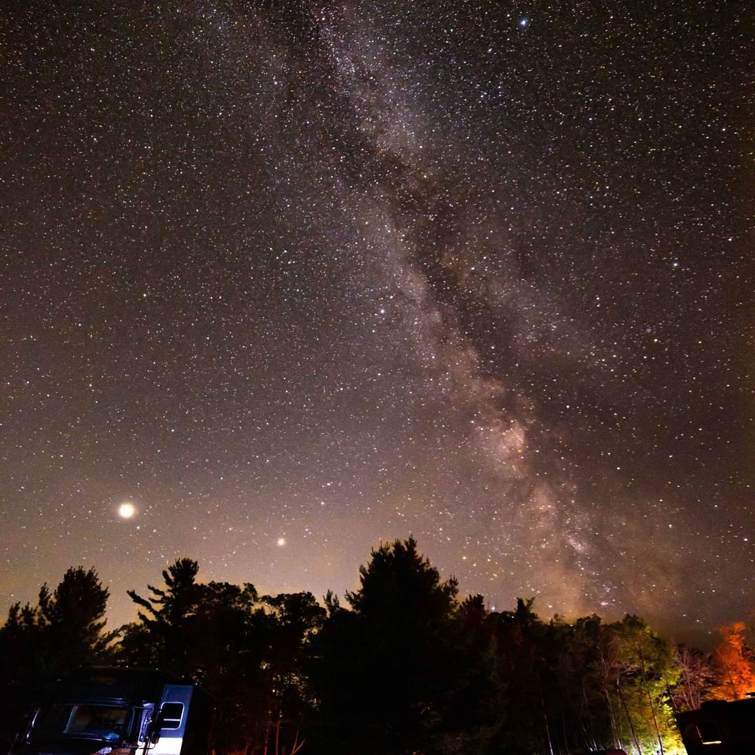
*Feature Image Bay City State Park – Photo Courtesy Tricia Lewis Photography
What We Will Cover
Great Lakes Accessible Beach Access
We think everyone should be able to experience our great beaches. So if a park or a beach has wheelchair-accessible walkways or handicap beach chairs available, we want to know about it. The Michigan Department of Natural Resources lists 29 Michigan state-managed beaches accessible with walkways and/or offers a wheelchair for access to the beach and waterfront. Some of the smaller, more remote beach areas may lack these facilities. However, we were surprised to learn more local parks are putting these accommodations into place. We list accessibility options for those beaches in our list.
Michigan Beach Maps and Directions
We offer Michigan DNR-provided park maps and directions you can immediately access with your smartphone.
The List of Top Michigan Beaches to Visit
We had problems coming to terms with a true ranking based on some criteria. We have yet to visit a Michigan beach that we didn’t like. However, this ranked list is loosely based on popularity, size and location.
50. Escanaba Municipal Beach
A clean and sandy beach conveniently located near downtown Escanaba. Lots of parking and many grassy park areas nearby to run, play, and let the dogs out. With clean sand and clear warm water in the summer, kids love it here, building in the sand and playing in the water. During the season, a lifeguard on duty with a portion of the water is sectioned off for kids to swim safely. However, there can be drop-offs farther out, and undertows during rough weather.
Accessibility of Escanaba Municipal Beach – There is no indication of an accessible walkway down to the water’s edge beach area on Lake Michigan.
Map and Directions to Escanaba Municipal Beach – Bath House Rd, Escanaba, MI 49829
49. White Rock Roadside Park – Harbor Beach
Great views of Lake Huron and White Rock. Observation deck, walking trails connecting to a non-motorized path on M-25. White Rock is a large, white, offshore boulder used as a boundary marker to define the territory released by the Native American tribes of Michigan to the United States under the Treaty of Detroit in 1807.
Due to the high water levels of the past few years, the stairs to the beach have been removed. The path down is very steep and a bit overgrown. Adequate hiking boots are necessary to make the traverse well. This is one of those Michigan beaches that get overlooked but shouldn’t be.
Accessibility of White Rock Roadside Park – There is no indication of an accessible walkway down to the water’s edge beach area on Lake Huron.
Map and Directions to White Rock Roadside Park – M-25, Harbor Beach, MI 48441
48. Range Light Beach – Presque Isle
One of the nicest beaches in northeast Michigan, hands down. Quiet, private, and ideal for children. It has a spectacular view and a fun/clean beach. It’s a good place for a quick photo op with a piece of history – an 1840 lighthouse. Known for being a good spot to collect Petoskey stones. A must-see.
Accessibility of Range Light Beach – There is no indication of an accessible walkway down to the water’s edge beach area on Lake Huron.
Map and Directions to Range Light Beach – 5889-5985 E Grand Lake Rd, Presque Isle, MI 49777
47. South Shore Park – Rogers City
Rogers City, located on the beaches of magnificent Lake Huron, is a modest town with a great secret: it is home to the world’s biggest limestone quarry. South Shore Park allows children of all ages to discover such old fossils from the same limestone. There is information and photographs to assist you in deciding what you may have discovered, as well as a wash station.
Accessibility of South Shore Park – There is no indication of an accessible walkway down to Lake Huron’s edge beach area.
Map and Directions to South Shore Park – Rogers City, MI 49779
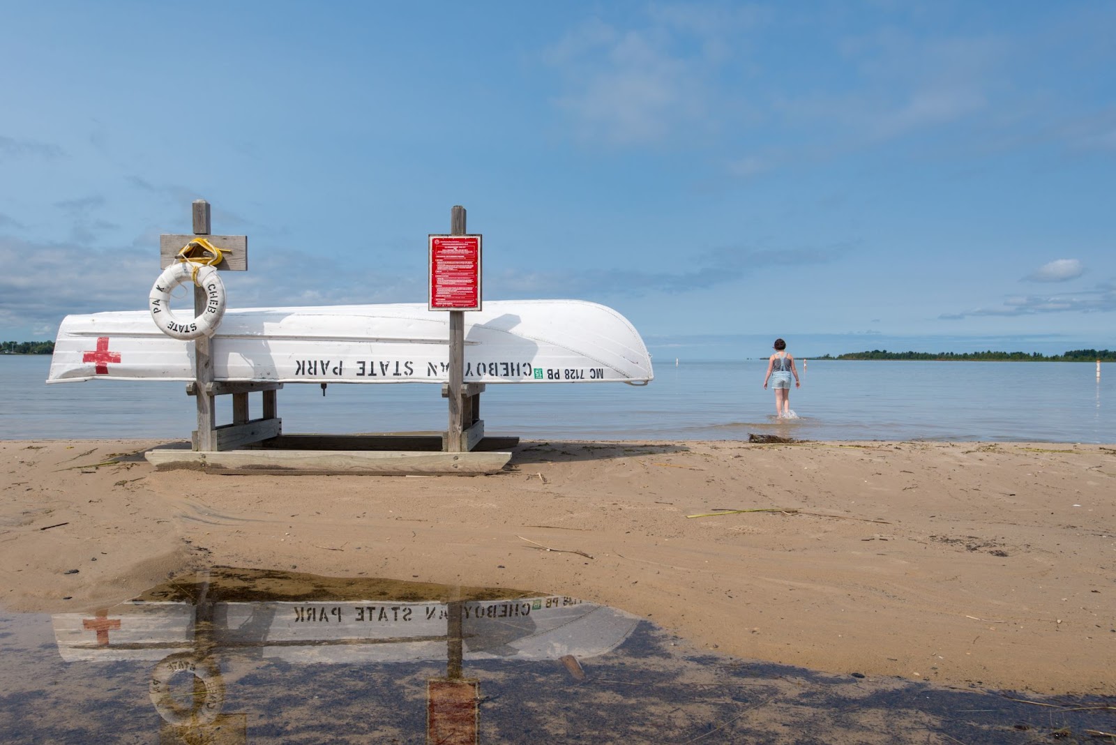
46. Huron Shores Roadside Park – Cheboygan
This is a modest wayside park located halfway between Rogers City and Cheboygan. It’s a seasonal park with public facilities in outhouses. Outside the gate on the south side is a route that goes to the beach; however, the path is not handicap accessible, and one should exercise caution when walking to the beach on this sandy, narrow stretch. A beautiful beach with a variety of Michigan valuable rocks for the serious rockhound.
Accessibility of Huron Shores Roadside Park – There is no indication of an accessible walkway down to the water’s edge beach area on Lake Superior.
Map and Directions to Huron Shores Roadside Park– Cheboygan, MI 49721
45. Agate Beach Park – Toivola
This Lake Superior campground, located twenty-five miles southwest of Houghton, has rustic toilets, no electricity, picnic tables, a sandy beach, and allows tents. Lake Superior primitive campgrounds From Memorial Day through Labor Day, the park is open.
Accessibility of Agate Beach Park – There is no indication of an accessible walkway down to the water’s edge beach area on Lake Superior.
Map and Directions to Agate Beach Park – Toivola, MI 49965
44. Sand Point Beach – Munising
The water was ice cold yet crystal clear, known for being pure. Excellent photo opportunity. In the midday heat, the beach begins to fill up. The sand is fine-grained and comfortable to walk on. You may swim to a sandbar and wade in the water. It is considered one of the most lovely beaches on the Upper Penninsula. It’s also a perfect way to end your day, with beautiful waves and a gorgeous sunset.
Accessibility of Sand Point Beach – There is no indication of an accessible walkway down to the water’s edge beach area on Lake Superior.
Map and Directions to Sand Point Beach – Michigan 49862
43. Straits State Park Beach – Mackinac
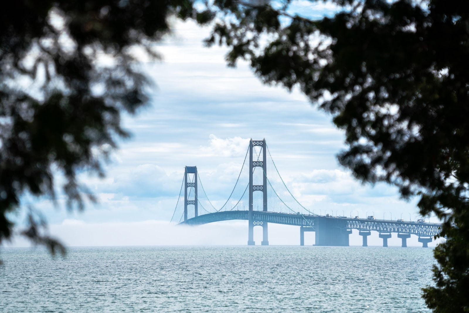
Straits State Park has 181 leisure spaces with spectacular views of the Mackinac Bridge and the Straits of Mackinac. On the northern coast of the Straits of Mackinac, St. Ignace is home to a park and beach. The Father Marquette National Memorial and Park is also within the limits of the state park. It’s a beach with views of the Mackinac Bridge, so you may swim in the straits of Mackinac while admiring the bridge.
Accessibility of Straits State Park – There is no indication of an accessible walkway down to the water’s edge beach area to the Straits of Mackinac.
Map and Directions to Straits State Park Beach – 720 Church St, St Ignace, MI 49781
42. Sable Falls Beach

This rocky beach in the Pictured Rocks National Lakeshore is located at the end of the Sable Falls Trail and offers views of the Grand Sable Dunes. The pathway from the parking lot is just approximately a third of a mile long, but there are 168 steps to the foot of the falls and a few more steps to the beach. Please keep in mind that gathering beach stones is prohibited inside the national lakeshore. There are picnic tables and bathrooms near the parking lot. Pets are welcome. This is one of the most beautiful Michigan beaches that typically gets overlooked.
Accessibility of Sable Falls Beach – There is no indication of an accessible walkway down to the water’s edge beach area on Lake Superior.
Map and Directions to Sable Falls Beach – Sable Falls Trail, Seney, MI 49883
41. Muskegon State Park
Muskegon State Park has more than 5 miles of Lake Michigan shoreline and sand dunes that are up to 100 feet high. The park’s campground offers beachfront campsites overlooking Lake Michigan. Its White Pine Trail runs through the park along the Muskegon River and connects to Muskegon Lake. Muskegon State Park is one of the top places to visit in Michigan for summer recreation including swimming, sunbathing, canoeing/kayaking, hiking, and biking trails (including a mountain bike course).
Accessibility of Muskegon State Park – Wheelchair-accessible entrance.
Map and Directions to Muskegon State Park – 3560 Memorial Dr, North Muskegon, MI 49445
40. McLain State Park Beach
McLain State Park is located in the middle of the Keweenaw Peninsula on magnificent Lake Superior, halfway between Calumet and Hancock. On Lake Superior, the park has two miles of sandy beach. Visitors may also enjoy fishing, windsurfing, berry picking, beachcombing, rockhounding, sightseeing, and hunting in the park. The sunsets in McLain State Park are beautiful, as is the view of the lighthouse.
The park’s position between Calumet and Hancock makes it an ideal starting point for tourists to see abandoned shaft houses, tram cars, slag heaps, and ghost towns. In addition, visitors to the Keweenaw are encouraged to visit the newly established Keweenaw National Historical Park, which has preserved treasures from the copper mining days.
Closest Webcam for Weather Conditions Near Hancock
Accessibility for the McLain State Park Beach – This beach offers an accessible walkway down the waterfront.
Map and Directions to McLain State Park Beach – 18350 Highway M-203 Hancock MI, 49930
39. Keith J. Charters Traverse City State Park Beach
Charters, Keith J. Traverse City State Park is a popular urban park located on the Grand Traverse Bay’s east arm, about two miles from downtown Traverse City. A contemporary campsite, a fully equipped lodge, tiny cottages, and a day-use area are part of the 75-acre park. The day-use facility is right across US Highway 31 and has a quarter-mile of sandy beach, a tiny beach house, and a picnic area.
Accessibility for the Keith J. Charters Traverse City State Park Beach – An accessible walkway down to the waterfront and a beach wheelchair is available to borrow.
Map and Directions to the Keith J. Charters Traverse City State Park – 1132 US-31 N. Traverse City MI, 49686
38. Bay City State Park
Bay City State Park, located on the beaches of Saginaw Bay, is home to the Tobico Marsh, one of the Great Lakes’ most significant remaining freshwater coastal wetlands. The park has nearly 2,000 acres of wetland forests, wet meadows, cattail marshlands, and oak savannah plains, making it an ideal staging ground for migratory birds. The park has long been recognized for its diverse birds and as a shelter for wetland creatures and vegetation.
Accessibility for the Bay City State Park Beach – This beach offers a seasonally accessible walkway down to the water’s edge. The park also has a beach wheelchair that is available for use year-round.
Map and Directions to Bay City State Park – 3582 State Park Dr. Bay City MI, 48706-1356
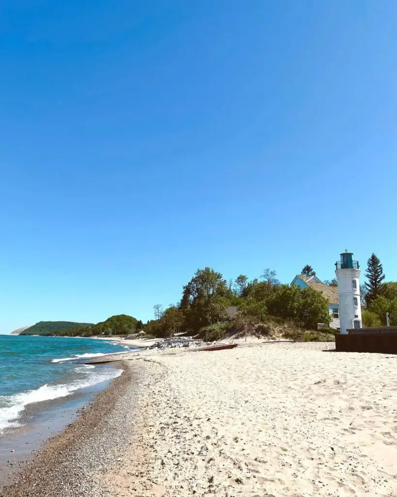
37. Petoskey State Park Beach

Petoskey State Park, located on Little Traverse Bay, has a mile of magnificent Lake Michigan shoreline, two modern campsites, and trails. The park, just 3 miles northeast of Petoskey and 6 miles south of Harbor Springs, is a favorite site for visitors looking for Petoskey stones.
The Old Baldy Trail is a half-mile circle that leads to the top of the Old Baldy Dune, which is well-known for its spectacular vistas. The Portage Trail is a significantly longer trek. This is the one rockhounds come back to all the Michigan beaches year after year.
Accessibility of the Petoskey State Park Beach – There is an accessible walkway down to the water’s edge in the day-use area on Lake Michigan. In addition, there is a beach wheelchair available to borrow. Please visit the concession stand located in the beach house.
Map and Directions to Petoskey State Park – 2475 M-119 Hwy. Petoskey MI, 49770
36. Old Mission Park, Old Mission Peninsula – Traverse City

Mission Point Park on Old Mission Peninsula is one of the most beautiful little beaches in Michigan, and it is located in the Grand Traverse Bay region. There is a swimming beach, a picnic pavilion, and plenty of room for a game of frisbee or soccer at Mission Point Park. A children’s playground and a fishing pier are also available.
The swimming beach, which was recently refurbished, has a sandy bottom, a modest coastline, and crystal clear seas. The park is located on Traverse City’s Old Mission Peninsula, near the end of Center Road. Stop by the Old Mission General Store for some delectable fudge, ice cream, and baked bread!
All visitors to the Old Mission Park can say they have been exactly halfway between the north and south pole. This is because the park sits extremely close to the 45th latitude.
Accessibility of Old Mission Park – There is no indication of an accessible walkway down to the water’s edge beach area on Grand Traverse Bay.
Map and Directions to Old Mission Park – Traverse City, MI 49686
35. Sturgeon Bay Beach – Carp Lake
Some folks really want to keep this beach a secret. Carp Lake Michigan’s Sturgeon Bay Beach is a fantastic location for a walk along the beach, rock hopping, or a beach picnic. There is little parking along the North Lake Shore Drive. Absolutely stunning and private. The water is clean and chilly, with aqua greens and blues reminiscent of the Caribbean. Dog friendly. Rustic no changing areas
Accessibility of Sturgeon Bay Beach – There is no indication of an accessible walkway down to the water’s edge beach area on Sturgeon Bay.
Map and Directions to Sturgeon Bay Beach – 9680-10498 N Lake Shore Dr, Carp Lake, MI 49718
34. Ludington State Park Beach – Ludington

There are three campgrounds in the park, as well as sandy beaches, picturesque sand dunes, an iconic lighthouse, marshes, marshlands, and woodlands. It is located between Hamlin Lake and Lake Michigan, and both lakes have several miles of magnificent beachfront. The Big Sable Point Lighthouse was built in 1867 and rebuilt in 1988. Bird lovers, hikers, boaters, and fishermen will love the park.
Hiking, summer swimming, picnics, fishing, canoeing/kayaking on Hamlin Lake, beachcombing, and other activities are available all year.
Accessibility Ludington State Park Beach – There is an accessible walkway down to the waterfront in the Lake Michigan day-use area. In addition, there are beach wheelchairs available to borrow in both the Lake Michigan and Hamlin Lake day-use areas.
Map and Directions to Ludington State Park Park – 8800 M-116, Ludington, MI 49431
33. Hoeft State Park Beach – Rogers City

Hoeft State Park has a mile of sandy Lake Huron beachfront and is highly forested. A paved non-motorized route connects the park to the Huron Sunrise Trail, which runs from Rogers City to the world’s biggest open-pit limestone quarry, riding along the coastline close to Lake Huron.
This was one of Michigan’s initial 14 state parks. On January 2, 1922, timber baron Paul H. Hoeft gave the original land. The Civilian Conservation Corps erected a picnic shelter in the day-use area in the late 1930s, which is still in use today.
Accessibility of the Hoeft State Park Beach – There is not an accessible walkway down to the water’s edge nor any beach wheelchair available.
Map and Directions to Hoeft State Park – 5001 US-23, Rogers City, MI 49779
32. Twelvemile Beach – Munising
Twelvemile Beach is a 12-mile stretch of virgin sand beach extending east of the cliffs, about in the Pictured Rocks National Lakeshore center. A day-use facility near the east end of Twelvemile Beach Campground provides convenient access. It’s a short walk from the parking lot, but there’s a big flight of stairs heading down to the beach from the bluff. Pets are welcome.
Though not as popular as Miners Castle or Miners Beach, Twelvemile Beach is still worth visiting if you’re in the area. The beach itself is what you would expect — white sand, clear water, and lots of driftwood to explore. There are no facilities at this location (other than a bathroom), so be sure to bring plenty of drinks and snacks with you.
Accessibility of Twelvemile Beach – There is not an accessible walkway down to the water’s edge nor any beach wheelchair available.
Map and Directions to Twelvemile Beach – Grand Marais, MI
31. William C. Sterling State Park in Monroe
The only Michigan park on Lake Erie is William C. Sterling State Park near Monroe. It is well-known for its walleye fishing, three lagoons, and sandy shoreline at Sandy Creek’s mouth. Lakefront camping, animal watching, seven miles of trails, more than a mile of sandy beach, boating, and shore fishing on Lake Erie are all available on the park’s 1,300 acres.
Accessibility of Sterling State Park Beach – There is not an accessible walkway down to the water’s edge nor any beach wheelchair available.
Map and Directions to Sterling State Park – 2800 State Park Road, Monroe MI, 48162
30. Carl D. Bradley – Lakeview Memorial Park – Manistique Beach
It is located on US Highway 2 in Manistique in the Upper Peninsula. The park was renamed in July of 2014 after the famous Shipwreck of the freighter Carl D. Bradley. Its beach on Lake Michigan is wild and rustic, with alternating sandy and rocky shoreline areas. The park is great for watching the sunset and photographing the Manistique East Breakwater Lighthouse.
Accessibility at the Carl D. Bradley – Lakeview Memorial Park – There are no listed accessibility aids listed in the park.
Map and Directions to the Carl D. Bradley – Lakeview Memorial Park – 1254 W Lakeshore Dr, Manistique, MI 49854
29. Great Sand Bay – Eagle River

Great Sand Bay is located on the gorgeous Keweenaw Peninsula’s coastline. This lovely harbor is between Eagle River and Eagle Harbor on the northwest edge of gorgeous Lake Superior. Great Sand Bay is a wonderful area to stop and search for agates and other gorgeous pebbles. It also has some lovely wind-swept sand dunes. This is an excellent location for watching sunsets or relaxing while admiring Lake Superior’s magnificence.
Great Sand Bay and the rest of this coast have incredible views. There are some cottages in the area, but most of the land is public property and open to exploring. The Keweenaw Peninsula can be difficult to drive around because of all its twists and turns, but it makes for wonderful road trips in the fall when the colors are changing. If you’re looking for a place to relax away from crowds, check out Great Sand Bay!
Accessibility at Great Sand Bay – There are no accessibility aids listed in the park.
Map and Directions to Great Sand Bay – M-26, Mohawk, MI 49950
28. Frankfort Public Beach and Playground – Frankfort
A lovely beach that feels like it’s right in the center of Frankfort. The vistas are breathtaking, especially when the weather is stormy or rough. The sand is immaculate, and one of our favorite features of this beach is the abundance of seats. This is one of the great Michigan beaches for families and ideal for senior people out for a stroll or as a spot to regroup when you have a large group of children with you.
It’s awe-inspiring to see the big waves crash onto the pier, making massive splashes. The twin piers and lighthouse that stretch into Lake Michigan and form Frankfort Harbor are the major focal point of this park, and maybe all of Frankfort. The lighthouse at the end of the pier is particularly beautiful at sunset. Surfing and sailing seem to be popular pastimes. In addition, there seem to be folks flying kites just about every day.
Accessibility at the Frankfort Public Beach and Playground – Accessible sitting is provided via benches, and ADA walkways offer access to the beach. There are public restrooms accessible.
Map and Directions to Frankfort Public Beach and Playground – Frankfort, MI 49635
27. Tiscornia Park Beach – St. Joseph
A scenic and peaceful lakefront park. This family-friendly park is set on sixteen acres along Lake Michigan’s beachfront in the northwest portion of the city. The North Pier Lighthouse and walkway, which is a popular site for fishing and watching sunsets, as well as bathroom facilities, a sandy beach, a pier with a lighthouse, and a picnic shelter that can seat around 35 people, are among the amenities.
Both residents and non-residents must pay a nominal daily parking fee per car. Near the facilities, there is a parking kiosk.
Accessibility at the Tiscornia Beach – Wheelchair accessible entrance and parking lot
Map and Directions to Tiscornia Beach – 80 Ridgeway St, St Joseph, MI 49085
26. Mich-E-Ke-Wis Park – Alpena
Mich-e-ke-wis Park is located along State Avenue on Lake Huron, between Thunder Bay Avenue and Mason Street. This park has softball fields, playground equipment, a BMX bike park, volleyball courts, horseshoe pits, a picnic area, a beach, off-street parking, and a covered warming / general park shelter structure for social activities.
The park’s remoteness provides a peaceful place for people and wildlife. On the shore, you can observe herons, egrets, and the odd bald eagle looking for food.
Accessibility at the Mich-E-Ke-Wis Park – Wheelchair accessible entrance and parking lot
Map and Directions to Mich-E-Ke-Wis Park – 1302 S State Ave, Alpena, MI 49707
25. Hoffmaster State Park Beach
P.J. Hoffmaster State Park, situated in the town of Muskegon, is blessed with three miles of stunning Lake Michigan beach and features a contemporary campground, towering dunes, 10 miles of scenic trails, and the Gillette Sand Dune Visitor Center.
One of the park’s main attractions is the dune climb along the Dune Overlook Trail, an approximately half-mile round trip climb with about 220 steps and benches. Next, follow the 2-mile-long (roundtrip) Homestead Trail, which includes a stop at Lake Michigan for a more moderately steep hike.
Accessibility at the P.J. Hoffmaster State Park – There are two beach wheelchairs available to borrow. Contact the park or check at the contact station.
Map and Directions to P.J. Hoffmaster State Park – 6585 Lake Harbor Road, Muskegon MI, 49441
24. Lexington State Harbor Beach
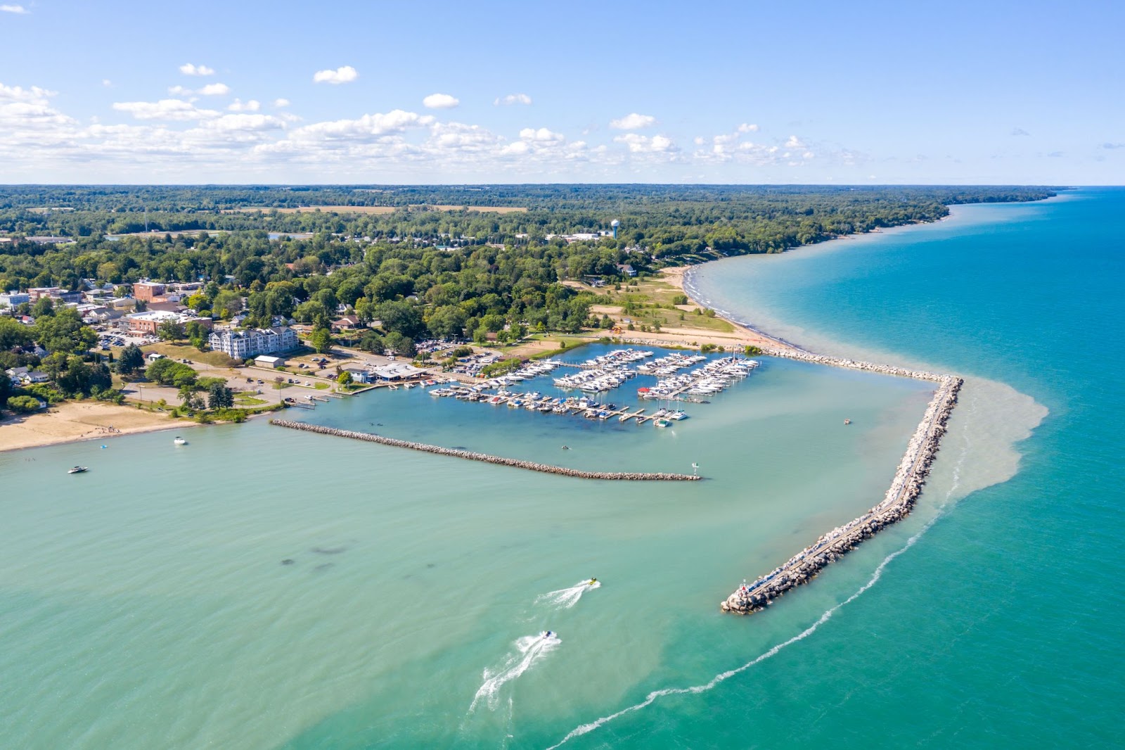
This is the most unusual of all the Great Lakes beaches we have listed. The beach area is located just outside the harbor breakwall. This little beach is described as a hidden gem. Walking on the Pier, you can get great views of the harbor action. It’s kid- and dog-friendly; they have a playground, picnic tables, grills, and clean bathrooms. This side of Lake Huron is windy year-round, so it stays cooler even on the hottest days. Shops are abundant and quite a few restaurants that are only a few steps away from town. They even have an ice cream shop. Catching a beautiful sunset is a perfect way to close the day.
Accessibility at Lexington State Harbor Beach – No listed accommodations for access to the beach and waterfront.
Map and Directions to Lexington State Harbor Beach – 7411 Huron Ave, Lexington, MI 48450
23. Orchard Beach State Park — Manistee

Orchard Beach State Park is a 201-acre public recreation area on Lake Michigan’s shore in Manistee Township, Manistee County, Michigan. The state park is located on a bluff three miles north of Manistee and offers camping and spectacular views of Lake Michigan. The park is most well-known for its breathtaking views of sunsets and Lake Michigan. Due to excessive water and erosion, access to the beach (only accessible through the steps) is closed.
The park is surrounded by self-guided hiking routes. One hundred sixty-six campsites (some with 50 amp service), one mini-cabin, two paved disability sites, and two restroom/shower facilities. The park was named after an ancient apple orchard that stood over a century ago.
Accessibility at Orchard Beach State Park – There are no listed accommodations for accessing the beach and waterfront..
Map and Directions to Orchard Beach State Park – 2064 Lakeshore Rd, Manistee, MI 49660
22. Empire Beach – Empire
Top beach near the Sleeping Bear National Lakeshore. This public beach and park is located on the coasts of Lake Michigan and South Bar Lake. This beach is ideal for families, with a playground, grilling equipment and fire rings, and an ancient lighthouse. Only a few blocks from downtown. For a modest cost, there is on-site parking.
The water has the look of the Caribbean…the hue is a clear blue, but it’s chilly! The sunsets are spectacular at Empire Beach, and there is a hiking track, Empire Trail, that leads to a stunning viewpoint with a bird’s eye view of the sea and beach.
Accessibility at Empire Beach – No accessibility items are listed at Empire Beach.
Map and Directions to Empire Beach – Empire, MI 49630
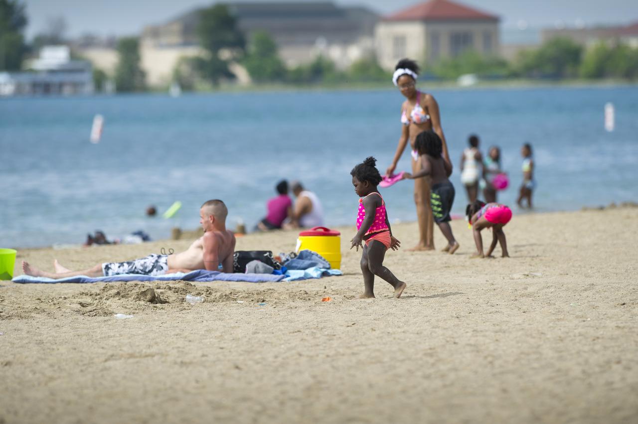
21. Belle Isle State Park – Detroit
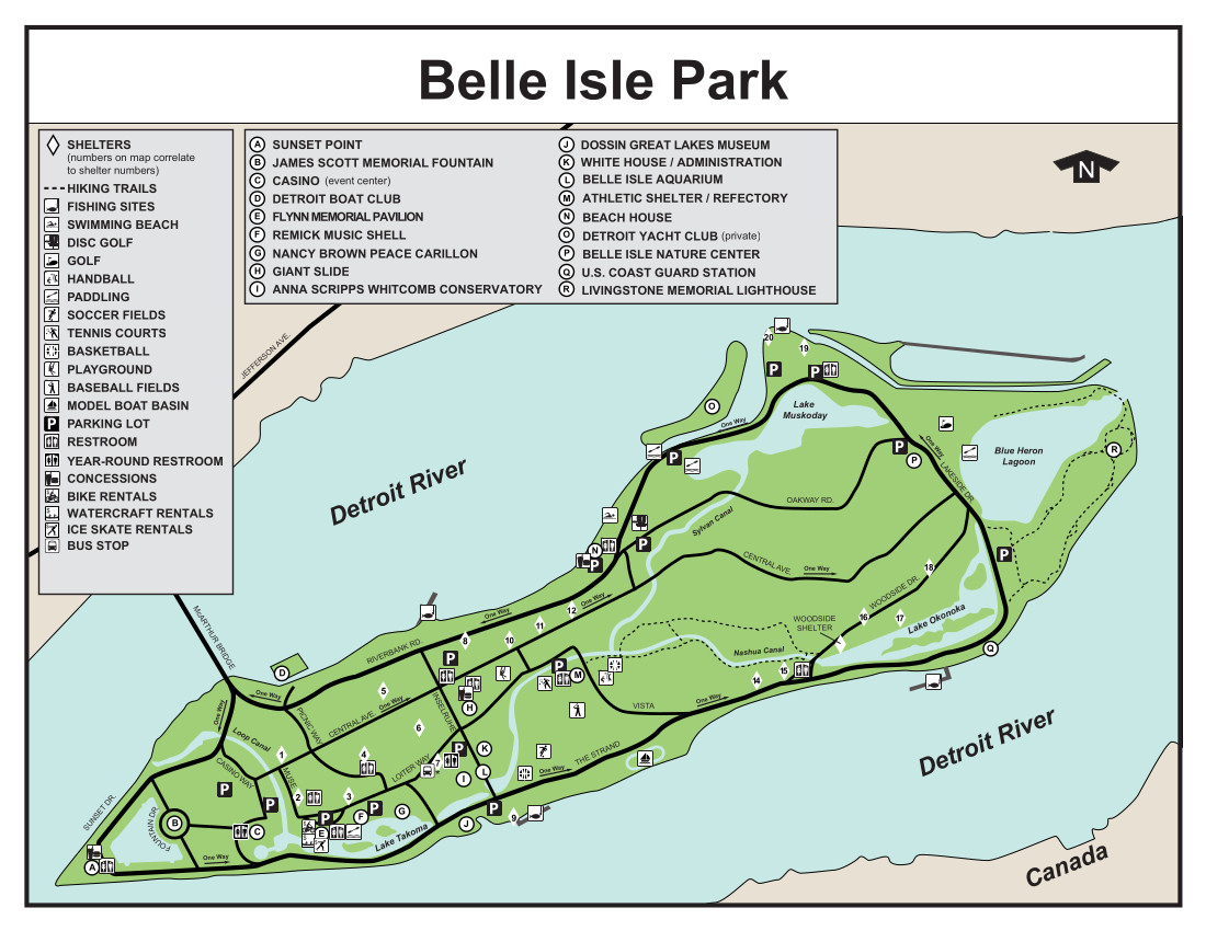
Belle Isle State Park is a Detroit treasure and one of the newest Michigan state parks. The 987-acre island park is home to the Anna Scripps Whitcomb Conservatory, the Belle Isle Aquarium, the Dossin Great Lakes Museum, a giant slide, athletic fields, picnic areas, tennis courts, the Belle Isle Nature Zoo, the James Scott Memorial Fountain, and other attractions that appeal to people of all ages and interests. The swimming beach is open daily from 5 am.- 9 p.m. starting the second week in June through Labor Day.
Accessibility at the Belle Isle State Park – A playground and picnic shelter are accessible attractions. The track chair at Belle Isle allows guests to explore sections of the park that standard wheelchairs may not be able to reach. These off-road electric chairs can readily handle trails, snow, sand, and up to 8 inches of water and are provided free of charge on a first-come, first-served basis.
Map and Directions to Belle Isle State Park – 99 Pleasure Drive, Detroit MI, 48207
20. Sleeper State Park Beach – Caseville
Sleeper State Park encompasses 723 acres of woodland, marshes, wooded dunes, and a half-mile length of sandy beachfront along Lake Huron’s Saginaw Bay. Visitors may view sunrises and sunsets, explore the woodland paths, unwind on the beach, and relax in the shade of the contemporary campsite.
The day-use facility is right across M-25/Port Austin Road and has a half-mile of sandy beach, a beach house, restrooms, and a picnic area. A pedestrian overpass bridge spanning M-25 allows secure access from the campgrounds.
The park was named in honor of Albert E. Sleeper, the governor of Michigan from 1917 to 1920 and a Huron County citizen who signed the legislation that established the state park system.
Accessibility at the Sleeper State Park – There is a gently sloping sidewalk to the beach. However, there are no indicated accommodations to the water’s edge.
Map and Directions to Sleeper State Park – 6573 State Park Rd, Caseville, MI 48725
19. Oscoda Beach Park — Oscoda

Oscoda Township Beach Park is located on Lake Huron’s River Road in Oscoda. The 9.6-acre park offers around 1,000 feet of Lake Huron coastline and a number of facilities. Visitors may also enjoy the basketball court, skate ramps, a wooden band shelter, an accessible pavilion, a boardwalk, a sunbathing deck, children’s play equipment, picnic tables, and grills in addition to the public beach.
There is an accessible bathhouse with facilities on the property. This park is home to the “Dock Reserve,” the historic location of a dock that existed before the 1911 Fire. Every year, this park holds the Oscoda Art-on-the-Beach Arts and Crafts Show.
18. South Beach – South Haven
This park is a short walk from downtown South Haven and offers stunning views of the lake and the town itself. The park is ideal for families who want to take advantage of everything South Haven offers since it offers a playground, a picnic area, and grills. Dogs are also welcome! You may relax on the beach after bringing your dog for a walk along the boardwalk that overlooks Lake Michigan. South Beach is wheelchair accessible and features grills, a picnic area, play equipment, bathrooms, and a beautiful view of South Haven’s Historic Lighthouse.
Accessibility at South Beach Park – There are no accessibility accommodations listed for South Beach.
Map and Directions to South Beach Park – 60 Water St, South Haven, MI 49090
17. Silver Beach County Park – St. Joseph
The Silver Beach County Park is located in St. Joseph, Michigan. The park straddles the mouth of the St. Joseph River. The Silver Beach County Park features a clean, wide sandy beach on Lake Michigan. It offers public access to the South Pier. Of the Park’s 2,450 feet of Lake Michigan shoreline, over half of the lakefront is denoted as a public swimming area in the summer.
Silver Beach was transferred to as one of Berrien County’s Park in the early 1990s. Since then, many refinements have made it a premier tourist destination in Southwest Michigan.
Accessibility at Silver Beach County Park – Silver Beach County Park features a barrier-free walkway from the parking lot, along the beachfront, and throughout the Park. Beach wheelchairs are available in the summer on a free, first-come-first-serve basis. Stop in the beach office (the building next to the Restroom buildings) to reserve a beach wheelchair.
Map and Directions to Silver Beach County Park – 101 Broad St, St Joseph, MI 49085
16. Caseville County Park Beach – Caseville
Some folks call the Caseville County Park the mini Daytona Beach of the north. You can drive right up and park on the beach’s edge. The park’s shoreline features a substantial sandy area with lots of space for building sandcastles, playing touch football, renting kayaks, and swimming all day. It has a small cafe and a pavilion. Because of its closeness to the vast campsite and short distance to town, it attracts many people. It’s regarded as the best area to swim in Caseville.
Accessibility at Caseville County Park Beach – The Caseville County Park features a barrier-free walkway from the parking lot toward the waterfront.
Map and Directions to Caseville County Park Beach – 6400 Main St, Caseville, MI 48725
15. Saugatuck Dunes State Park — Holland
The Saugatuck Dunes State Park is considered one of the best beaches on Lake Michigan, with 2.5 miles of sandy beach, coastal dunes, wooded areas, 13 miles of trails, and the 300-acre Patty Birkholz Natural Area. Four routes lead tourists to Lake Michigan across hilly terrain and sandy pathways. The Beach Trail is the shortest, measuring 75 miles one way.
The park’s 300-acre Patty Birkholz Natural Area comprises a coastal dune system, and three endangered plant species are monuments to environmental protection and coastal dune restoration. In addition, the Felt Estate and Shore Acres Township Park are next to the park and provide a 2-mile mountain bike route, a disc golf course, and other complementary outdoor leisure possibilities.
Accessibility at Saugatuck Dunes State Park – Unfortunately, the Saugatuck Dunes State Park Beach does not offer any listed accessibility aids for beach access.
Map and Directions to Saugatuck Dunes State Park – 6575 138th Ave. Saugatuck Dunes MI, 49453
14. Hunter’s Point Park Beach – Copper Harbor
It’s difficult to choose a favorite beach in Copper Harbor, but Hunter’s Point Park Beach is a strong candidate. This beach is regarded as one of the most beautiful in the country. It is part of Hunter’s Point Park, which includes hiking, biking, and kayaking, and is located in Michigan’s Upper Peninsula.
You can view Fort Wilkins, a former army outpost, and Lake Superior extending out before you from the shore. There are several sandstone cliffs to explore, and you may even look for agates along the coastline.
Nearest Webcam to Check Weather Conditions Near Copper Harbor – A View From the Field Almost Live from Copper Harbor
Accessibility at Hunters Point Park – Unfortunately, the park does not offer any listed accessibility aids for beach access.
Map and Directions to Hunters Point Park – Copper Harbor, MI 49918
13. Warren Dunes State Park Beach – Sawyer
Warren Dunes State Park in Berrien County is one of Michigan’s largest and most popular parks. It’s also one of the great Michigan beaches near Indiana. The park’s 6 miles of Lake Michigan shoreline includes 3 miles of beachfront with enormous dunes rising to 240 feet above the water. A waterfall falling into Lake Michigan from a ravine provides a stunning sight during spring runoff when it continually pours.
Accessibility of Warren Dunes State Park Beach – There are three accessible walkways between the day-use sidewalk and the water. In addition, there are two beach/aqua wheelchairs available to borrow at the ranger station.
Map and Directions to the Warren Dunes State Park Beach – 12032 Red Arrow Hwy, Sawyer, MI 49125
12. Tawas Point State Park Beach – East Tawas
Tawas Point has long been referred to as the Midwest’s Cape Cod. The changing sand has created a natural land hook that includes sandy beaches, wetlands, tiny dunes, and various species. The Sandy Hook Trail stretches about 12 miles along Tawas Point, a two-mile land that separates Tawas Bay from Lake Huron. The trail is predominantly sand, with a few boardwalk sections to preserve eroding portions.
Tawas Point is home to red foxes, white-tailed deer, turtles, and snakes, among other animals. In addition, the route, which is designated as an important bird area, allows visitors to witness over 300 species of migrating birds in the spring and fall.
Accessibility of Tawas Point State Park Beach – The walkway is not available due to high water.
Map and Directions to the Tawas Point State Park Beach – 686 Tawas Beach Rd, East Tawas, MI 48730
11. Silver Lake State Park Beach and Sand Dunes – Hart

Silver Lake State Park has 3 miles of beautiful Lake Michigan beachfront. The park has a contemporary campsite, over 2,000 acres of dunes, and a day-use area on Silver Lake, located inland.
The 500-acre Silver Lake State Park ORV Area is one of the park’s distinguishing features; it is the only dune riding option in the eastern United States. The region is quite busy, especially on weekends, and it is recommended that you learn about access, the voucher system, and unique laws and restrictions ahead of time. Amazingly drag racing is now a legal activity on the dunes.
Mac Wood’s Silver Lake Sand Dunes Ride offers a 40-minute educational, one-of-a-kind dune trip in a designated park region that is not open to other vehicles. Reservations are mandatory for the tours, which run from mid-May through October.
Map and Directions to the Silver Lake State Park – 8890 W Shore Dr, Mears, MI 49436
Accessibility of Silver Lake State Park Beach – There are two beach wheelchairs for rent, one at the park entry station near the lighthouse parking lot and the other at the campsite office.
10. Pere Marquette Beach – Muskegon
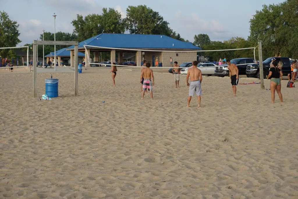
Pere Marquette Beach is located at the northernmost extremity of the City of Muskegon’s 2.5-mile Lake Michigan coastline, which is bounded by the Muskegon Channel. It’s considered one of the best northern Michigan beaches. The waves scrape the gorgeous stretch of pristine, sandy beach every day. The 200-foot disabled pathway makes it easy for everyone to get around. Visitors will frequently see the incredible sight of kiteboarders because the beach has become a big draw for the sport and onlookers. Kayaks and stand-up paddleboards are also popular. The park is home to a large number of Beach Volleyball players and the Burning Foot Beer Festival.
Accessibility of Pere Marquette Beach – There is a 200-foot pathway to the beach and waterfront
Map and Directions to the Pere Marquette Beach – 3510 Channel Dr, Muskegon, MI 49441
9. Port Cresent State Park – Port Austin
This 640-acre preserve features 3 miles of shoreline, fishing, cross-country skiing & scenic views. The park was once the site of a lumber town called Port Crescent. Remains of the town’s long dock pilings are still evident on the beach. It has an extensive boardwalk to travel along the beach in order to find a perfect spot to play on the beach among its dunes.
There are two great beaches. One at the Day Use park and one at the campground. You can camp on the beach.
Accessibility of the Port Crescent State Park Beach – There is water access at the campground beach with an accessible walkway.
Map and Directions to the Port Crescent State Park Beach – 1775 Port Austin Rd, Port Austin, MI 48467
8. Grand Haven City Beach
City Beach Park is roughly 19.6 acres in size and is located along Harbor Avenue south of Grand Haven State Park on Lake Michigan. This sandy public beach stretches for over three-quarters of a mile. The park hosts various special events, such as sandcastle building contests, kite events, pole vaulting, and seaside weddings. The parking lot at City Beach is also a popular Lake access point for surfers, kite surfers, paddle boarders, and kayakers.
One review of the park said it best “Beautiful beaches, beautiful lighthouses, and a cute town. The Grand Haven Michigan beaches have beautiful sand and are very clean. We had the pleasure of watching surfers and windsurfers. There was plenty of parking, which was great as we watched the beautiful sunset.”
Accessibility of the Grand Haven City Beach – There is an ADA walkway within the park for water access. The park can also provide the use of a Trackchair for an individual service for several hours. A Trackchair is the ultimate all-terrain wheelchair that can be used in the sand and along the water’s edge.
Map and Directions to the Grand Haven City Beach – S Harbor Dr, Grand Haven, MI 49417
7. Black Rocks – Presque Isle Park – Marquette
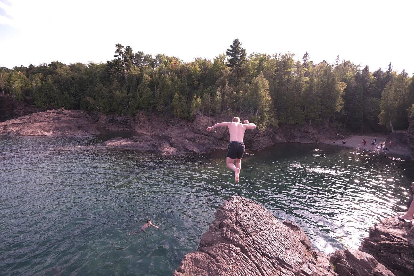
Presque Isle Park, Marquette’s recreational crown jewel, receives special attention. Folks can find this famous city park on Presque Isle, a 323-acre wooded oval-shaped peninsula in the northern extremity of Marquette. This park juts into Lake Superior and is known as being the spot for taking pictures when Lake Superior kicks up a wild storm. Presque Isle is well-known for its natural beauty throughout the United States.
The Black Rocks are an old rock feature that sits 20-30 feet above Lake Superior and is one of Marquette’s “things to do.” Aside from their height, the cliffs’ black tint lends a unique environment to the seashore. Cliff leaping into Lake Superior is ideal at Black Rocks in Presque Isle Park.
Picnic tables and cooking amenities are plentiful in the two big picnic sites. The bigger two, located on the park’s southeast side, have a playground area with a merry-go-round, swings, slides, and climbing gear. There are also several park seats in the park.
Accessibility of Presque Isle Park – There are no listed accommodations for access to the cliff area of the park.
Map and Directions to the Presque Isle Park – Peter White Dr, Marquette, MI 49855
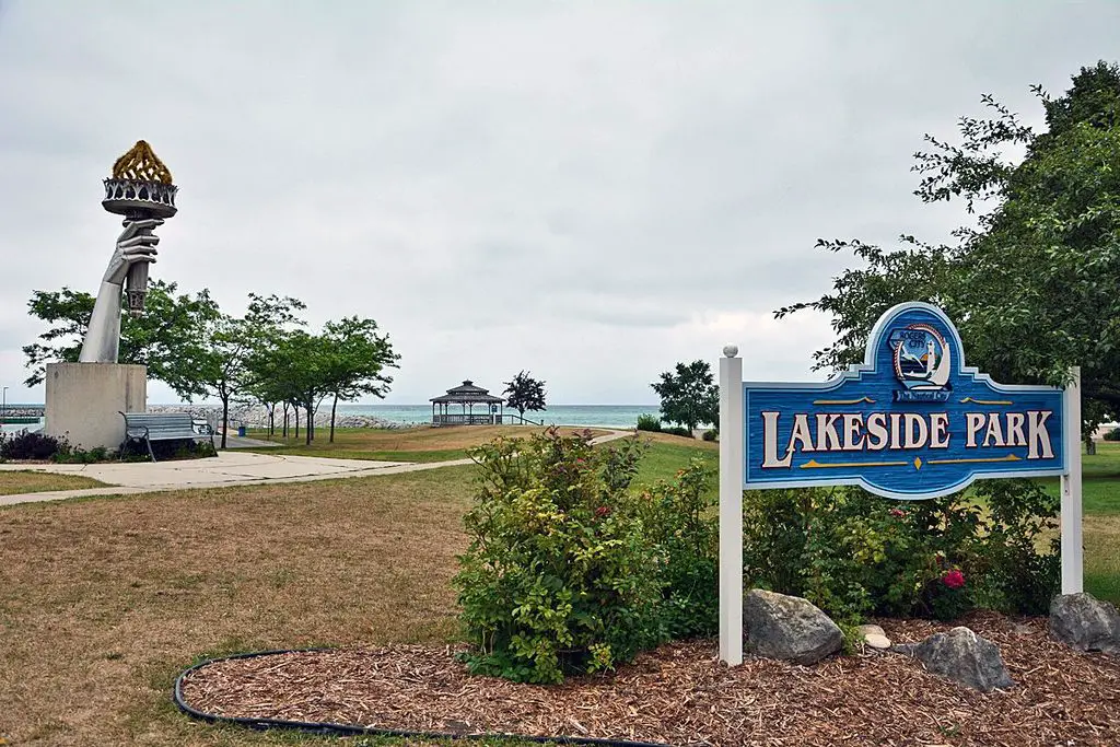
6. Lakeside Beach – City of Port Huron
The City of Port Huron welcomes all to enjoy its beautiful waterfront and experience all Lake Huron offers. We currently maintain two main beaches, Lakeside Beach and Lighthouse Beach. This well-appointed city park is one of the best beaches in Southeast Michigan. It offers bathrooms, two pavilions, a playground, a volleyball court, grills, and picnic tables. A splash pad for kids is operational from 11 am until 7 pm daily. Concessions are available from Thur – Fri: 12 pm. to 4 pm. And weekends from Noon to 6 pm.?
Accessibility of Lakeside Beach – There are no listed accommodations for access to the water’s edge; however, there are paved sidewalks and benches to the beach’s edge.
Map and Directions to Lakeside Beach – 3670 Gratiot Ave, Port Huron, MI 48060
5. Mackinaw City Beaches

Mackinaw City is a favorite Northern Michigan vacation destination, with visitors traveling from worldwide to stay in the quaint village. In addition, the Straits of Mackinac will warm up and attract swimmers in the summer months.
Tucked in along the shore, just south of the Old Mackinaw Point Lighthouse, is a string of little parks along a beachfront with some of the best views of the Mackinaw Bridge and the Straits. It’s part of Mackinaw City’s largest sandy beach. The beach has three parks; Alexander Henry Park, Maritime Park, Gary R Williams Memorial Park, and Wowatam Park. You can park on the street in each of the areas.
Accessibility of Mackinaw City Beach – There are no listed accommodations for access to the beaches. However, there are sidewalks to the shoreline.
Map and Directions to the Mackinaw City Beach – N Huron Ave, Mackinaw City, MI 49701
4. Cheboygan State Park Beach
This stunning recreation area is located on a bluff overlooking Lake Huron. Cheboygan State Park is known as the most popular state park in northern Michigan and boasts three miles of sandy Lake Huron shoreline. Visitors to this recreation area enjoy hiking, camping, swimming, boating, fishing, and hunting.
The park includes a well-marked path system that leads to spectacular views of the lake and glimpses of uncommon wildflowers like the showy lady’s slipper orchid. Visitors enjoy a variety of housing options, including contemporary campsites, rustic cottages, tepees, and a fully-furnished modern lodge. Duncan Bay has a carry-in boat launch, and fishing is accessible both on the bay and on Elliot Creek.
Cheboygan State Park lies along the Huron Shores Heritage Route, featuring 200 miles of spectacular scenic views of Lake Huron on US-23.
Accessibility of Cheboygan State Park Beach – There are no listed accommodations for access to the beaches.
Map and Directions to the Cheboygan State Park Beach – 4490 Beach Road, Cheboygan, MI 49721
3. Stearns Park Beach – Ludington
Stearns Park is a focal point in Ludington. It’s a place where people of all ages gather for a swim, play in the sand or have a game of touch football on the beach. With 2,500 feet of sandy beachfront and plenty of free parking, this is Ludington’s largest beach. Swim, construct a sandcastle, and take in the beauty of the Ludington North Breakwater Light from here. During the summer, the light is open for tours. Couples, families, and fishermen enjoy the half-mile trek out to the light. There are no lifeguards on duty. However, beach patrol officers are present from 11 a.m. to 8 p.m. The park also offers free Wi-Fi.
Accessibility of Stearns Park Beach – There are three accessible walkways built at the north and south concession booths and in the center of the beach. Wheelchairs, strollers, and anybody who has difficulty going through the sand may now utilize the boardwalk from the parking lot down to the beach. The personal transportation site Scootaround.com named Stearns Park Beach as one of the 8 Wheelchair Accessible Beaches in the United States. USA Today noted the park has to have as the fifth most accessible walkway in the nation and one of the top 50 beaches in the US.
Map and Directions to Stearns Park Beach – 420 N Lakeshore Dr, Ludington, MI 49431
2. Pictured Rocks National Lakeshore – Munising

This beach is located on Lake Superior’s south side and offers breathtaking views. Pictured Rocks National Lakeshore’s white quartzite cliffs soar 50 to 200 feet above the lake. There are almost 15 miles of sandy beaches in the park, as well as 200 miles of trails, including a 42-mile pathway that follows the shoreline. The Pictured Rocks are nearly 15 miles long. The most colorful section is between Chapel and Mosquito Bays, where you’ll discover numerous interesting rock formations such as Indian Head, Battleship Row, and Lovers Leap. The 100-foot-tall Miners Falls is the most popular sight at Pictured Rocks National Lakeshore.
Minerals cover the sandstone cliffs, causing multicolored streaks to stream down their face. If you intend to swim, pack a wet suit because the lake averages 40 degrees. It’s also a fantastic location for hiking and canoeing. During the summer months, two lighthouses are open for tourists.
1. Sleeping Bear Dunes National Lakeshore
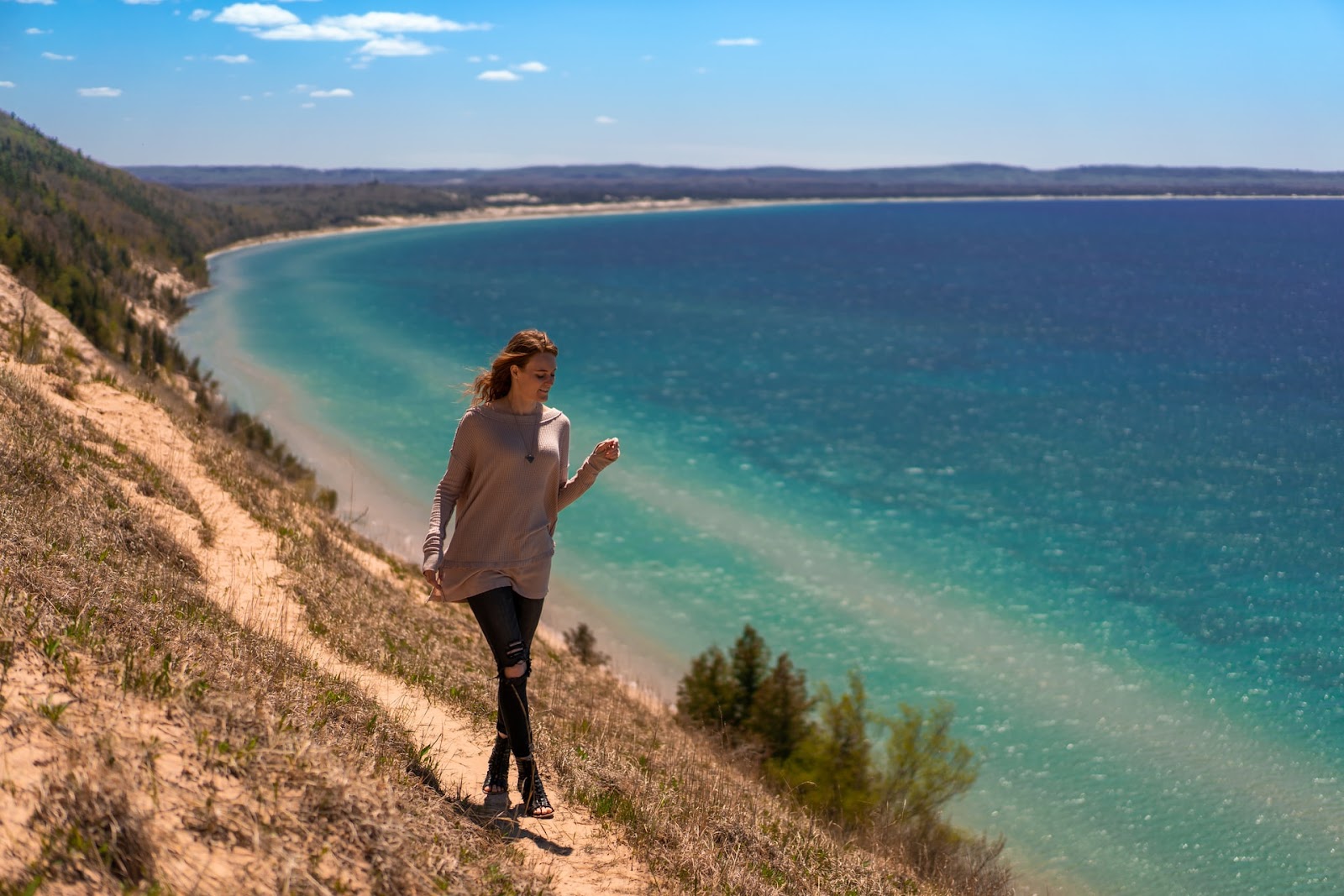
The Sleeping Bear Dunes National Lakeshore protects 35 miles of Lake Michigan beachfront in Leelanau and Benzie counties. This natural marvel boasts towering sand dunes sculpted by wind and water over hundreds of years, has been voted one of America’s most beautiful sites by Good Morning America and ABC News. National Geographic named Sleeping Bear Point, Sleeping Bear Dunes, Michigan, one of the top 21 beaches in the world, “pure fresh water and 450-foot bluffs mean eyes-open swimming and vast views over Lake Michigan.”
Forests and marshes, two islands (North Manitou Island and South Manitou Island), old farmsteads, and a former life-saving station are all part of the lakeshore. Hiking routes with excellent views over glacial moraine valleys, beautiful drives; swimming at approved beaches; kayaking or canoeing along the Lake Michigan shore are just a few outdoor activities.
Accessibility of Sleeping Bear Dunes National Lakeshore – To offer an exceptional experience, Sleeping Bear Dunes caters to disabled beachgoers. The Duneside Accessible Nature Trail at the Dune Climb is built of crushed limestone, making it simpler to maneuver a wheelchair. Sand wheelchairs are also available at the Maritime Museum at the Dune Climb. Sleeping Bear Dunes has begun to offer and initiate services for persons who are deaf or hard of hearing, ranging from ranger-led treks to portable wireless gadgets.
Map and Directions to Sleeping Bear Dunes National Lakeshore – 9922 W Front St, Empire, MI 49630
A Beach Checklist – What to Bring
- Arrive Early in The Day. Some Michigan beaches might be challenging to obtain a parking place. Arriving early will allow you to pick a close parking spot and the ideal spot to put down your towel.
- Packing Sunscreen is indisputable. Nothing ruins a day at the beach like sunburns, so bring sunscreen. Request that someone else apply sunscreen to the difficult-to-reach areas.
- Bring a mesh bag for your stuff. To stow beach things like towels, shovels, blue tooth speakers, inflatables, and extra clothing, take a handbag, supermarket bag, or waterproof duffel bag. However, these bags prevent moisture from escaping and promote mildew growth, as well as stop beach things from drying off.
- Bring a lot of towels. Don’t forget to carry plenty of fresh towels when you go to the beach. This is especially important if you take little children to the beach or want to get in the water.
- Bug spray – check!. If you go to the beach early in the day or late in the evening, you may encounter mosquitos, sand flies, fleas, and other bothersome creatures.
- Be prepared for rain and chilly breezes. Even if you’re looking forward to a warm day at the beach, it’s vital to remember that the weather in Michigan can change at any time. It is especially important if you intend to go swimming, so carry plenty of dry sweaters, blankets, jeans, and shoes.
- Use Leave No Trace Principles. Nobody wants to spend the day on a filthy beach. You must pick up after yourself if you bring anything to the beach. Remember to dispose of your litter in the proper rubbish or recycling bin.
Related Questions About Michigan Beaches
What is the prettiest beach in Michigan?
That is a subjective question. However, most agree that the Sleeping Bear National Lakeshore beaches top all the lists for the prettiest beaches in Michigan.
What is the cleanest beach in Michigan?
Since Michigan has a container deposit law, Michigan beaches and parks tend to be clean and debris-free. However, late in the summer, algae blooms tend to form in the warmer waters of the southern end of the lakes.
Where are white sand beaches in Michigan?
Michigan has a mix of rocky and sandy beaches. Most beaches on this list have dry sandy beaches that extend into the lake and are perfect for kids learning to swim.
What beach in Michigan has clear blue water?
Almost all of Michigan’s beaches have clear blue water early in the summer. As the weather warms, this phenomenon can be found on most northern Michigan beaches, where the water is cooler and fewer algae is evident.