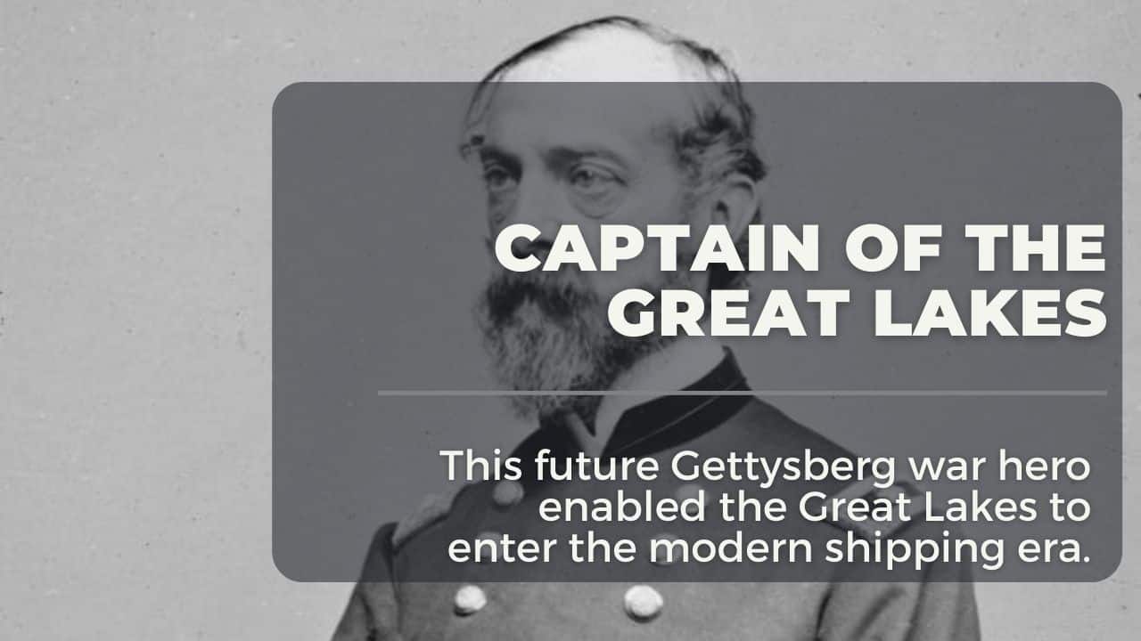
General George Meade – US Army Engineer, Great Lakes Surveyor and Gettysburg Commander
In the mid-1800s, much of Michigan was wilderness. While many settlements were established on the shore, few government maps and almost no official documentation of water depth and shore topology were established. Local knowledge from “fishermen and coastal” was depended on. As growth in the upper Great Lakes began, steamship companies made calls on the U.S. government to provide official maps and depth charts. By the 1840s, the US Army was tasked with conducting the first accurate survey of Lake Huron from the St. Mary’s River to the St. Clair River in the south. This was a critical assignment for future General George Meade.
Table of Contents
General George Meade’s Early Life
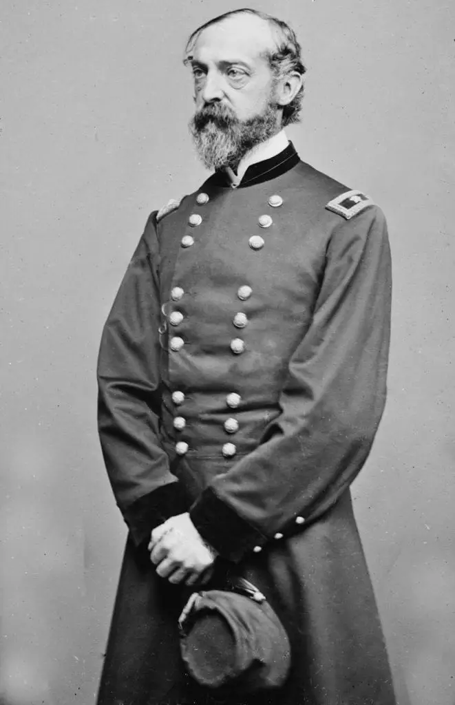
George Gordon Meade (December 31, 1815 – November 6, 1872) was a United States Army officer, engineer, and Civil War general best known for commanding the Union Army of the Potomac to victory at the Battle of Gettysburg during the American Civil War. Before the war, he served in the Corps of Topographical Engineers, led the Great Lakes survey, and directed coastal engineering projects
George Meade, Engineer of the Lakes

Early Life and Education
George Meade was born in Cádiz, Spain, to an American family and returned to the United States with his parents as a child. He entered the United States Military Academy at West Point in 1831 and graduated in 1835, ranking 19th in his class.
After graduation, he served briefly in the Third U.S. Artillery during the Second Seminole War. He resigned his commission in 1836 to pursue civil engineering but returned to the Army in 1842 by joining the Corps of Topographical Engineers to continue engineering work.
Corps of Topographical Engineers and Pre-War Career
As a member of the Corps of Topographical Engineers, Meade performed surveying, mapping and coastal construction work in the 1840s and 1850s. He assisted in boundary surveys, oversaw construction of lighthouses and breakwaters on the Atlantic coast, and became a key figure in national hydrographic work.
Mexican-American War and Engineering Work
During the Mexican-American War (1846-1848), Meade served under Generals Zachary Taylor and Winfield Scott. He performed topographical duties such as surveying terrain, drawing maps and selecting river crossings. After the war he resumed engineering work on lighthouses and coastal surveys until the outbreak of civil conflict
Future General George Meade Comes to the Great Lakes.

In 1857, Meade was assigned to command the Northern Lakes Survey for the Great Lakes. His responsibilities included charting shorelines, marking navigational hazards, establishing water reference levels, and recommending harbor improvements. These surveys formed a foundation for safer navigation and later coastal management in the region. Captain George Meade relieved Lt. Col. James Kearney on the Lakes Survey mission of the Great Lakes. Meade had already established the successful building of lighthouses and mapped the shoals and reefs from the Jersey shore to the Florida Keys. In Florida, the shallow reefs ravaged shipping since the Spanish plied the Caribbean in the 1500s.
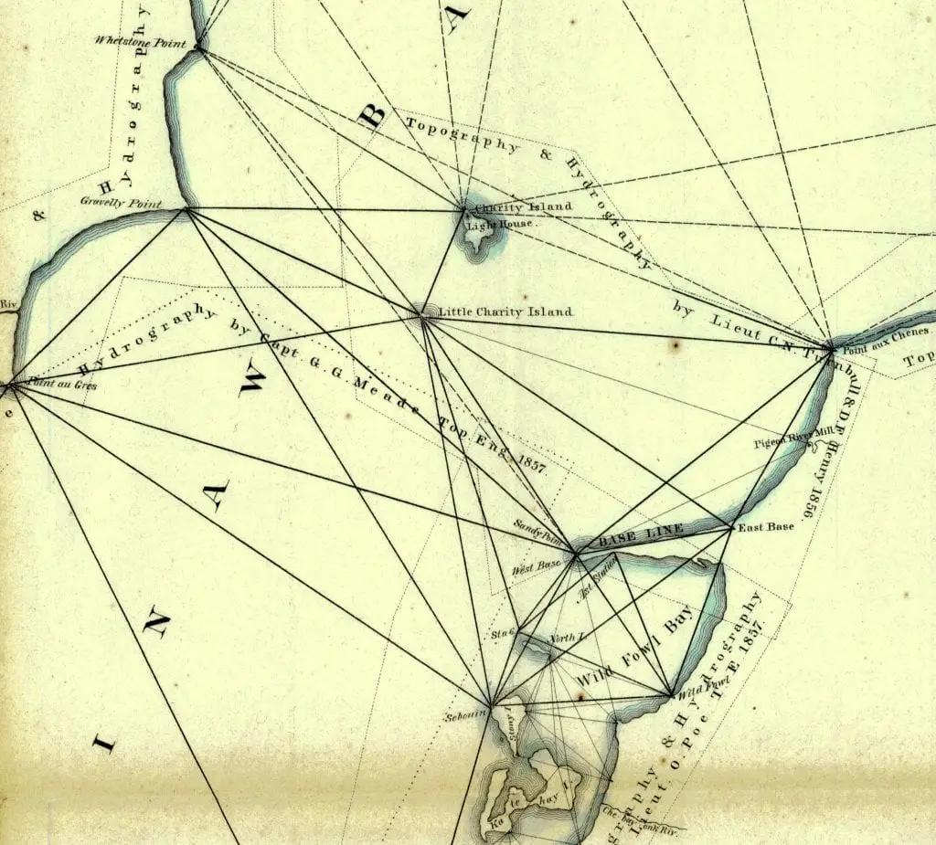
George Meade came to Michigan in 1857 to make the first survey of Saginaw Bay and Lake Huron. As a civil engineer of the US Army, he “leveled the baseline” at Sand Point. The method used a series of triangulated line-of-sight towers based on an angle that could be accurately measured between points. All the measurements on Saginaw Bay and Lake Huron were based on the baseline established on the length of Sand Point
170 Foot Towers Loomed Over Saginaw Bay

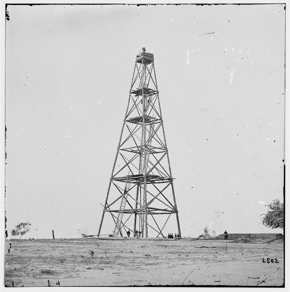
The line-of-sight signaling towers erected on Charity Island, Oak Point, Sand Point, Tawas Point, Pointe Aux Barques, Forestville, and elsewhere assisted with survey measurements. These towers were measured from 82 to 169 feet above the water level and were considered the highest artificial triangulation structures ever built in the United States. A survey instrument used a theodolite to measure the flashing mirror of a distant tower.
Sand Point was Made the Center of Lake Huron
Captain Meade needed a Prime Meridian point. He established this at a base camp located on Sand Point. The jut of land extended out into Saginaw Bay, offering a large line of site vantage point. Meade cleared an area and placed a marker while surveying to denote the new Prime Meridian line for Saginaw Bay and all of Lake Huron.
From the United States Land Survey Station, Sand Point, Saginaw Bay, all “geodetic positions of all points of triangulation” were calculated. There is a record of Latitude and Longitude observations and calculations made from Sand Point from July 2 through October 9th, 1857. They calculated the longitude position of Sand Point Station, Latitude at 43° 54’ 39” 79 N, Longitude 5h, 33m 22s.976 west of Greenwich at (computed at 83° 20’ 44” .64 ) [ Note that the original longitude convention was added. Page 1266 “Message of the President of the United States Communicated to the Two Houses of Congress,” 1858]
He completed the survey of Lake Huron and extended the surveys of Lake Michigan down to Grand and Little Traverse Bays. Before Captain Meade’s command, water level readings on the Great Lakes were taken locally with temporary gauges; a uniform plane of reference had not been established. In 1858, based on his recommendation, instrumentation was installed to tabulate records across the basin. In 1860, the first detailed report of the Great Lakes was published.

Civil War Interrupts Progress
In 1861, war was declared between the North and the South. Washington, D.C., sent notice calling Captain Meade into active service as a brigadier general. His orders were delivered to Detroit as Meade was making preparations to return to Washington, DC, to take over a new Topographic group authorized by Congress. Local lore tells that notice of his assignment was delivered to the Sand Point Station from Port Austin. This was due to the absence of a Post Office in Caseville.
Meades Engineering Advancements

Captain Meade fulfilled these orders by completing the surveying all of Lake Huron, Saginaw Bay, and upper Lake Michigan down to Grand and Little Traverse Bays. In true engineering fashion, he also modified a method to determine longitudes by electric telegraphy
Another feat was to recommend that standardized instruments be set across the Great Lakes basin to measure water levels. Besides, Meade established 19 weather stations on five of the Great Lakes and set up a system of analyzing data obtained from the weather instruments to predict storms to warn mariners. He also developed a system for denoting wind force and direct observations.
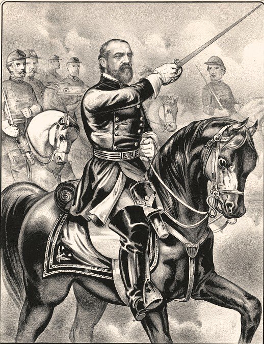
Before he left the Great Lakes for the war, George Meade urged Congress to fund further survey work on Lake Michigan and Superior, noting that the waterways’ economic growth and safety could be achieved. General George Meade won the Battle of Gettysburg in 1863, which he was considered the hero in the turning point of the war.
Civil War Service and Rise to Command

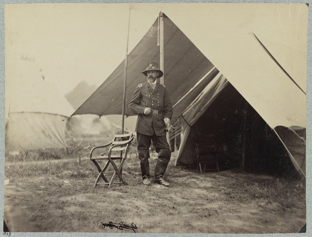
When the Civil War began in 1861, Meade was appointed brigadier general of volunteers and initially commanded a brigade in the Pennsylvania Reserves. He helped construct defenses around Washington, D.C., and fought in the Peninsula Campaign. He was seriously wounded at the Battle of Glendale but returned to action later.
Meade then served as a division commander at South Mountain and Antietam, and as a corps commander at Fredericksburg and Chancellorsville. In late June 1863, he was selected to lead the Army of the Potomac, replacing General Joseph Hooker
Battle of Gettysburg

Only three days after being appointed commander, Meade led the Army of the Potomac at the Battle of Gettysburg (July 1–3, 1863). He positioned his forces on strong defensive ground and repelled repeated attacks by Confederate General Robert E. Lee’s Army of Northern Virginia. The battle ended in a significant Union victory that halted Lee’s invasion of the North.
Although the Confederate army retreated, critics, including President Abraham Lincoln, believed Meade failed to pursue aggressively enough to destroy Lee’s force. Nonetheless, his actions at Gettysburg remain his defining achievement.
Later Civil War Campaigns
After Gettysburg, Meade continued to command the Army of the Potomac under the overall direction of General Ulysses S. Grant from 1864 onward. He participated in major campaigns including the Overland Campaign, Siege of Petersburg and others, executing large-scale operations though with less independent control than earlier in the war.
Post-War Career and Death
After the war, Meade remained in the Army and held command positions including the Military Division of the Atlantic and the Department of the South. He oversaw aspects of Reconstruction and military governance in former Confederate states. Meade died in Philadelphia in 1872 and is buried at Laurel Hill Cemetery.
Legacy of General George Meade
Meade’s legacy is defined by his Gettysburg victory and the perception of cautious command. Scholars note that his effectiveness on the battlefield and organizational skill were tempered by clashes with political leaders and other commanders. His engineering work and survey leadership contributed to scientific and navigation improvements in the mid-19th century.
Works Cited for General George Meade
History.com Editors. “George G. Meade – General, Civil War & Gettysburg.” History.com, A&E Television Networks, 9 Nov. 2009, updated 28 May 2025. Accessed 12 Jan. 2026.
“George Meade.” Wikipedia, Wikimedia Foundation, last edited 2 January 2026 . Accessed 12 Jan. 2026.
“George Gordon Meade (1815–1872).” U.S. Army Corps of Engineers, U.S. Army. Accessed 12 Jan. 2026.
“George G. Meade.” National Park Service, U.S. Department of the Interior. Accessed 12 Jan. 2026.
Meade, George Gordon. “The Life and Letters of George Gordon Meade, Major-General United States Army.” Edited by George Gordon Meade, Charles Scribner’s Sons, 1913. HathiTrust Digital Library. Accessed 12 Jan. 2026.
Meade, George Gordon. “Report of the Survey of the North and Northwest Lakes.” Appendix I of the Report of the Chief Topographical Engineer, Washington: L. Towers, 1859. University of Michigan Library Digital Collections. Accessed 12 Jan. 2026.
“Meade, George Gordon.” 1911 Encyclopædia Britannica, Vol. 17. Public Domain. Accessed 12 Jan. 2026.
“United States Lake Survey.” Wikipedia, Wikimedia Foundation, last edited 25 September 2025 . Accessed 12 Jan. 2026.
“United States Army Corps of Topographical Engineers.” Wikipedia, Wikimedia Foundation, last edited 11 January 2026 . Accessed 12 Jan. 2026.
Related Links and Reading of General George Meade
- Ora Labora Colony and Final Days of the Civil War – The Spring of 1866 did not bring warmth to the Colony so desperately needed. The war had ended. Men had returned. However, the battle-hardened veterans were not standing by the Colony’s founder and the community was deep in debt and morale was low.
- Port Crescent – A Ghost Town – Port Crescent State Park is one of the largest state parks in southern Michigan. Located at the tip of Michigan’s “thumb” along three miles of sandy shoreline of Lake Huron Saginaw Bay. However, a little-known aspect of this park is that it sits on the location of a ghost town.
- Shore Indian Trail – Hull’s Trace – The Shore Indian trail was one of the five major routes of land travel leading out of Detroit. It was one of the best known to the early settlers. The trail begins from the rapids of the Maumee River to Toledo, then closely along the shore through Monroe and Brownstown to Detroit. From Detroit, it continues northward along the Detroit and St. Claire Rivers, past Fort. Joseph, (Fort Gratiot), and into the Thumb.
- Buried Gold on the Beach of the Upper Thumb – There is a tale in some of the historic newspaper papers of Michigan’s Upper Thumb that speaks of Indian gold and a hermit who owned a bit of land around what was called Loosemore point.