Tag: Lake Effect Snow

Lake Effect Snow

Lake-effect snow occurs when cold air passes over warmer lake waters, picking up moisture and depositing it as heavy snowfall on downwind shores. This phenomenon is common in regions near large lakes, such as the Great Lakes, and can lead to intense, localized snowstorms with significant accumulation. Factors like wind direction, lake temperature, and topography influence the severity and location of lake-effect snow, making it a notable feature of winter weather in affected areas.

Featured articles about Lake Effect Snow

Michigan weather map

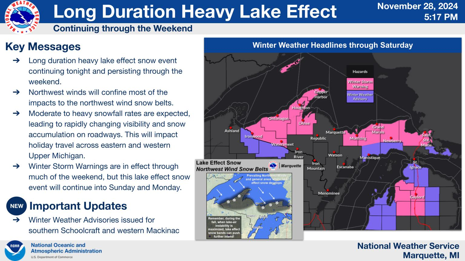
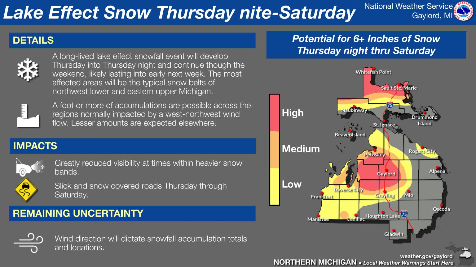
Michigan Winter Weather Update: Snow, Wind, and Cold Grip Southeast, Southwest, Northern Lower, and Upper Peninsula

Michigan is experiencing hazardous weather conditions with cold temperatures and significant lake effect snow. Areas, particularly in the snowbelt regions, are facing travel difficulties due to heavy snowfall and strong winds, with wind chills dropping below zero. Some respite from the harsh cold is anticipated this weekend.

Continue reading

Southeast Michigan Faces Snow Squalls, Upper Peninsula Braces for 3-Foot Snow Totals – UPDATED

Michigan is experiencing severe winter weather, including snow squalls in the Southeast and heavy lake-effect snow in the Northern regions, with up to 3 feet of snow expected in the Upper Peninsula. Conditions are hazardous for travelers, with whiteouts and low visibility. Winter Storm Warnings are in effect through the weekend.

Continue reading

Michigan Thanksgiving Week Weather Nightmare – Rain, Snow, and Ice Collide To Threaten Post-Holiday Plans Statewide

Grand Rapids is preparing for rain and snow this Thanksgiving week, with the National Weather Service predicting potential travel disruptions. Light rain today will shift to snow midweek, especially in the Upper Peninsula where significant accumulation is expected. Cold temperatures will persist, leading to hazardous lake-effect conditions over the weekend.

Continue reading
Exit mobile version