


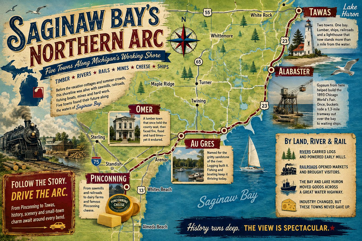
Saginaw Bay’s Northern Arc: Five Towns Along Michigan’s Working Shore
From Pinconning cheese to Alabaster gypsum, these communities grew through timber, railroads, rivers, fishing and Great Lakes shipping.
The northern edge of Saginaw Bay looks quiet from the highway today. Marinas, roadside markets, old downtown blocks and stretches of open water define much of the trip. The region’s history was far less peaceful.
Their histories are closely connected. Saginaw Bay history is filled with towns that rose because workers could cut timber, move freight, catch fish, mine stone or load ships along the water.
Table of Contents
Saginaw Bay’s Northern Arc
Pinconning, Omer, Au Gres, Alabaster and the Tawas area developed around heavy work. Lumber camps fed sawmills. Rivers carried logs. Railroads moved freight and passengers. Fishing boats worked the bay. Gypsum from Alabaster traveled to distant cities aboard Great Lakes vessels.
Together, these communities form what we call Saginaw Bay’s Northern Arc.
The name is not an official government designation. It describes the broad curve running from Pinconning through Arenac County and along the Lake Huron shore to Tawas Bay.
Each town filled a different role. Pinconning became known for cheese. Omer served lumber traffic along the Rifle River. Au Gres grew beside its river and the bay. Alabaster became an industrial mining town. Tawas developed around mills, docks, railroads and a protected harbor.
The Michigan Moments videos and related articles gathered here show how these five towns adjusted after the lumber era ended and tourism became more important.
Five Towns Connected by Water, Rail and U.S. 23
The modern route follows a loose arc:
Pinconning – Omer – Au Gres – Alabaster – Tawas

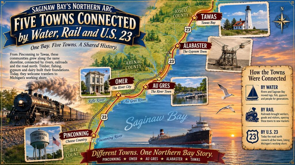
Pinconning sits west of the main Lake Huron shoreline route. From Omer northward, U.S. 23 ties the communities together. The historic connections were more complicated.
Rivers moved timber before dependable roads existed. Railroads later connected the towns with Bay City and markets farther south. Great Lakes vessels carried lumber, fish, gypsum and other goods across the region.
U.S. 23 eventually became the main travel corridor. Tourists replaced many of the workers and freight shipments that had once supported the local economy.
That change is central to the story of Saginaw Bay’s Northern Arc.
Pinconning: From Timber and Railroads to Cheese
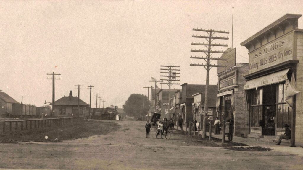
Pinconning began as a lumber settlement in the 1870s. George VanEtten and Henry Kaiser established a sawmill and company store near the Pinconning River. The community grew as workers arrived to cut timber and operate the mill.
Transportation remained difficult. Rivers were useful for moving logs, but roads were often poor or nearly impassable. Rail service became the town’s main connection with the outside world. When the timber industry faded, dairy farming provided a new economic base. Cleared forestland became pasture and farmland.
Pinconning Creamery opened in 1907. Local cheesemakers later developed the mild Colby-style cheese that became closely associated with the city. Pinconning’s history is often reduced to roadside cheese stores. The larger story is more important: the town survived the end of the lumber economy by changing what it produced.
Watch: Pinconning — Timber, Cheese and Ingenuity
This Michigan Moments episode follows Pinconning from its sawmill years through the rise of dairy farming and cheese production.

Omer: Fire, Flood and Michigan’s Smallest City

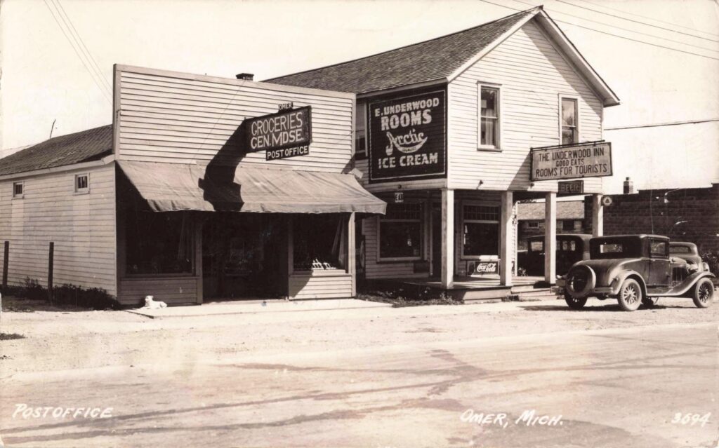
Omer developed beside the Rifle River during the lumber era. The settlement was first known as Rifle River Mills, a name that reflected its connection to sawmills and river transportation. Logs moved downstream, while mills and local businesses served workers and farm families.
Omer later became the first county seat of Arenac County. The honor did not last. Voters moved the county seat to Standish, leaving Omer with a former courthouse that later became a Masonic hall. The town faced repeated setbacks. Fire destroyed much of Omer’s business district in 1914. Flooding also damaged property and transportation routes. As the lumber industry declined, Omer lost much of the economic activity that had supported its early growth.
Omer remains incorporated as a city despite its small population. That gives it one of Michigan’s more unusual civic identities.
Watch: The History of Omer
The Michigan Moments episode uses historic photographs to document Omer’s lumber years, public buildings, fires and floods.

Supporting article:
Related regional article:
Au Gres: The River That Changed Jobs

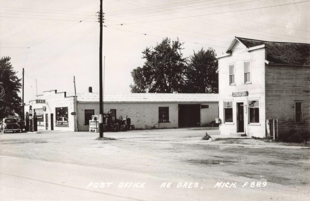
Au Gres grew where the Au Gres River reaches Saginaw Bay.
During the lumber era, the river helped move logs and support nearby mills. The bay provided another transportation route for freight and commercial fishing. The community’s name is linked to the gritty sandstone found in and around the river. As timber production declined, Au Gres changed with it. Fishing, boating, marinas, and tourism became more important.
That transition gives the town one of the clearest stories in this collection: the river that once carried timber later carried fishing boats and tourists. Au Gres also became a gateway to Charity Island. The island lighthouse and surrounding waters form part of the region’s larger maritime history.
Watch: Seven Photos That Changed Au Gres
This Michigan Moments episode uses seven historical images to show changes in the riverfront, downtown and daily life.

Alabaster: The Lost Mill Town Built on Gypsum
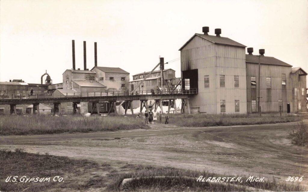
Alabaster developed around one industry: gypsum. Mining began during the 1860s. The mineral was processed into plaster and building products, then shipped across the Great Lakes.
Alabaster became a company town. Workers lived near the quarry, mill, and shipping facilities. The company influenced housing, employment, and much of daily life. The town’s gypsum reached far beyond Michigan. Material from Alabaster was reportedly used in buildings constructed for Chicago’s 1893 World’s Columbian Exposition.

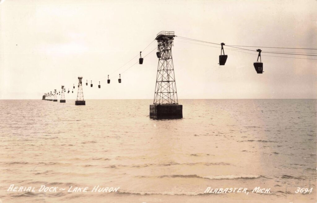
The community later became known for its long offshore tramway. Large buckets carried gypsum over the water to ships waiting in deeper parts of the bay. Fire changed the town’s physical appearance. Industrial buildings and company structures disappeared, leaving fewer reminders of the large operation that once stood along the shore.
Watch: Alabaster’s Lost Mill Town
The Alabaster Michigan Moments episode focuses on the mill, quarry, company town and the fire that changed the community.

Alabaster provides the strongest industrial story in Saginaw Bay’s Northern Arc. Its history connects a small Michigan settlement with Great Lakes shipping and one of the most famous fairs in American history.
Tawas: Two Cities, One Bay and a Working Harbor

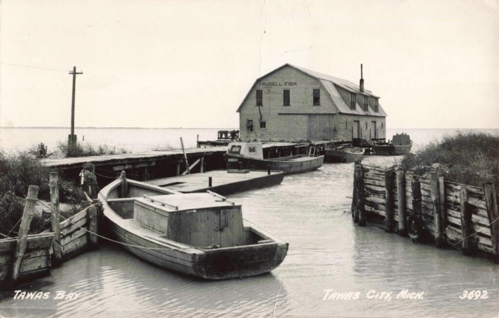
The Tawas section includes both Tawas City and East Tawas. The two communities developed beside the same bay but followed separate paths.
Tawas City became the Iosco County seat. East Tawas grew around lumber operations, docks, and commercial activity farther east along the bay. Tawas Bay offered protection from rough Lake Huron weather. Ships could seek shelter there, while mills and businesses used the harbor to move lumber and supplies.
Railroads later helped bring passengers and tourists into the area. Excursion trains carried visitors to beaches, hotels and resort grounds before automobiles became common. The lumber economy eventually declined, but tourism continued growing.
Tawas Point became one of the area’s best-known landmarks. The first lighthouse was built in 1853. As sand accumulated, the shoreline extended outward and left the lighthouse far from the end of the point. That process continued even after a replacement lighthouse was built in 1876.
The lighthouse did not retreat inland. The land grew around it.
Watch: Tawas Bay — Where Timber Met the Tide
The main Tawas Michigan Moments episode follows the bay’s lumber, railroad, shipping and tourism history.


More Tawas and Northern Bay History
The Tawas collection is larger than the other town sections. It may work best with one primary video at the top and the two additional videos placed under a separate “More Tawas Videos” heading.
Before the Resorts, This Was a Working Shore
The communities along Saginaw Bay’s Northern Arc are now marketed through fishing, beaches, boating, wildlife and small-town travel. Those features are real, but they came later. The first economy depended on natural resources and transportation.
Pinconning cut timber and later produced cheese. Omer used the Rifle River to serve lumber operations. Au Gres depended on its river and access to the bay. Alabaster mined and shipped gypsum. Tawas operated mills, docks and railroad facilities.
The shoreline was not merely a place to look at the water. It was a place to work. That distinction helps explain why these towns developed where they did.
Driving Tour of Saginaw Bay’s Northern Arc – Pinconning to Tawas Heritage Route
Follow Michigan’s northern Saginaw Bay shore from Pinconning to Tawas. The route links cheese country, a former courthouse, riverfront parks, local museums, the Alabaster gypsum marker, Tawas Bay and the historic Tawas Point Lighthouse.
Pinconning – Omer – Au Gres – Alabaster – Tawas City – East Tawas – Tawas Point

1. Pinconning Cheese Company
221 N. Mable St., Pinconning
This makes a practical starting point because it represents the cheese industry that replaced much of Pinconning’s earlier lumber economy. The business remains open as a cheese, deli and fudge shop.
2. Bay County Pinconning Park
3041 E. Pinconning Road
The park provides access to Saginaw Bay through trails, boardwalks, observation areas, a beach and boat launch. It adds the shoreline and wildlife side of the Pinconning story.
3. Omer Masonic Hall Historical Marker
U.S. 23 at North George Street
The 1890 building served as Arenac County’s second courthouse before the county seat moved to Standish. It later became a Masonic hall and survived the 1914 fire that damaged much of Omer’s business district.
4. Arenac County Historical Society Museum
304 E. Michigan Ave., Au Gres
The museum occupies a former Methodist church dating to about 1883. Its exhibits and archives cover the communities, families and industries of Arenac County.
5. Au Gres Riverfront Park
522 Park St., Au Gres
This public stop sits beside the Au Gres River and includes fishing access, picnic areas and other visitor facilities. The river was central to the town’s logging years and later became part of its fishing and recreation economy.
6. Alabaster Historical Marker
Benson Road at Turtle Road
The marker stands in a roadside pull-off overlooking the Lake Huron shore. It covers the gypsum quarry opened in 1862, the 1891 industrial fire and Alabaster gypsum used for Chicago’s 1893 World’s Columbian Exposition.
The quarry remains an industrial site. Visitors should remain at the public marker and avoid entering company or private property.
7. Shoreline Park and Welcome to Tawas Bay Marker
429 W. Lake St., Tawas City
The park includes a long fishing pier, boardwalk, beach, picnic facilities and views across Tawas Bay. Its historical display covers the former courthouse, Coast Guard station, downtown waterfront and Tawas Point Lighthouse.
8. Iosco County Historical Museum
405 W. Bay St., East Tawas
The museum preserves photographs, records and objects tied to communities across Iosco County, including Tawas and Alabaster. Museum schedules vary by season, so hours should be confirmed before the trip.
9. Tawas Point Lighthouse and State Park
686 Tawas Beach Road, East Tawas
The 1876 lighthouse marks the entrance to Tawas Bay. Seasonal tours include the keeper’s dwelling and an 85-step tower climb, while the surrounding state park offers beaches, trails and birdwatching.
A Michigan Recreation Passport is required for vehicle entry to the state park. Lighthouse hours and tour schedules should be checked before traveling. Museum hours and public access should be confirmed before travel.
Five Towns, One Northern Bay Story
Pinconning, Omer, Au Gres, Alabaster and Tawas were never one political region. They did not share one county government, school system or industry. They did share the water.
Rivers and the bay determined where mills, docks, mines and towns developed. Railroads connected those places with larger markets. U.S. 23 later connected them with travelers. Their history shows how quickly a working town can change when its primary industry disappears. The sawmills closed. Passenger trains faded. Docks were abandoned. Industrial buildings burned or were dismantled.
But the communities remained.
The Michigan Moments videos gathered here help restore the people, buildings and industries that shaped Saginaw Bay’s Northern Arc before it became a modern travel route.

