


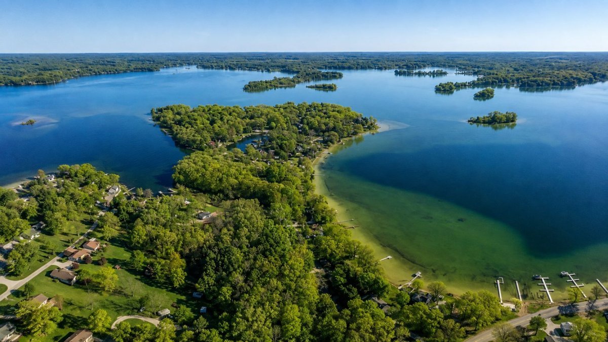
Best Boating Lakes in Michigan: From Inland Gems to Great Lakes Harbors
A 20-foot pontoon that handles beautifully on Higgins Lake can become a dangerous liability the moment it hits the unpredictable chop of Saginaw Bay. Michigan has more than 11,000 inland lakes and 3,288 miles of Great Lakes coastline, yet many captains stick to the same overcrowded launches every weekend. Finding the best boating lakes in Michigan requires an understanding of how local geography and weather patterns dictate the safety and success of your trip.
You probably already know that a Saturday morning at a popular Oakland County ramp often involves more waiting than actual cruising. It’s frustrating to plan a day on the water only to be met by confusing DNR depth markings or sudden Lake Huron swells that your boat wasn’t built to handle. This guide offers a clear look at the state’s premier destinations, from the deep glacial basins of the north to the protected harbors of the Thumb.
We will help you identify which lakes suit your specific boat type and provide alternatives to the most congested tourist spots. You will also find practical details on regional differences in water conditions and the logistics of navigating Great Lakes harbors like Caseville and Port Austin. This overview ensures you spend less time at the dock and more time on the water.
Key Takeaways
- Distinguish between the sheltered basins of inland waters and the maritime conditions found along the Great Lakes coastline.
- Evaluate the best boating lakes in Michigan for your vessel type, including the deep glacial waters of Torch and Higgins Lakes.
- Navigate the specific challenges of Saginaw Bay and the Tip of the Thumb by using local harbors like Caseville for refuge.
- Verify current 2026 legal requirements for safety gear and the mandatory Michigan Boater Education Card to avoid fines.
- Learn how to find less crowded launch sites and interpret real-time water conditions using regional tools.
The Michigan Boating Map: Great Lakes vs. Inland Waters
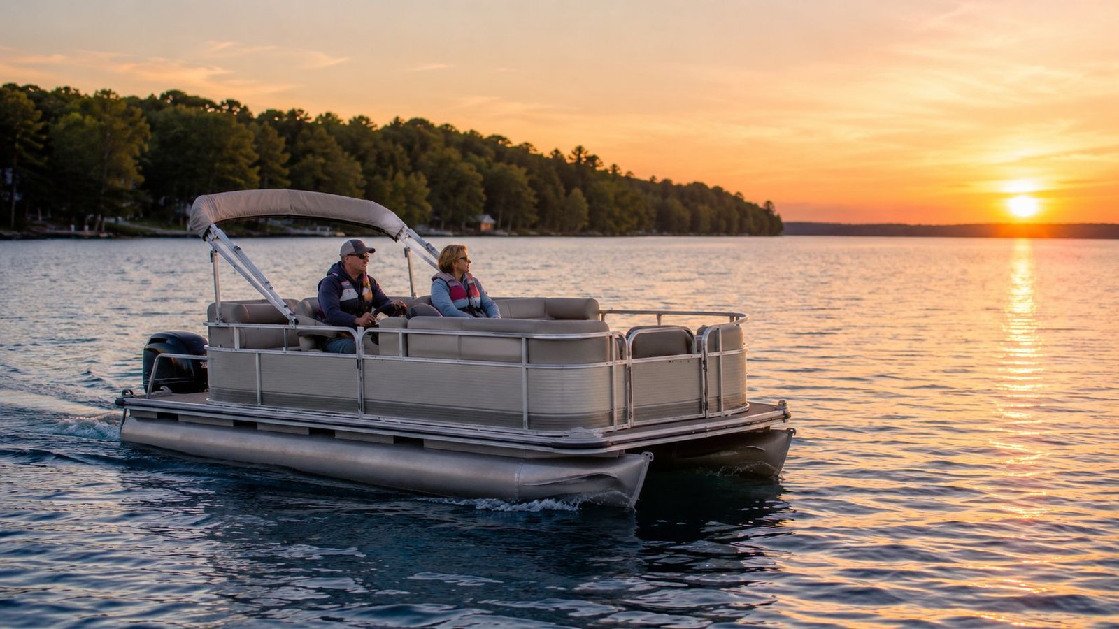

Michigan contains more than 11,000 inland lakes and 3,288 miles of Great Lakes coastline, creating a geography that demands two very different styles of seamanship. For anyone exploring **boating lakes in Michigan **, the first step is understanding that a sheltered inland basin and the open Great Lakes are not the same environment. While a 16-foot pontoon provides a stable platform for a sunset cruise on Higgins Lake in Roscommon County, that same vessel can quickly become overwhelmed by the four-foot swells common on Lake Huron.
The Michigan Department of Natural Resources (DNR) maintains over 1,300 public boat launches to help manage this vast access. These sites range from primitive gravel ramps on remote Upper Peninsula waters to multi-lane concrete facilities in major coastal harbors. Knowing which launch fits your trailer and draft is essential before leaving the driveway.
Navigating the Great Lakes Coastline
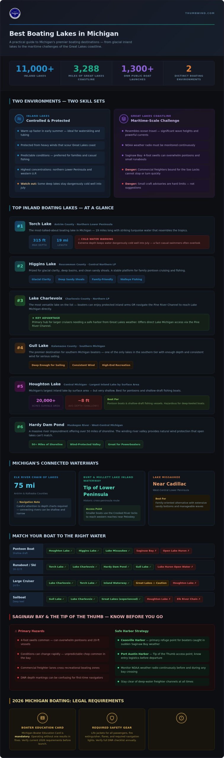
Boating on Lake Michigan or Lake Huron offers a maritime-scale experience that resembles ocean travel more than lake recreation. These waters feature significant wave heights and powerful currents that require constant monitoring of NOAA weather radio. Small craft advisories are not suggestions; they are warnings that conditions have exceeded the safety limits of most recreational boats.
Captains must also account for commercial traffic. Major shipping lanes carry massive freighters toward the Soo Locks, and these vessels cannot stop or turn quickly to avoid a fiberglass runabout. Staying clear of these deep-water channels is a primary safety rule for coastal boaters.
The Appeal of Michigan Inland Lakes
Inland boating lakes in Michigan provide a much more controlled environment. These waters warm up faster in the early summer and offer protection from the heavy winds that frequently scour the Great Lakes coast. This makes them the preferred choice for waterskiing, tubing, and quiet afternoons of walleye fishing.
The highest concentrations of these inland gems are found in the northern Lower Peninsula and the western U.P. Lakes like Torch and Burt Lake offer miles of navigable water without the risk of being caught miles from shore in a sudden gale. For many families, the predictability of these smaller basins outweighs the raw scale of the Great Lakes. Boaters who overnight at northern inland lakes will also find that the minimal light pollution makes these waters ideal for experiencing a dark sky park Michigan has to offer, with some of the darkest skies in the Midwest visible from the shoreline.
Top Inland Boating Lakes for Recreational Use
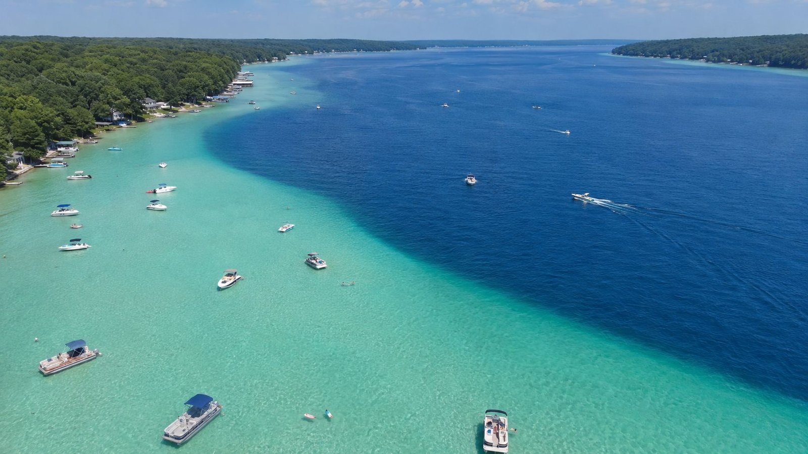
Torch Lake in Antrim County is often the first name mentioned when discussing boating lakes in Michigan. Its 19-mile length and striking turquoise water attract thousands of boaters every summer. While the color resembles the tropics, the lake reaches depths of 315 feet. This extreme depth means the water remains dangerously cold well into July, a fact that casual swimmers often overlook.
Higgins Lake in Roscommon County offers a similar glacial clarity. It is prized for its deep basins and clean sandy shoals. In Charlevoix County, Lake Charlevoix provides a different advantage. Boaters can enjoy the protection of the inland arms or navigate the Pine River Channel to access Lake Michigan directly. This flexibility makes it a primary hub for larger cruisers that need a safe harbor from Great Lakes weather.
Gull Lake in Kalamazoo County serves as the premier destination for the southern part of the state. It is one of the few boating lakes in Michigan in the southern tier that offers enough depth and consistent wind for serious sailing. The lake’s shoreline is heavily developed, reflecting its status as a high-end recreational center for the region.
The Chain of Lakes System
The Elk River Chain of Lakes spans 75 miles across Antrim and Kalkaska counties. Navigating this system requires a careful eye on depth charts, as the connecting rivers can be shallow and narrow. Burt Lake and Mullett Lake form the core of the Inland Waterway. This historic route allows vessels to travel across the tip of the Lower Peninsula. Smaller boats often use the Crooked River locks to reach the western reaches of the system near Petoskey.
Central Michigan Favorites
Houghton Lake is the largest inland lake in Michigan by surface area, covering over 20,000 acres. However, it is notoriously shallow with an average depth of only 8 feet. This makes it ideal for pontoon boats and shallow-draft fishing vessels but hazardous for deep-keeled boats. Near Cadillac, Lake Missaukee offers a family-oriented alternative with extensive sandy bottoms and manageable waves.
For powerboaters, Hardy Dam Pond on the Muskegon River provides a massive impoundment with over 50 miles of shoreline. The winding nature of the river valley offers protection from the wind that open lakes lack. If you want to stay informed about regional water conditions and outdoor news, subscribe to Michigan Moments for weekly updates from across the state.

Boating the Tip of the Thumb and Saginaw Bay


Saginaw Bay offers a stark contrast to the deep, glacial boating lakes in Michigan found in the northern Lower Peninsula. While lakes like Torch reach depths of over 300 feet, Saginaw Bay is relatively shallow, averaging between 15 and 35 feet in the inner bay. This lack of depth creates a unique "choppy" water condition when winds pick up, as waves stack closer together than they do in the open Great Lakes. Despite these challenges, the bay remains one of the premier destinations in the Midwest for freshwater sailing and walleye fishing.
Caseville Harbor serves as a critical refuge and recreational hub for boaters entering the bay from Lake Huron. Located in Huron County, it provides essential docking and fuel services that make it a logical starting point for any trip into the inner bay. Farther east, Port Austin acts as the gateway to the limestone formations that define the "Tip of the Thumb." This region requires careful navigation due to submerged rocky reefs that have historically challenged even the most experienced mariners.
Island Hopping in Saginaw Bay
Navigating to Charity Island is a highlight for many coastal boaters, though the trip requires a reliable vessel and a clear weather window. The island sits nearly 10 miles from the mainland, and docking is notoriously limited. Most visitors anchor offshore and use a dinghy to reach the beach. The Pointe aux Barques region nearby carries a heavy historical significance, as it was once a site of frequent shipwrecks before modern navigation tools. For those seeking quieter waters, the Saginaw Bay islands near Wild Fowl Bay offer remote anchoring spots and excellent wildlife viewing.
Port Austin and the Sea Caves
The limestone sea caves and the famous Turnip Rock near Port Austin are best viewed from the water. Because the area is extremely shallow and filled with boulders, small powerboats and kayaks dominate this stretch of the coast. Larger vessels should keep a safe distance from the shoreline to avoid grounding. Harbor Beach, located farther south along the Lake Huron coast, features the world’s largest man-made freshwater harbor, providing a massive protected area for recreation. Before launching, boaters should check regional webcams to monitor real-time lake conditions and wave heights at the pier heads.
Logistics and Regulations for Michigan Boaters
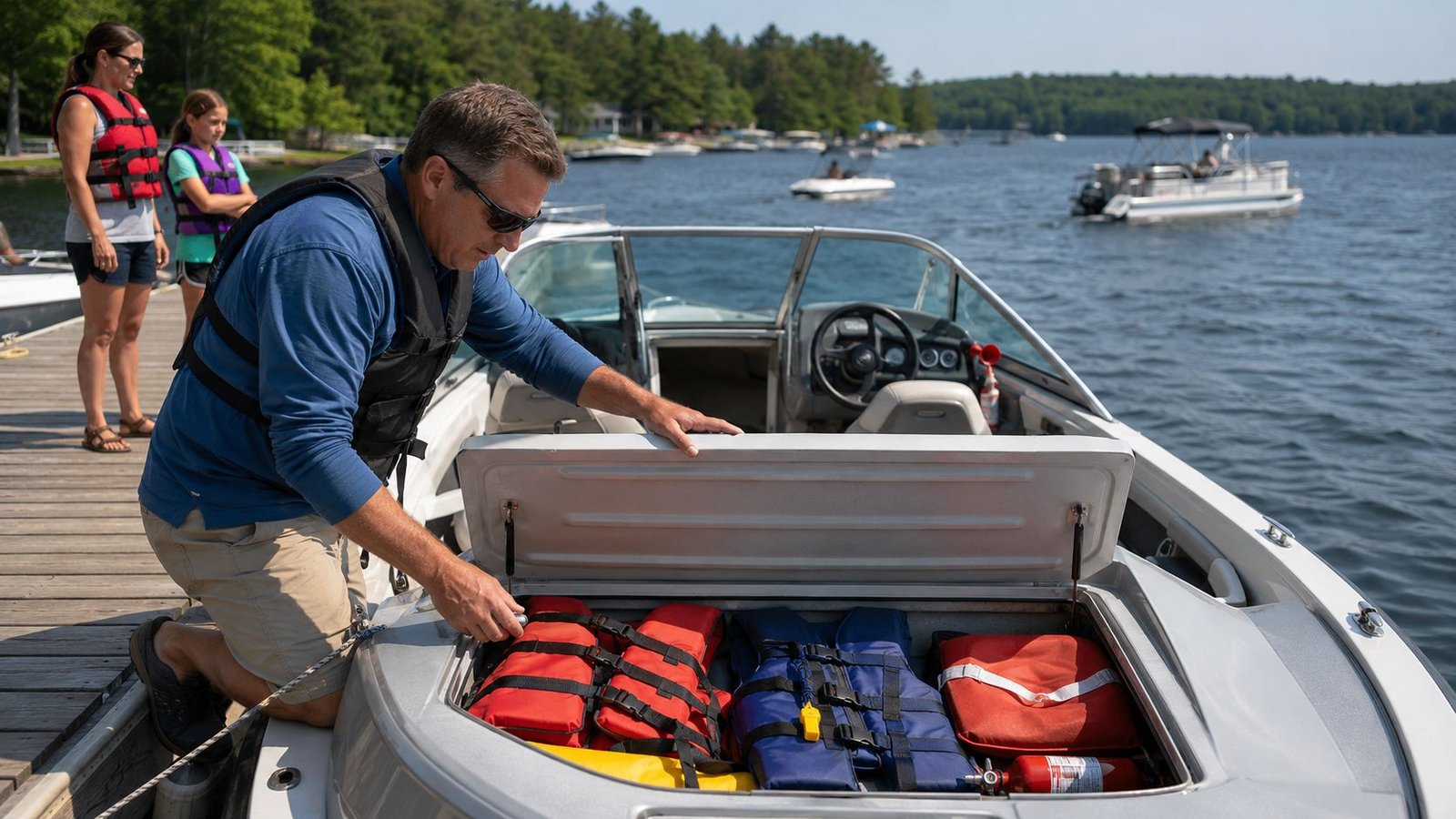
Operating a vessel on boating lakes in Michigan requires more than just a trailer and a full tank of gas. The Michigan Department of Natural Resources (DNR) enforces strict safety requirements to manage the high volume of traffic on both inland and Great Lakes waters. Every boat must carry a U.S. Coast Guard-approved life jacket for each person on board; boats over 16 feet must also have a throwable flotation device. Fire extinguishers and sound-producing devices, such as a whistle or horn, are also mandatory for most motorized vessels.
The legal landscape for operators continues to evolve. By 2026, the Michigan Boater Education Card is required for anyone born after July 1, 1996, who operates a motorized vessel. Even if you fall outside this age bracket, completing the course provides a necessary refresher on right-of-way rules that are frequently ignored during busy holiday weekends. You can obtain this card through several DNR-approved online providers after passing a proctored or online exam.
Protecting the water is now a legal mandate for anyone moving between different boating lakes in Michigan. The "Clean, Drain, Dry" law requires you to pull the drain plug and remove all aquatic plants from your trailer before leaving a launch site. These efforts are part of a larger strategy to stop the spread of invasive species like zebra mussels and the Asian Carp threat that could devastate the Great Lakes ecosystem if they bypass current electrical barriers.
DNR Rules and Licensing
All motorized boats and sailboats over 12 feet must be registered with the Secretary of State. This registration is valid for three years and expires on March 31 of the final year. If you plan to use state-managed launches, ensure your vehicle has the Recreation Passport. This fee supports the maintenance of the state’s vast launch network. For those planning multi-day trips, our Michigan State Campgrounds guide explains which parks offer dedicated boat-in sites or transient slips.
Environmental Hazards and Water Levels
Great Lakes water levels fluctuate significantly over multi-year cycles. High water can submerge docks and create floating debris hazards, while low levels can make previously safe harbor entrances impassable for deep-draft boats. Always check local depth reports rather than relying on outdated charts. On inland lakes, "No Wake" zones are strictly enforced within 100 feet of the shoreline, docks, or anchored rafts. Violating these zones causes shoreline erosion and remains a primary cause of conflict between boaters and property owners.
Preparing for Your Season on Michigan Waters
Successful trips require more than just knowing the location of a ramp. You must balance the desire for the clear, turquoise waters of northern inland basins with the technical demands of navigating the Great Lakes coast. Choosing the right vessel for the environment is essential, whether you are exploring the shallow reaches of Saginaw Bay or the deep glacial trenches of the north.
Staying current on DNR regulations and invasive species laws is the only way to protect these resources for the next generation of captains. Relying on expert regional reporting and real-time weather data helps you avoid the crowds and the unpredictable weather that defines boating lakes in Michigan. Safe boating starts with reliable information and a respect for the local maritime history that shaped these harbors.
We look forward to seeing you at the launch this summer. Enjoy the clear water and the unique heritage of our Great Lakes state.
Frequently Asked Questions
Do I need a license to drive a boat in Michigan?
Michigan requires a boater education card for anyone born after July 1, 1996, who operates a motorized vessel over 6 horsepower. This card remains valid for life and does not require renewal like a standard driver’s license. You can complete the required course through several DNR-approved online platforms or attend an in-person class held by local sheriff departments.
What is the largest inland lake in Michigan for boating?
Houghton Lake in Roscommon County is the largest inland lake by surface area, covering more than 20,000 acres. While it provides a massive amount of space for boating lakes in Michigan, it is notoriously shallow with an average depth of 8 feet. Captains of larger cruisers often prefer Torch Lake or Lake Charlevoix because they offer much deeper basins and more predictable navigation.
Can I take a pontoon boat on Lake Huron or Lake Michigan?
You can operate a pontoon on the Great Lakes only during periods of extreme calm when wave heights remain under one foot. Most pontoon boats aren’t built to handle the steep, rapid chop that develops quickly on open Great Lakes waters. It’s safer to keep these vessels within protected harbors or use them on inland waters where you won’t risk being swamped by a sudden swell.
Are there any "No Wake" lakes in Michigan?
Michigan has hundreds of lakes with permanent "No Wake" restrictions to prevent shoreline erosion and protect sensitive ecosystems. Even on all-sports lakes, state law requires you to maintain a slow, no-wake speed whenever you are within 100 feet of the shoreline, docks, or anchored rafts. Local ordinances may also restrict high-speed boating to specific hours of the day, typically between 10:00 a.m. and 6:30 p.m.
What are the rules for towing a tube or skier in Michigan?
You must have a designated observer on board to watch the person being towed while the driver focuses on navigating the water. Michigan law restricts towing activities to the hours between one hour before sunrise and one hour after sunset. Every person on a tube or skis must wear a U.S. Coast Guard-approved life jacket; inflatable belts or vests do not meet the legal requirement for towing.
How do I check current water conditions for the Thumb region?
Checking live webcams in Caseville or Port Austin is the most reliable way to see real-time wave heights and pier conditions before you leave the dock. General weather apps often miss the specific wind patterns of Saginaw Bay, so you should also monitor NOAA weather radio for small craft advisories. These regional tools are essential for safely navigating the diverse boating lakes in Michigan.
Disclaimer
Information published on Thumbwind.com is provided for general informational purposes. While we make reasonable efforts to keep articles accurate and current, details such as prices, hours, regulations, access conditions, and other information may change without notice. Readers should verify important details with the appropriate business, agency or official source before making travel, financial or other decisions. Thumbwind.com is not responsible for the content, availability or practices of third-party websites linked from our articles.