


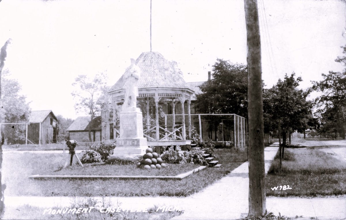
Tracing Caseville History: A Guide to Huron County’s Industrial Roots
In the late 1800s, Caseville’s salt wells produced up to 50,000 barrels annually, a massive output that fueled the rapid growth of this Saginaw Bay community. Most people recognize this Huron County town for its modern summer festivals, but the true caseville history is rooted in heavy industry and rugged survival. It is often difficult to separate documented records from local folklore, especially when you are searching for the physical remains of 19th-century mills and docks along the shoreline.
You will learn the verified origins of the settlement, starting with its formal organization in 1860. This guide identifies specific industrial landmarks still visible today, including the sites of the Pigeon River salt works and the docks where shipbuilders launched 5,000-ton vessels like the Frank Crawford. We also examine the relationship between early settlers and the Chippewa tribe at Shebahyonk. This timeline provides the geographic context needed to find these historical remains along the coast, moving past the myths to show how the region actually functioned.
Key Takeaways
- Trace the township’s origins to the April 1860 meeting where officials established the first local government at a riverside schoolhouse.
- Learn about the settlement at Shebahyonk, where the Chippewa tribe and early pioneers maintained a peaceful trading relationship.
- Locate the physical remains of the Gillingham fishing docks and the foundations of 19th-century salt blocks near the mouth of the Pigeon River.
- Verify documented caseville history using records from the 1884 Album of Huron County to separate facts from local folklore.
- Identify how to access the Caseville Museum and its collection of artifacts from regional iron works and shipwrecks.
The Founding of Caseville: 1860 Organization and Early Settlement
Caseville Township officially organized on April 2, 1860. This meeting took place at the small schoolhouse near the Pigeon River mouth, marking a transition from a scattered settlement to a structured local government. While the area had been known as the Pigeon River Settlement, this formal act solidified its place in Huron County. According to a Caseville, Michigan historical overview, the original boundaries were much larger than they are today. This territory eventually split to form Brookfield, Chandler, and Winsor townships.
Early pioneers didn’t have paved roads or clear maps. They reached the area by following Native American Indian trails that stretched from Pointe aux Barques along the Saginaw Bay shoreline. These paths provided the only reliable land route through the dense timber of the Thumb. It’s a central part of caseville history that the beach itself often served as the primary highway for those moving west from the lighthouse at the tip of the county.
To better understand this concept, watch this helpful video:

The Role of the Pigeon River
The river mouth was the logical choice for a government center because it served as the only deep-water access point for miles. Settlers arriving by water faced significant challenges, as shifting sandbars often blocked the entrance to the river. Land travel was equally difficult, but the river provided the power needed for early sawmills. This intersection of water and land made the schoolhouse near the mouth the most accessible spot for the 1860 meeting.
Key Figures in the 1860 Election
Voters chose Alexander Wheeler as the first township supervisor. He was an influential figure in early Huron County politics and helped set the town’s industrial trajectory. Abraham A. Fox took the role of treasurer, and Francis Crawford served as the first clerk. Beyond politics, the community’s social life began to form around this time. George Cleaver and Reverend Mr. Cross conducted the first religious services and funerals, providing a sense of stability for the growing population.
Chippewa Presence and the Industrial Shift at Shebahyonk
Before the salt wells and sawmills defined the region, the Chippewa (Ojibwe) tribe maintained a principal town at Shebahyonk. This site, located just south of modern Caseville, represents a critical chapter in caseville history. Documented accounts from the mid-1800s describe a peaceful coexistence between the tribe and early pioneers. They traded essential goods; settlers provided manufactured tools while the Chippewa traded fresh fish and maple sugar. The village at Shebahyonk wasn’t just a seasonal camp; it was a central hub for the region’s Anishinaabe people.
Tribal members used flint muskets and tomahawks for hunting and protection. Records from the era also mention they boiled maple sap in brass kettles of unknown origin. These items likely reached the area through early French trade routes long before the first permanent pioneers arrived. This period of subsistence living eventually bowed to the massive scale of Huron County’s industrial heritage as the demand for timber grew.
The Maple Sugar Trade
In the spring, the Chippewa harvested sap using birch-bark troughs. The 1884 records highlight how this trade formed the area’s first local economy. It was a sophisticated system of forest management that preceded the arrival of steam-powered machinery. Pioneers often relied on these established tribal trade networks to survive their first winters. You can see how these early interactions shaped the map by looking at Michigan Indian place names.
From Trails to Timber
As the lumber industry expanded, it moved beyond the riverbanks. Loggers pushed into the Saginaw Bay islands and the surrounding marshes to harvest white pine. This shift was permanent. The seasonal camps of the Chippewa were replaced by permanent salt blocks and massive lumber mills. By the late 1800s, the shoreline had transformed from a wilderness of trails into a hub of smokestacks, shipping docks, and industrial noise.

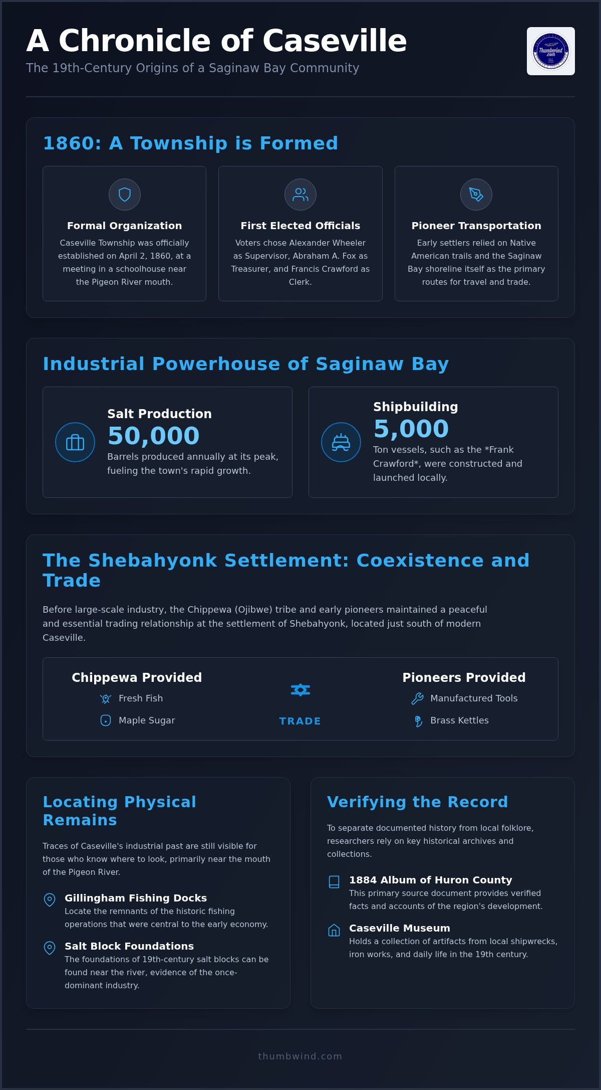
How to Locate Caseville’s Historical Industrial Landmarks
Locating the physical remains of caseville history requires looking past the modern storefronts and summer crowds. While much of the 19th-century infrastructure is gone, the industrial footprint remains along the water and in the surviving brickwork of the village. Researchers often consult Huron County historical records to identify the exact locations of vanished mills and salt blocks.
Start at the harbor to find the site of the Gillingham fishing docks. This area was a central hub for the Great Lakes commercial fishing trade that sustained the local economy after the lumber boom peaked. Nearby, at the mouth of the Pigeon River, you can still find the stone foundations of the original salt blocks and lumber mills. These ruins mark where the town’s primary wealth was generated during the late 1800s.
To see the terrain as it appeared to the first pioneers, visit Albert E. Sleeper State Park. The shoreline and forest density here provide a baseline for understanding the massive scale of the timber clearing that occurred. If you’re planning a visit to these sites, check our Michigan upper thumb webcams to see current conditions at the harbor.
A Walking Tour of Modern History
Begin at the Pigeon River bridge to orient yourself with the 1860 settlement site. From there, walk toward the harbor to find historical markers detailing the local iron works and salt production. Finish your tour at the Caseville Cemetery on Prospect Street. The headstones of the Wheeler and Crawford families serve as a direct link to the town’s founding officials.
Identifying 19th-Century Architecture
Tracing the industrial side of caseville history involves identifying the difference between original settler homes and later Victorian structures. The fires of 1871 and 1881 destroyed many of the earliest wood-frame buildings. Most of the historical stock you see today dates to the rebuilding efforts of the late 1800s. Look for the 1894 Maccabees Hall, which now houses the Historical Society of Caseville. This brick structure represents the shift from temporary wood shelters to permanent civic buildings.
Preserving the Record: Museums and Archives in the 21st Century
The Historical Society of Caseville protects the documented timeline of the village. They operate out of the 1894 Maccabees Hall at 6733 Prospect Street. This museum houses artifacts from the local iron works and several regional shipwrecks. It remains the most reliable location for anyone researching caseville history through physical evidence.
Archival records from the 1884 Album of Huron County provide the most accurate look at the town’s first 25 years. These archives document the rapid transition from a small settlement to an industrial center. Modern residents help expand this record by documenting family stories in the fishing and farming sectors.
You can see how the modern shoreline looks today by viewing live regional webcams. These cameras offer a real-time window into the areas where salt blocks once stood. It’s a practical way to compare archival photos with the current state of the Saginaw Bay coast without leaving your home.
The Maccabees Hall Collection
The museum features a range of early commercial fishing gear and heavy lumbering tools. These artifacts illustrate the manual labor that drove the local economy before the age of automation. You can see the actual tools used to harvest white pine and process salt. The hall itself is a significant survivor of early 20th-century development. It remains a sturdy example of the brick architecture that replaced the wood-frame buildings lost in earlier fires.
Connecting Caseville to the Broader Thumb
Caseville’s growth is tied to the unique geography and culture of Michigan’s Thumb. The industrial decline in the early 1900s forced the community to adapt as the salt and timber trades faded. This transition wasn’t an end but a new beginning. It transformed a gritty manufacturing center into the recreational destination that defines the region today. Visitors who come for the history often stay for the seasonal celebrations, and the fall festivals in Michigan that draw crowds to the Thumb each autumn are a direct extension of this community spirit.
Rediscovering Caseville’s Industrial Heart
Understanding caseville history requires looking beyond the modern shoreline to see the grit of the 19th century. The town’s shift from the tribal trade at Shebahyonk to a massive salt and lumber producer shows the rapid transformation of Huron County. From the first 1860 meeting at the riverside schoolhouse to the launch of 5,000-ton ships, every landmark tells a story of survival and growth. These physical remains, like the Gillingham docks and the foundations near the Pigeon River, provide a direct link to the pioneers who cleared the dense timber of the Thumb.
Since 2009, Thumbwind has provided independent Michigan journalism with direct access to local historical society records. We focus on the documented facts that separate regional heritage from local myths. You can continue your research by visiting our archives or using our live webcams to see how these sites look today. Read more Michigan Moments and regional history features at Thumbwind to deepen your knowledge of the Great Lakes state.
The next time you walk along the Saginaw Bay, look for the brickwork and stone that remain from the salt blocks. These small details are the surviving pulse of a community that built itself on the edge of the wilderness.
Frequently Asked Questions
When was Caseville, Michigan officially founded?
Caseville Township was officially organized on April 2, 1860, during a meeting held at the local schoolhouse near the Pigeon River mouth. While pioneers had lived in the area since the 1840s under the name Pigeon River Settlement, this date marks the start of formal local government. The village later incorporated in 1870 as the lumber and salt industries began to peak. Just as these early residents valued the role of their schoolhouse in shaping the future, modern students can explore CHC50125 Diploma of Early Childhood Education and Care through Axiom College to build their own professional skills.
What happened to the Chippewa tribe that lived in Caseville?
The Chippewa (Ojibwe) tribe maintained a principal town at Shebahyonk, located just south of the modern village limits. They coexisted with early settlers for decades, trading forest goods like maple sugar and fresh fish for manufactured tools. This lifestyle shifted permanently in the late 19th century when large-scale industrial lumbering and salt manufacturing displaced seasonal camps and altered the shoreline.
Where can I see the historical salt and lumber mills today?
You can find the remaining stone foundations of the original salt blocks and lumber mills near the mouth of the Pigeon River. While the wooden structures didn’t survive the fires of the late 1800s, these ruins identify where the town’s industrial wealth was generated. These sites are central to understanding caseville history and the rugged nature of early Huron County commerce.
Who were the first settlers of Caseville?
Reuben Dodge is recognized as the first permanent settler, arriving in the mid-1840s to hunt and trap along the river. By the time the township organized in 1860, the community was led by Alexander Wheeler, Abraham A. Fox, and Francis Crawford. These men held the first elective offices and funded the early mills that drew hundreds of workers to the region.
What is the oldest building still standing in Caseville?
The 1894 Maccabees Hall is the most prominent historical building still standing in the village. It currently houses the Caseville Museum and serves as a rare example of the brick architecture that replaced wood-frame structures after the Great Fires of 1871 and 1881. You can also find several Victorian-era homes along the side streets that date back to the town’s late 19th-century rebuilding phase.
Disclaimer
Information published on Thumbwind.com is provided for general informational purposes. While we make reasonable efforts to keep articles accurate and current, details such as prices, hours, regulations, access conditions, and other information may change without notice. Readers should verify important details with the appropriate business, agency or official source before making travel, financial or other decisions. Thumbwind.com is not responsible for the content, availability or practices of third-party websites linked from our articles.