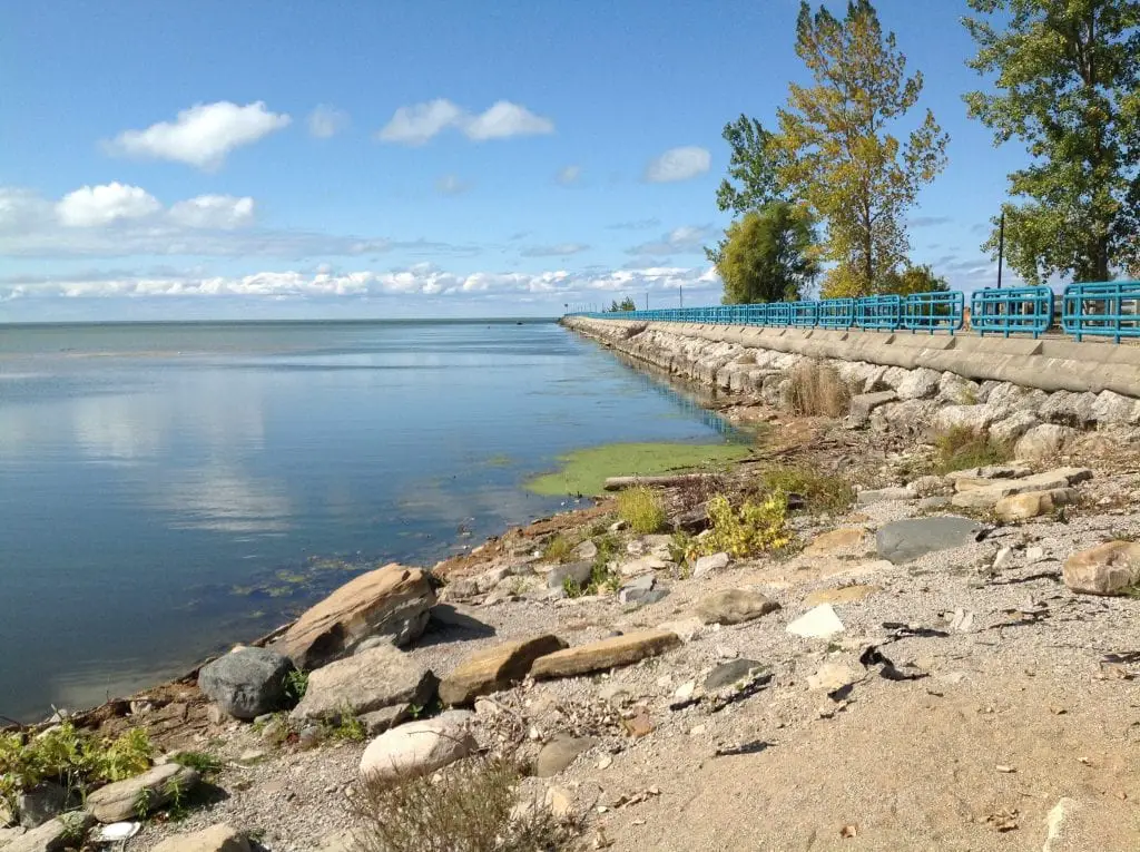
The 2012 Lake Huron water levels approached measurements not seen in over 50 years. The U.S. Army Corps of Engineers is reporting water levels in Lakes Michigan and Huron are 11 inches below its level of a year ago. Lakes St. Clair, Erie, and Ontario are 11, 13, and 12 inches, respectively, lower than their levels of a year ago.
Over the next month, Lake Superior is forecasted to remain near its current level, while Lake Michigan-Huron is expected to fall another 2 inches. The water levels of Lakes St. Clair, Erie, and Ontario are forecasted to fall 6, 5, and 3 inches, respectively, over the next thirty days.
If dry conditions continue, the Corps estimates that by December the Michigan-Huron levels will approach the historic low water levels last seen in 1964.
Conditions Likely to Get Worse…Someday
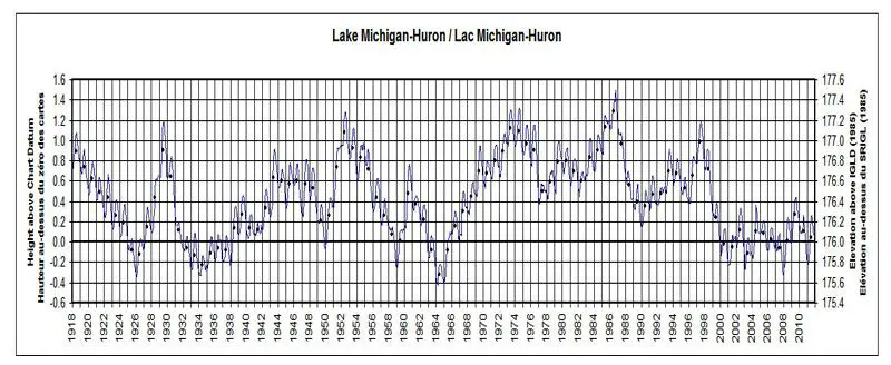
What’s disturbing is that the lake levels are not recovering. A review of the chart datum collected by NOAA and the USACE typically showed a water level bounce back within two years of low level. Since the late 1800s water levels of all the Great Lakes fluctuated above and below the long-term average year to year. However, since 1997 lake levels have trended lower in each consecutive year with no recovery.
Related Articles to 2012 Lake Huron Water Levels
Michigan Offers Strong Voice on Climate Change – Over the past decade, Yale University has asked the American public a wide range of climate-related questions. This includes if they believe in climate change. This week the Yale Program on Climate Change Communication released local “Climate Opinion Factsheets”. The factsheets include key measures of public climate change knowledge, attitudes, policy support, and behavior. They are broken down for each of the 50 states, 435 congressional districts, and 3,142 counties across the US. It turns out Michigan residents have a strong viewpoint on climate change. Michigan has even stronger expectations of what to do about it.
Website Makes It Easy To Find Michigan’s Historical Markers – The Michigan Legislature authorized the Michigan Historical Marker Program in 1955. Since that time, the program has reviewed and approved the placement of more than 1,700 markers throughout the state.
Polar Vortex Spikes Ice Coverage Across Al the Great Lakes in 2022 – Recent extreme weather patterns and sub-zero conditions across the Upper Great Lakes region have blown away forecasts of yet another year of below-average ice cover. The recent polar vortex spikes Great Lakes ice cover.
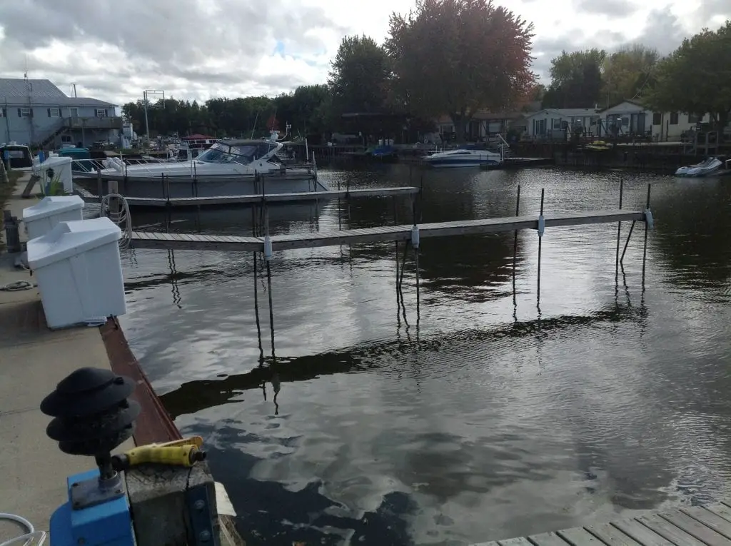
In 2012 Great Lakes Water Levels Dropped and Marinas Scrambled – Marina’s were dredging, boats were being damaged on shallow reefs not seen a generation, and lake shipping was facing hard times. There was serious concern on how far it would go and what would happen next.